All posts by OriginallyPB

Folsom Bros. Co.

In January 1902 the San Diego Union reported that a new real estate firm, Folsom Bros., whose ad appeared in another column, had located at 1015 Fourth Street; ‘These gentlemen are from the east, having business affiliations there, and are enthusiasts on San Diego’s climate and natural resources’. The ad in the other column announced that Folsom Brothers, 1015 Fourth St., had some parties coming to San Diego from the east early in the year who contemplated investing and making their homes here, and invited owners who had houses or good building lots for sale to call their office; ‘Your chance for a sale will be better with us, as we have been hustling on the quiet outside of San Diego for the past year and do not depend merely on local transfers’. The new company also acquired a two-seat steam Locomobile, enabling them to hustle around inside San Diego as well.

The Folsom brothers, Murtrie (M. W.) and Wilbur (W. A.), were in their mid-20s in 1902 and their enthusiasm for the local climate and natural resources might have been encouraged by their parents, Mark and Helen Folsom, who had relocated to San Diego a few years earlier. Shortly after their debut in the papers, in March 1902, they reported that one of the parties they had recently induced to come here from the east, A. J. Dula of North Carolina, had purchased a 5-acre orange and lemon ranch in Chula Vista for $5000, and that they had other sales on the way.

Aurelius J. Dula was a native of North Carolina, a Confederate veteran who had been wounded at Gettysburg and Cold Harbor and had been elected in 1895 to the North Carolina state senate. Although he was nearly 60 years old, he was also the Folsom brothers’ brother-in-law, having married their older sister Lillian in 1892. Although Dula and the Folsom brothers first collaborated on the lemon ranch in Chula Vista, they soon turned their attention to the Pacific Beach area and Pueblo Lot 1800, part of the endowment that the American city of San Diego had inherited from the Mexican pueblo and had granted to the San Diego Land and Town Company, a subsidiary of the Santa Fe Railroad, as a subsidy for building the railroad that connected San Diego to the east. Pueblo Lot 1800 is located within the perimeter of today’s Lamont Street and Crown Point, Moorland, Riviera and Pacific Beach Drives (pueblo lots were typically a half-mile square and 160 acres, but the southeast corner of this lot was cut off by Mission Bay).

In November 1902 A. J. Dula and O. M. Schmidt, a retired wholesale grocery merchant from St. Louis, purchased most of the east half of Pueblo Lot 1800, everything except the northerly 61 feet and 5 acres in the northeast corner, and filed a map subdividing it as Fortuna Park Addition. In February 1903 they bought most of the west half as well, everything except the northerly 61 feet and about 6 acres in the southwest corner, and filed a subdivision map for Second Fortuna Park Addition. Folsom Bros. Co., representing their brother-in-law and his business partner, placed ads in the local papers offering lots in these new subdivision for $25. A few months later, in August 1903, Dula granted all his right, title and interest in these two tracts (excepting any portions already sold) to M. W. Folsom, who in November 1903 granted this interest to his father, Mark Folsom (O. M. Schmidt followed suit in 1905, granting all of his remaining interest in Fortuna Park, Second Fortuna Park and all bay frontage or any other property in Pueblo Lot 1800 to Folsom Bros. Co.).

With a foothold in the Fortuna Park additions, Folsom Bros. Co. set its sights on the Pacific Beach subdivision on the other side of Pacific Avenue, as Pacific Beach Drive was then called. In 1903 Pacific Beach was primarily an agricultural community with an economy centered around lemon cultivation. The first lemon groves had been planted in 1892 and over the next few years had grown to cover over 300 acres. Nearly half of the 54 households in Pacific Beach enumerated in the 1900 census were lemon ranchers or involved in harvesting and packing lemons, and many of the rest were also engaged in agriculture, as ranchers, farmers, or farm laborers. The Folsom brothers believed that Pacific Beach had more potential as a residential district, and that this would be achieved by development; grading streets, lining them with curbs and sidewalks, and most importantly, building houses.

When the Pacific Beach Company had been dissolved in 1898 its unsold land in the Pacific Beach subdivision was distributed to the remaining stockholders, principally Oliver J. Stough, whose share amounted to about a hundred blocks, four thousand lots, nearly 660 acres or about 70% of the unimproved land in the subdivision. In November 1903 the San Diego Union reported that Pacific Beach had ‘changed owners’; the larger portion of the suburb had passed from Mr. Stough to the firm of Folsom Bros. Co. (although they noted that even with the deal closed and the papers in escrow the actual transfer was not expected to take place until later). When asked about their plans, M. W. Folsom replied that ‘improvement and development’ would best express what the future had in store for Pacific Beach. There would be houses, and lots of them, not mere renting or beachfront shacks, but homes, quiet, refined and beautiful homes. He declared that at least sixty first-class modern dwellings would be built within one year, probably constructed from cement blocks. He added that the original liquor-selling restrictions of the old Pacific Beach Company would be rigidly adhered to (all deeds granted by the Pacific Beach Company had included a clause banning the vending of intoxicating liquors, either directly or under some evasive guise). Folsom family members were among the participants in the planned housing boom; one of the first new homes, started in January 1904 at Thomas Avenue and Ingraham Street (then called Broadway), was to be the home of Mark Folsom. Plans were for it to be constructed of concrete, elaborately finished on the exterior, and surrounded by spacious lawns. The Dulas and Wilbur Folsom also built homes nearby on Broadway, while Murtrie Folsom’s home was on Garnet Avenue.

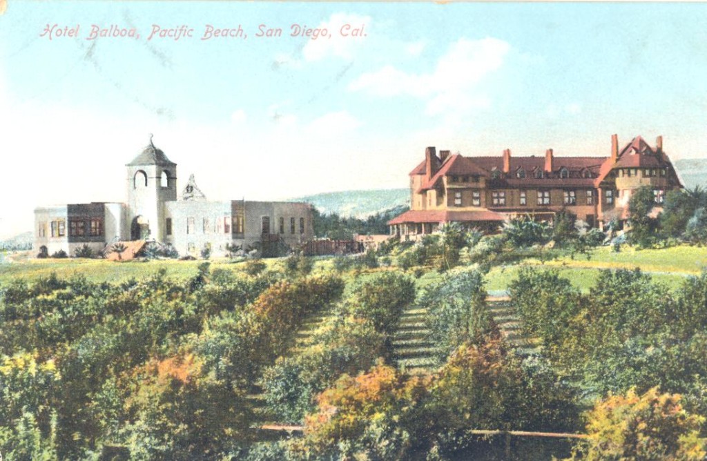
Folsom Bros. Co. also acquired other properties in Pacific Beach, including the hotel building which in 1897 had been relocated from its original location at the beach to the corner of Lamont and Hornblend streets, and in January 1904 it reopened as the Pacific Beach Hotel. In April they leased the 16-acre College Campus between Garnet Avenue and Jewell, Emerald and Lamont streets, together with buildings and improvements, and announced plans to convert the former San Diego College of Letters into a first class resort (the lease included an option to buy after one year, which Folsom Bros. Co. exercised in 1905). While the conversion was underway, Folsom Bros. Co. offered a $100 prize for the best name for their new hotel and in July 1904, after careful consideration of over 1200 entries, announced that the name finally selected was Hotel Balboa (the lucky winner, the first to suggest Balboa, had the choice of a $100 lot in PB or $100 in gold; nine other contestants, who had also mentioned Balboa, were given a consolation prize of $20 off any PB lot).

Hotel Balboa

Over the next few years Pacific Beach did undergo a period of growth which many attributed to the Folsom Bros. Co.’s activities. The Evening Tribune reported in April 1904 that the sale of building lots by Folsom Bros during the past week had been unprecedented and that the recent growth in the population of PB was due to the enterprise of Folsom Bros. Co.; ‘on a number of occasions no less than five teams might be seen conveying prospective buyers through the suburb’. In August 1904 the Union noted the marked success of Folsom Bros. Co. in developing the suburb; ‘the large number of new residences and the amount of improvements fully attest to the rapid advance of this section of the city’. Twenty-one families were said to have been added to the population in the previous month. In response to their own growth, the Folsom Bros. Company filed articles of incorporation in August 1904, adding O. W. Cotton, F. M. Elliot and B. S. Kirby as stockholders and directors.

In July 1906 Folsom Bros. Co. secretary O. W. Cotton wrote a glowing testimonial about his company for the San Diego Union in which he said that in their three and one-half years of business they had grown from employing three people until today their regular payroll included from fifty to sixty names, and that this was just the beginning of what they planned to accomplish. An Alabastine stone plant, a factory for the manufacture of artificial stone or concrete building blocks, which had started as a little experimental block yard at Pacific Beach employing four men now employed thirty with a factory downtown. They had remodeled and rebuilt the Pacific Beach college, named it Hotel Balboa, and now have one of the most delightful year-round hotels on the coast.

Dr. Martha Dunn Corey was the first physician in Pacific Beach and, with her husband, had been among the first to attempt lemon ranching. She had moved away in 1900 to practice medicine in Ohio and when she returned in 1906 to set up a practice in La Jolla she claimed to be delighted with the changes she saw. She found the growth and improvement remarkable and said that every old resident of Pacific Beach should thank Folsom Bros. Co. for what they had done. Not everyone was ready to thank Folsom Bros. Co. for the growth and improvement, however. In January 1907 Pacific Beach rancher Wilbur Conover sent a letter to the common council complaining that ‘real estate town lot boomers’ were destroying numbers of fine trees and making a barren waste of what was once a beautiful section while grading ‘useless and silly 80-foot streets’ that there was no need for and no one wanted. O. W. Cotton explained to the council that the trees were within the areas dedicated for streets and were above the grade of the streets and had to go.

The 1903 transactions making Folsom Bros. Co. ‘owners’ of Pacific Beach had not actually been finalized at the time and for several years M. W. and W. A. Folsom, or Folsom Bros. Co., were listed as ‘trustees’ of these properties in the city lot books. In December 1906 another blockbuster land deal was announced involving the same parties and the same properties, which Folsom Bros. Co. had ‘held under contract for some time’ according to the papers, and this time deeds were recorded and Folsom Bros. Co. did become the owners of most of Pacific Beach. At the same time it transferred some of the properties which it already owned in its own right, including the College Campus, to Union Title and Trust Co. The completion of these transactions was accompanied by a reorganization of Folsom Bros. Co., with a number of prominent citizens including A. H. Frost and O. M. Schmidt, and Pacific Beach residents Sterling Honeycutt and H. L. Littlefield, added as stockholders. Frost and Schmidt joined the Folsom brothers and Cotton on the board of directors.

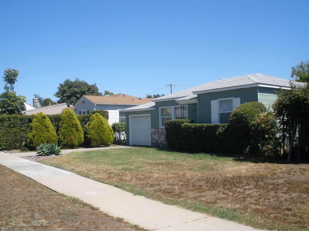
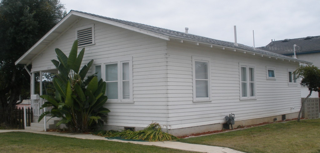
With its ownership in the tract established and reinforced with additional stockholders and capital, Folsom Bros. Co. renewed its efforts to market lots in Pacific Beach. A series of ads appeared in the San Diego Union predicting rapid increases in property values and encouraging buyers to ‘buy as early as you can at Pacific Beach’. An opening sale of 250 building lots was announced for January 1, 1907. Pacific Building Company, recently incorporated by prominent business men of San Diego and stockholders of Folsom Bros. Co., would be open for business January 1, and would build houses costing from $1,500 to $10,000 at Pacific Beach for any lot owner. The Pacific Building Company did open for business and did build homes in the Pacific Beach area; the report of building permits in the San Diego Union in early 1907 generally included at least one for the company in Pacific Beach or Fortuna Park, mostly of the ‘up-to-date bungalow type’. One of these up-to-date bungalows, built for Joseph Israel in 1907, is still standing at the southwest corner of Reed Avenue and Morrell Street (Joseph Israel was the son of lighthouse keeper Robert Israel and had grown up in the old Point Loma lighthouse).

OLYMPUS DIGITAL CAMERA

In January 1907 work had begun on a ‘cut-off’ to allow the railway from San Diego to reach the Pacific Beach station at Grand Avenue and Lamont Street over the route of today’s Grand Avenue rather than the circuitous route it had taken around the former race track via Mission Bay Drive and Garnet and Balboa Avenues. The improvements to the line led to speculation that it would also be electrified, and possibly even continued beyond La Jolla to Los Angeles. Folsom Bros. Co. was quick to exploit the publicity surrounding the work; an ad in the Union announced that ‘dirt is flying’ on the new short-line to Pacific Beach, shortening the line and reducing travel time. It was the beginning of the re-construction of the whole line for rapid transit. The time to buy lots at Pacific Beach was NOW, not after the line was completed, since prices would be doubled and over on the day the first electric car passed.

Improvements to the infrastructure in Pacific Beach also continued in 1907. One project involved grading, curbs and sidewalks on Lamont Street from the railroad station at Grand Avenue north past the Folsom Bros. Co. offices in the former Pacific Beach Hotel and the Hotel Balboa to Emerald Street. Another project was improvement of the grounds of the Hotel Balboa itself and the grading of Kendall Street from the hotel to the bay, making a ‘splendid entrance into Fortuna Park’. A two-inch water main was also laid and ‘avenues of fine palms’ were planted.

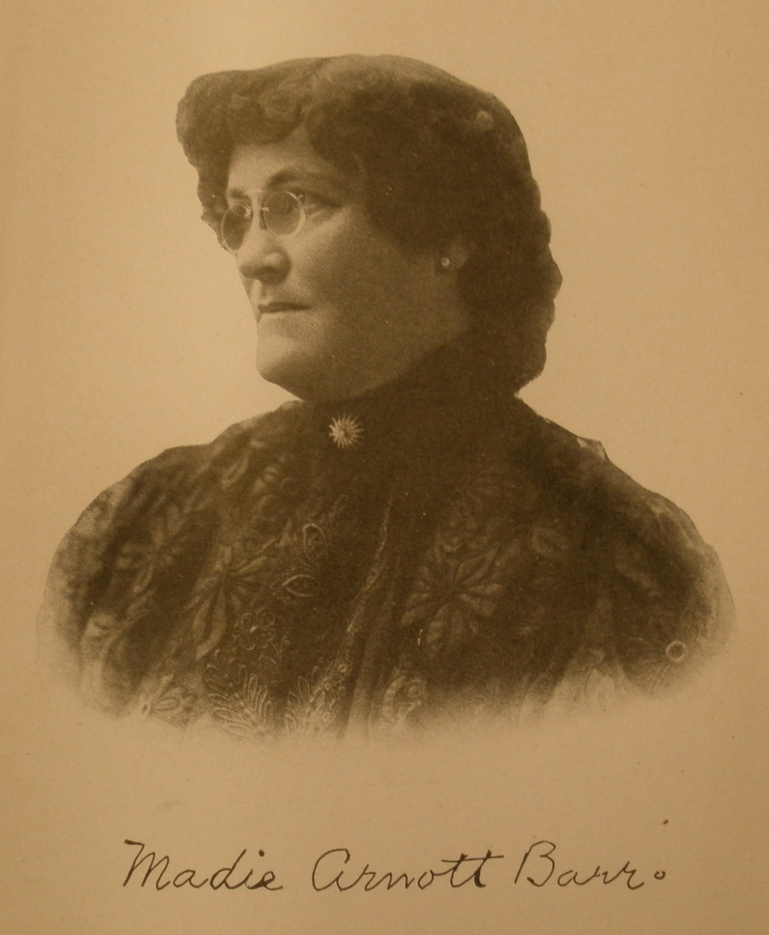
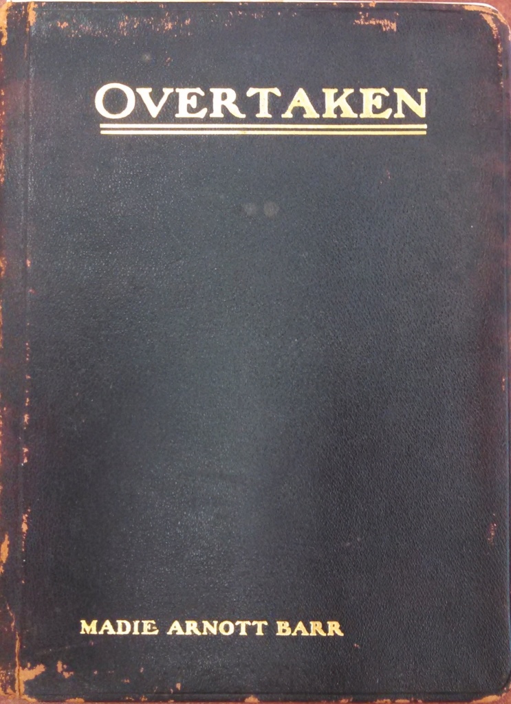
In March 1908 Folsom Bros. Co. further increased its stake in Pacific Beach property, purchasing 366 lots from Madie Arnott Barr for $40,000. This property was in the eastern half of Pueblo Lot 1791 west of Ingraham Street between Felspar and Chalcedony. The company also purchased what the San Diego Union called the ‘front door’ to Pacific Beach; the property on the south side of Grand Avenue, between the Brae Mar railroad station at Bayard Street and the ocean, giving it a large ocean frontage at the foot of Grand, which the paper predicted would soon be ‘graded and oiled’.

Further changes also occurred in the corporate structure of Folsom Bros. Co. in 1908. In February of that year, W. W. Whitson bought out the shares of O. W. Cotton, its secretary, and O. M. Schmidt, its treasurer, and several other stockholders, and was elected vice-president and treasurer. Murtrie Folsom continued as president and Wilbur Folsom became second vice-president and secretary. Cotton left the company to become president and general manager of Pacific Building Company. Later in the same year, November 1908, the Folsom brothers bought out Whitson and several smaller stockholders. Two new directors, Philip Morse and Dr. F. R. Burnham, were added to the board of the company, which then owned 4000-5000 lots and improved property in Pacific Beach, including the Hotel Balboa, and was valued at $1 million.

However, growth in Pacific Beach had slowed after 1907 as potential residents were increasingly moving to the new districts opened up by the extension of street car lines north and east of downtown San Diego. The lists of building permits published in the Union in 1908 often showed that Pacific Building Company had taken out six or eight permits, but generally none were for Pacific Beach and instead were for areas such as Mission Hills, Hillcrest, North Park and Mountain View. One list in 1909 showed Pacific Building Company with ten permits, including three in Point Loma and Ocean Beach (which were served by an electric railway) but none in Pacific Beach (the electric cars of the rapid transit line that Folsom Bros. Co. had predicted never did pass through Pacific Beach and the railroad was scrapped in 1917, although a portion of the right-of-way along the beach was incorporated into the San Diego Electric Railway line to La Jolla via Mission Beach in 1924).

In 1907 the San Diego city directory listed 170 names in 125 households for Pacific Beach, more than double the number reported in 1903. One indication of Folsom Bros. Co.’s involvement in that growth was that 20 of these residents were directly employed by Folsom Bros. Co., including laborers, gardeners, salesmen, a cook and a waiter, presumably at the Hotel Balboa, and the Folsom brothers themselves. In 1909 the city directory listed 193 residents in Pacific Beach in 130 households, barely more than were listed in 1907. The rise in property values predicted by Folsom Bros. Co. ads had also failed to materialize. In 1907 they had reported the sale of 125 lots at an average of $250. In 1909 pairs of lots in a bay-front block with unlimited views were selling for $295. The Hotel Balboa, which Folsom Bros. Co. had created from the former San Diego College of Letters in 1905 and turned into a ‘first class resort’ also did not live up to expectations. In 1909 a portion of the hotel was leased to the Pacific Beach Country Club and in 1910 the entire campus became the San Diego Army and Navy Academy.

In January 1910 the Folsom brothers announced that they had retired from active management of Folsom Bros. Co., and were joining forces with D. C. Collier, one of San Diego’s leading real estate firms, to form the Collier-Folsom Sales Offices (although they continued to hold a large stock interest in the company they had founded). A. H. Frost became president of Folsom Bros. Co. and in January 1911 changed its name to San Diego Beach Company. San Diego Beach Company, initially based in the same offices at the former Pacific Beach Hotel building, continued to own much of Pacific Beach and was a major player in the PB real estate market for decades. Ironically, one of its first major real estate transactions was the August 1910 sale of its interests in Fortuna Park, the Folsoms’ first foothold in the Pacific Beach area, to the Asher-Mollison Company.

The Folsom brothers’ association with D. C. Collier was brief, and by 1911 they were again in business together as the Folsom Investment Company, Pacific Beach property a specialty, with Murtrie as president and manager and Wilbur as vice-president and treasurer. They also still lived in Pacific Beach; Wilbur’s family, his mother Helen and the Dulas were neighbors on Broadway (Ingraham Street), and Murtrie’s family lived on Garnet Avenue. By 1912, however, they had all moved away from Pacific Beach (also to the new streetcar suburbs) and for the next ten or twelve years the brothers worked independently as salesmen and real estate agents.

After a long period of stagnation, the real estate market in Pacific Beach began to show signs of life again in the early 1920s. In 1924 Earl Taylor established a Pacific Beach business district centered at the corner of Garnet Avenue and Cass Street and anchored by the Dunaway Pharmacy building, built in 1925. In 1924, the San Diego Electric Railway opened the ‘Beach Line’ between downtown San Diego and La Jolla via Mission Beach which ran along what is now Mission Boulevard in Pacific Beach and was expected to boost the local economy in general and real estate values in particular. Once again, grading, paving and sidewalking of a new business center, this time on Garnet Avenue between Cass and the beach, was underway.

The Folsom brothers joined the anticipated real estate boom and attempted to re-enter the market they had dominated two decades earlier. For about a month, in June 1924, they advertised as Folsom Bros., general sales and development agents for Consolidated Pacific Beach Properties with their office, ‘Headquarters for Pacific Beach real estate’, at Garnet and Cass. However, while they maintained an office in PB for several more years by June 1926 their occasional ads in the Union, ‘Shank for bargains. He knows values at Pacific Beach’, referred readers to Joseph Shank, mgr. city office, Folsom Bros, 1126 7th St. In October 1926 Geo. Hawley announced that his company had opened an office at 1148 7th and that Folsom Bros. would also make it their city headquarters. In the end, the revival of the real estate market in Pacific Beach was brief, the great depression of the 1930s led to another downturn, and Folsom Bros. disappeared from the real estate scene.

In the 1930s Murtrie Folsom was described in city directories as a publisher or writer and on the 1940 census described himself as a statistician. In the 1940s, styling himself an ‘economic engineer’, he developed the idea for a ‘low-grade’ highway, a highway with grades of less than 3% and a maximum elevation of 4000 feet, between San Diego and Imperial County. He formed the Southwest Express Highway Association to promote his views and even travelled to Washington in the early years of the war to try to interest the military. Wilbur Folsom continued to sell real estate with occasional ads for individual properties in the local papers.

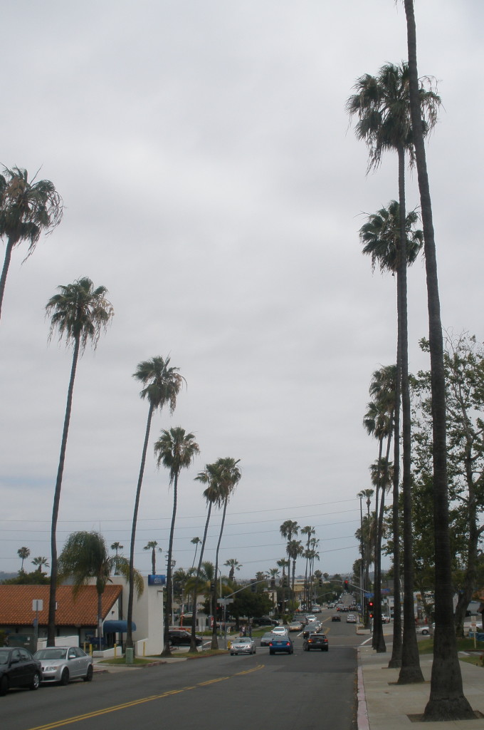
Although Folsom Bros. Co. actually owned the majority of Pacific Beach in the first decade of the twentieth century, and spent years improving and developing it, what little evidence there is of those activities is easily overlooked today. Gangs of men and teams of horses working for the company graded the streets and put in the cement curbs and sidewalks in some of the older sections of the community, especially in the area around Lamont and Kendall streets and Grand and Garnet avenues. The streets have since been paved but otherwise remain the same, and many sections of the curbs and sidewalks appear to date from those days. The most visible legacy of Folsom Bros. Co. though are the ‘avenues of fine palms’ which still line parts of Lamont Street and, after more than a century of growth, tower over the community that has also grown just like the Folsom brothers said it would.
OLYMPUS DIGITAL CAMERA

North Shore Highlands

OLYMPUS DIGITAL CAMERA

The Mexican Pueblo of San Diego covered the territory between National City and Del Mar west of the line of Interstate 805 (the land east of 805 had belonged to Mission San Diego). When San Diego became an American city in 1846 it assumed ownership of these pueblo lands and they were surveyed and platted into pueblo lots, typically a half-mile square and 160 acres. Some of these pueblo lots were sold to individuals; in 1867 Alonzo Horton famously bought six pueblo lots on which he established Horton’s Addition, now the heart of downtown San Diego. The city also offered pueblo lands as inducements to companies that proposed to end San Diego’s isolation by building railroads to the east. These lands were intended not only for the actual rights-of-way and for stations and shops, but also as subsidies to be used by the railroad companies as they saw fit.

The offer of thousands of acres of pueblo lands to the San Diego and Gila Southern Pacific and Atlantic in 1854 and the Texas and Pacific in 1873 did not result in any actual rail-building. In 1880 the city tried again, offering the land it was able to recover from the Texas and Pacific to the Atchison, Topeka and Santa Fe Railroad. Among the pueblo lots offered as subsidies were several in the area that would become Pacific Beach, including Pueblo Lot 1791, a half-mile square centered around today’s Gresham and Chalcedony Streets, and Pueblo Lot 1795, centered around Jewell Street and Grand Avenue. A subsidiary of the Santa Fe, the California Southern Railroad, did actually initiate construction of a railway which eventually connected to the Santa Fe and the east. When this railway met its initial construction milestones, in 1882, the property, including Pueblo Lots 1791 and 1795, was deeded to its real estate subsidiary, the San Diego Land and Town Company.

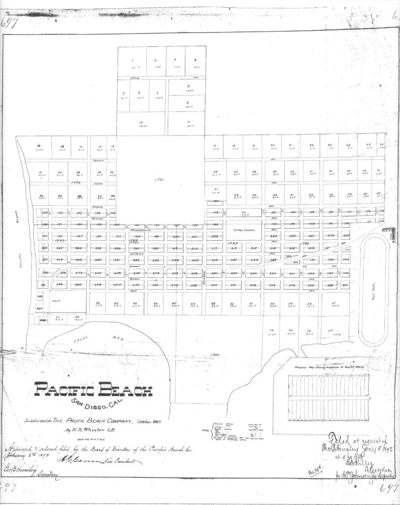
When the Pacific Beach Company was formed in 1887 it acquired Pueblo Lot 1795 from the Land and Town Company and the area within its boundaries became the central portion of the new Pacific Beach subdivision, including most of the College Campus (now Pacific Plaza). However, the Pacific Beach Company did not acquire the adjoining Pueblo Lot 1791, and it was left conspicuously blank in the first recorded subdivision map, Map 697, in 1892.

Map 697, Recorded January 1892

In 1893 the Pacific Beach Company did buy most of the eastern half of the pueblo lot and it was incorporated into the Pacific Beach subdivision in Map 791, recorded in 1894.

Map 791, recorded December 1894
Map 791, Recorded December 1894

The remaining portion of Pueblo Lot 1791, the west half and the north three-quarters of the north half of the north-east quarter (i.e., the west half and the north 3/16 of the east half), or about 95 of the original 160 acres, was acquired by Abel H. Frost in 1896 for $3500.

Frost arrived in San Diego in 1896 from Michigan, where he had been in the lumber business. In San Diego he joined forces with a niece and nephew and incorporated the A. H. Frost Company to manage his growing real estate empire. Frost also became a director and eventually president of the Folsom Bros. Co., which owned most of the property in Pacific Beach at the time, and when the Folsom brothers retired in 1910 he renamed it the San Diego Beach Company. While his San Diego Beach Company actively developed and promoted its properties in Pacific Beach, his A. H. Frost Company did nothing to promote the Frost tract in Pueblo Lot 1791, and it remained undeveloped for over 25 years (although about two acres at the eastern edge, that portion east of a northerly projection of Ingraham Street, was split off and included with other Frost property in the Congress Heights Addition, between Ingraham, Loring, Kendall and Beryl Streets, in 1914).

In 1923 the A. H. Frost Company sold the property in Pueblo Lot 1791 to the Southern Trust and Commerce Bank, and the portion south of Diamond Street was included in a new Congress Heights No. 2 subdivision. In 1925, the Southern Trust and Commerce Bank transferred both the original Congress Heights and Congress Heights No. 2 subdivisions (minus the few lots already sold) and the remaining undeveloped portion of the Frost tract north of Diamond to the Union Trust Company. This undeveloped portion, from Everts to Gresham between Diamond to Beryl Streets and from Everts to a northerly projection of Ingraham Street between Beryl and Loring, was subdivided in 1926 as North Shore Highlands. Actually, the boundary of Pueblo Lot 1791 lies about 75 feet west of Everts Street, so the row of lots along the west side of Everts is also within the North Shore Highlands subdivision. East of Foothill Boulevard, the western portion of Monmouth Drive and the area south of the Loring Street hill are also included in the subdivision.

When the first unit of North Shore Highlands went on sale in December 1926, the announcement in the San Diego Union highlighted the fact that A. H. Frost had held the property intact for 25 years, ‘refusing to have it spoiled by marketing it at the wrong time or cut up’, and as a result it was a ‘choice, highly improved property in the heart of fast-growing San Diego Beach, without a clutter of old homes on it’. The ‘beautiful sea-view district’ had an ‘inimitable panoramic view’, illustrated by a panoramic photo showing Pacific Beach, Crown Point and Mission Bay, apparently from the top of Loring Street hill (despite the fact that only a few lots were located in the foothills and most were on the coastal plain with little if any view). An ad offered this ‘choicest, most scenic residential property’ for only $940 to $1250, but warned that these present low opening prices would soon be a thing of the past.

The announcement of the opening sale also described a $200,000 improvement program to begin at once, consisting of paved streets, sidewalks and curbs, gas, water, electricity, sewers, ornamental lights and other features. Within a few months the Common Council of the city of San Diego passed a resolution of intention to grade and pave the streets with a Portland cement concrete pavement, and to construct cement sidewalks, curbs, culverts and sewer mains, cast iron water mains and an ornamental lighting system. The lighting system was to consist of reinforced concrete lighting posts, globes, refractors, lamps, and pot heads, along with cables and other appurtenances. The improvements were to be paid for by serial bonds, to be repaid at 7 percent interest by charges upon an improvement district which included all the property lying within North Shore Highlands.

By mid-1927 the promised improvements were well under way, according to George M. Hawley in the Evening Tribune. The Hawley organization had taken an exclusive contract for the promotion and sale of the North Shore Highlands tract and their July 23 ad in the Tribune followed a familiar script when they invited the public to a good luncheon and concert at their big tent at Diamond and Fanuel Streets, but also added a contemporary flourish; free airplane trips over the north shore district in a Ryan monoplane, ‘same type as carried Lindbergh over the Atlantic’ (Charles Lindbergh’s famous solo flight from New York to Paris in the ‘Spirit of St. Louis’, a San Diego-built Ryan monoplane, had occurred two months earlier, in May 1927).

The promoters of North Shore Highlands had envisioned a ‘new high-class residential subdivision’ with large lots and ‘race and building restrictions that would make it highly desirable’. The lots were large; the standard lot was 50 feet wide rather than the 25-foot width of most lots in Pacific Beach, and lots in the foothills area and on the strip along the west side of Everts Street were even larger. Race restrictions meant that the lot could never become the property of, or even be occupied by, ‘any person other than of the Caucasian race’ (unless they were a servant or employee of a Caucasian occupant). Among the building restrictions were requirements that the property could only be used for a single, private, residential purpose, the residence erected on the premises would be limited to one story and could not cost less than $4000, no common shingled roofs would be permitted, and no pepper, eucalyptus or cypress trees could ever be planted (black acacia could be planted, but only between the cement walk and the curb).

While the promoters proclaimed that these restrictions made North Shore Highlands highly desirable, and the introduction of the San Diego Electric Railway line to La Jolla via Mission Beach and Pacific Beach in 1924 had improved access to San Diego, potential purchasers were apparently not impressed; of the more than 300 lots in the subdivision only six had been purchased, and only three residences built, by 1930 (and the owner of one of these lots and residences was one of the promoters).

In addition to high purchase prices and the added costs of the building restrictions, purchasers of property in an improvement district like North Shore Highlands were required to pay an annual assessment to service the improvement bonds, and under the Mattoon Act of 1925 would also be responsible for a share of the assessments of any residents of the district who defaulted (two lots in North Shore Highlands were foreclosed and offered for sale by the city for non-payment of the improvement bond). The negative effect that the great depression of the 1930s had on the real estate market must have also impacted sales. Only ten residences could be counted in an aerial photo from 1935, after the tract had been on sale for more than eight years, and the 1937 San Diego city directory listed only ten addresses on its streets.

The completion of the causeway across Mission Bay to Crown Point in 1931 further reduced travel time to San Diego, the Mattoon Act was repealed in 1933 and the economy began recovering from the great depression in the mid-1930s. In 1937 a new promotional campaign by E. G. Anderson Co., developers of Crown Point, announced the ‘opening’ of North Shore Highlands, ‘prices from $500 . . . all improvements in and paid for . . . no bonds, no assessments’. The E. G. Anderson company also offered to build a ‘distinctive dwelling’ on a purchaser’s lot. Lot sales in North Shore Highlands began to respond; in the 1200 and 1300 blocks of Missouri Street the number of homes listed in the San Diego city directory increased from 1 in 1937 to 3 in 1938, 6 in 1939 and 8 in 1940.

The Consolidated Aircraft Corporation had relocated to San Diego in 1935 and in 1940, in anticipation of World War II, greatly expanded its San Diego manufacturing facilities to produce thousands of B-24 Liberator bombers. Tens of thousands of new workers migrated to San Diego to staff the factories, and all these new aircraft workers needed a place to live. The federal government responded to the acute housing shortage by building entire communities of temporary housing, including the Los Altos Terrace housing project just across Loring Street from North Shore Highlands. Commercial real estate developers followed suit by building inexpensive ‘standard built’ homes in existing housing tracts like North Shore Highlands.

Model standard-built homes in the 1300 block of Missouri today.
The original model standard built homes in the 1300 block of Missouri today.

Newspaper ads in 1941 invited the public to inspect standard built homes by Convers and Donahoe in the 1300 blocks of Missouri, Chalcedony and Law streets; ‘we have not tried to create something new but have incorporated in the floor plan the last word in conservative living. Ten homes completed or under construction’. The ad for Little Castles, Inc., reported continuous and increasing demand for well built homes in the Highlands of beautiful Pacific Beach; ‘Two-bedroom homes ranging from $3295 to $3895, turn-key job – no extras. A minimum down payment, balance like rent. Offices at 1311 Chalcedony St’.

Sales of standard built homes within North Shore Highlands exploded; the San Diego city directory showed that the number of homes in the 1200 and 1300 blocks of Missouri Street increased from 8 in 1940 to 28 in 1942. The comparable blocks on Chalcedony and Law streets each had one home in 1940 but there were 21 homes on Chalcedony and 16 on Law in 1942 (7 of these 65 homes were listed as vacant in 1942, presumably completed but not yet sold). By 1945 the number of homes on these streets had grown to 30, 24 and 22, well over half of the 40 lots on each street, and none were vacant. Similar growth occurred throughout the subdivision, at least outside of the foothills area where the steep terrain made construction of inexpensive homes impractical, and by 1950 these areas had been built out. And with zoning regulations still favoring single-family residences many of these standard built homes from the 1940s are still standing.

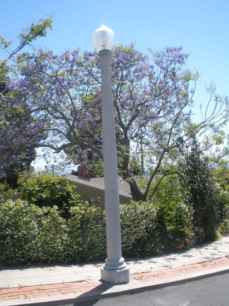
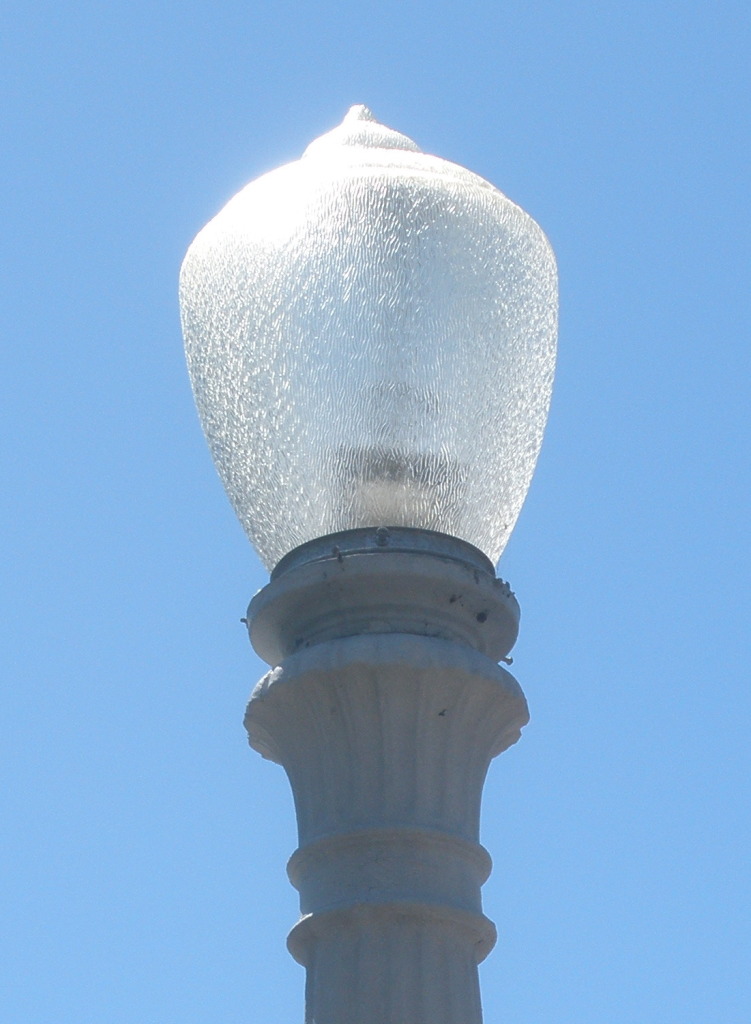
North Shore Highlands has a unique history and followed a separate development path from the rest of Pacific Beach, but what really sets it apart from the surrounding neighborhoods today are the ornamental street lights which still line the streets and even extend along Fanuel Street to Garnet Avenue and along Loring Street to Cass Street (at the time the lights were installed the highway between San Diego and Los Angeles ran through Pacific Beach along Garnet and Cass; Fanuel and Loring would have been the main access routes to this highway). Although the lights have been removed from Foothill Boulevard they can still be seen all the way up Loring Street hill and on Monmouth Drive. Ironically, while the ornamental street lights were installed in the 1920s to mark North Shore Highlands as a high-class residential community, they were not actually turned on until 1944, when the community had been largely settled by ordinary people in ‘standard built’ homes.

OLYMPUS DIGITAL CAMERA

PB’s Creation Myth

Many people trying to find information about Pacific Beach today would probably start with an internet search and find themselves looking at the Wikipedia page for ‘Pacific Beach, San Diego’. In the ‘History’ section they would learn that Pacific Beach was developed during the boom years of 1886-1888 by D. C. Reed, A. G. Gassen, Charles W. Pauley, R. A. Thomas, and O. S. Hubbell, and that it was Hubbell who ‘cleared away the grainfields, pitched a tent, mapped out the lots, hired an auctioneer and started to work’. This description of PB’s origin is also repeated verbatim in the websites of dozens of other organizations and businesses with some connection to Pacific Beach. However, while it is true that Pacific Beach was established during San Diego’s boom years and the individuals listed were among PB’s developers, this colorful account of its creation is mostly a myth.

The Wikipedia article cites Zelma Bays Locker’s 1976 Journal of San Diego History paper Whatever Happened to Izard Street? Pacific Beach and its Street Names as the source for this information, and the first problem with the Wikipedia account appears to be simply a misunderstanding of Mrs. Locker’s grammar. She never said ‘it was Hubbell’; what she said was ‘Promoters of the new subdivision were D. C. Reed, A. G. Gassen, Charles W. Pauley, R. A. Thomas and O. S. Hubbell, who “cleared away the grainfields, pitched a tent, mapped out the lots, hired an auctioneer and started to work.”’ While this sentence could have been phrased more clearly, it does seem that Mrs. Locker intended to attribute those development activities to the entire group of promoters, not to Hubbell alone. Nothing else in the historical record suggests that Hubbell had a preeminent role in the early development of Pacific Beach.

A more serious problem is that most of the activities attributed to the promoters (or Hubbell) never actually happened. The quotation about clearing the grainfields, pitching a tent, etc. came from a story by M. V. Depew that had appeared in the San Diego Sun in 1931, more than 40 years earlier. That article was about the race track that once stood on the east side of Rose Creek, where the ruins of the grandstand and the stables were still to be found ‘almost hidden by the rank vegetation of two score years’. According to Depew, it had been more than 40 years since clods flew from the hoofs of horses but nature with all her weapons of obliteration had been unable to wipe out the traces of those halcyon days. In those days, land companies were formed, maps were made and auctioneers pitched their tents on the sites. Brass bands, wind-whipped flags and flowery advertising led to frenzied days of untold profit, and ‘in this period Pacific Beach was born’. Reed, Gassen, Pauley, Thomas and Hubbell formed the Pacific Beach Company and, in the now-familiar words from Wikipedia, started to work.

Pacific Beach may have been born in the halcyon days when auctioneers pitched tents, but reports from those days indicate that its birth didn’t exactly follow this script. The Pacific Beach Company was incorporated in July 1887, originally by Reed, R. A. Thomas, and Hubbell, but also J. R. and W. W. Thomas, D. P. Hale, Thos. E. Metcalf, Chas. Collins and Geo. B. Hensley, later joined by Gassen and Pauley. The Pacific Beach Company did have a map drawn up by City Engineer H. K. Wheeler, in October 1887, laying out streets and avenues, blocks and lots. However, the lots were not sold at auction; on the contrary, the Pacific Beach Company announced that lots would be placed on sale December 12, 1887, and that the first man in line at their office at 8 o’clock Monday would have first choice of lots (Bancroft & Co., real estate agents, actually had a relay of men hold the first place in line after the office closed Saturday night, guaranteeing their clients that they could secure them any lot in Pacific Beach).

According to the December 13, 1887, San Diego Union, the opening sale of Pacific Beach lots was the most successful in the history of San Diego real estate transactions, all things considered. There was a large crowd of purchasers and the Pacific Beach Company did not resort to the usual methods of ‘booming’ the sale; there was no band in attendance, no free carriages and no free lunch. The property was sold in the same manner that all other business is transacted, on the recognized principle of ‘first come, first served’.

So, O. S. Hubbell may have pitched a tent but he didn’t map out the lots; that was done by City Engineer H. K. Wheeler. He may have hired an auctioneer but the opening sale was held at the Pacific Beach Company’s office downtown and purchasers were allowed to buy their choice of lots ‘first come, first served’.  There was no brass band or free lunch, and no mention of wind-whipped flags, flowery advertising or other signs of the frenzied days of untold profits that were supposed to have characterized the period when Pacific Beach was born.

And what about the grain fields? The San Diego Union reported in December 1887 that grading on the route of the Pacific Beach railroad from Morena to the beach (along Balboa and Grand Avenues) was progressing rapidly, that excavation for the planned college had been finished and brickwork begun, and that men were at work laying pipe from the city water works.  However, there was nothing in the Union to suggest that the rest of the tract had been cleared or otherwise prepared for development.

If anything was done to the grain fields in 1887 the effects were short-lived, and Pacific Beach continued to produce large crops of grain and hay for decades. For example, in April 1892 the Union reported that two mowing machines were started in a fine 100-acre barley field at Pacific Beach. The crop was very thick, tall and well headed out and would be cured for hay. The news in May 1895 was that hundreds of acres of grain were being harvested in Pacific Beach and the yield was good. Pacific Beach ranchers shipped $3,000 worth of produce, principally grain, to San Francisco on the steamer Santa Rosa in July 1897, according to the Evening Tribune. In November 1897 the Tribune noted that men and teams and plows were at work from daylight until dark putting in seed for next year’s hay crop. In 1899 the report was that O. J. Stough had nearly finished seeding 1200 acres to hay around the Beach (1200 acres is nearly 2 square miles; practically the entire area of Pacific Beach). In 1900 ‘The grain fields are beautiful and farmers say the prospects were never better’.

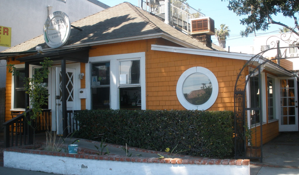
So, the Pacific Beach creation story turns out to be somewhat less dramatic than what is portrayed in Wikipedia, but just as historic. And as an interesting footnote, Wikipedia’s own creation story turns out to have a connection with Pacific Beach, and with Pacific Beach history. In 2001 the founders of Wikipedia worked at an office at the corner of Lamont and Hornblend Streets and they came up with the idea for an online encyclopedia with collaborative editing over dinner at Mama Mia’s restaurant, on Balboa Avenue between Lamont and Morrell. That restaurant building dates from about 1889, one of the first houses built in Pacific Beach and one of the oldest, if not the oldest, still standing. It was originally the home of PB pioneers Henry and Fannie Gleason.

OLYMPUS DIGITAL CAMERA

Original 1887 PB Map

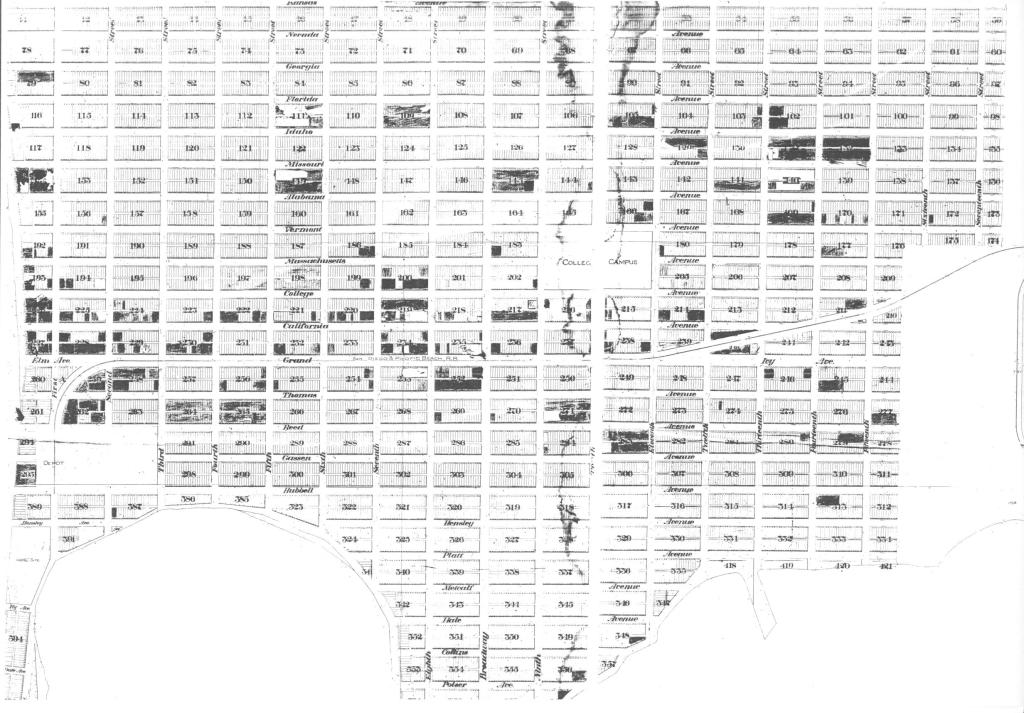
The San Diego History Center library in Balboa Park is a rich source of historical information, not only original documents from the early days of San Diego and a huge collection of historical photographs but also a knowledgeable staff. One day I asked their map expert if she knew about a map of the Cloverdale subdivision by H. K. Wheeler from the 1880s. She didn’t, but a few minutes later she returned and said that H. K. Wheeler had ‘rung a bell’ and would I be interested in another map by H. K. Wheeler, this one of the Pacific Beach subdivision from 1887. What she showed me was a large (18 X 20-inch) photocopy of a much larger (9 X 10-foot) map which she said was rolled up and stored on top of a shelf in the storage area behind her desk. I had seen early maps of the Pacific Beach subdivision, including the map that was generally considered the original PB subdivision map (Map 697, recorded in January, 1892), but this map was significantly different and seemed like it could be a kind of ‘missing link’ in Pacific Beach history.

Wheeler PB Map 5
Central portion of 1887 subdivision map of Pacific Beach by H. K. Wheeler. (SDHC #1669)

The most striking feature of the 1887 Wheeler map is how similar it is to what Pacific Beach has become in the intervening century. The entire area from the ocean to about Rose Creek and from the tips of Mission Beach and Crown Point to the Mt. Soledad foothills was divided into a grid of city blocks by north-south ‘streets’ and east-west ‘avenues’, most of which exist today and some of which have even kept their original names (Grand, Thomas and Reed Avenues). There was even a four-block area in the center of the community that was then set aside for a College Campus and which today is the Pacific Plaza shopping center. There were over 400 city blocks, most of them in the same location as they are today and many with the same block numbers.

In the 1887 Wheeler map the north-south streets were numbered, from First Street (nearest the ocean) to Seventeenth Street (near Rose Creek), with a somewhat wider street named Broadway (now Ingraham) between Eighth and Ninth. The east-west avenues included the much wider Grand Avenue, which was also to be the right-of-way for a railway to San Diego. Avenues north of Grand were named for states, except for College (now Garnet) Avenue, which ran by the College Campus. South of Grand the avenues were named for officials of the Pacific Beach Company and other local real estate operators; Thomas, Reed, Gassen, Hubbell, Hensley, Platt, Metcalf, Hale, Collins and Poiser.

In the 1892 map, however, the grid of city blocks was limited to a central slice of Pacific Beach, between Reed Avenue and Alabama Avenue (now Diamond Street). The streets and avenues in this area were the same as on the original 1887 map, and with the same names, but the newer map reclassified most of the area between today’s Diamond and Loring Streets, and between Reed Avenue and what became Pacific Beach Drive, as rural ‘acre lots’ of about 10 acres. Most of the streets did not continue into these rural areas and many of avenues that had appeared on the original map in these areas had been eliminated. Most of the area north of Loring and south of PB Drive was no longer included on the map at all. The 1892 map retained about 125 of the original 400-plus city blocks platted in the 1887 map, while adding about 75 new acre lots.

Map 697, Recorded January 1892

The Spring 1976 issue of the Journal of San Diego History contained a paper by Zelma Bays Locker titled Whatever Happened to Izard Street? Pacific Beach and its Street Names. From 1954 to 1967 Mrs. Locker had been the librarian in charge of the downtown San Diego Library’s California Room, a repository of local and regional historical archives, and after her retirement from the library she served as a director of the San Diego Historical Society, which became the San Diego History Center. She also lived on Yarmouth Court in Mission Beach, on the ‘outskirts’ of Pacific Beach, so she was well qualified to write an academic article on Pacific Beach history.

Mrs. Locker’s article was primarily about the street names that exist in Pacific Beach today, particularly the alphabetical series of north-south streets (Bayard, Cass, Dawes, etc.; Allison Street, the first in the series, has since been renamed Mission Boulevard). In 1900 the city of San Diego decided that all street names had to be unique, and since there were many other communities of San Diego with numbered streets or streets named for states, those in Pacific Beach would have to be renamed. She was unable to find any historical record of how the streets were renamed and her own research led her to conclude that the only underlying theme for these names was that they were all statesmen who would have been familiar to the public in 1900 (even though some of the names were misspelled, e.g., Everts Street was apparently named for William Evarts and Fanuel for Peter Fanueil). The street between Haines and Jewell, originally Broadway, was renamed Izard Street in 1900 after a revolutionary war patriot, but the phonetics of this name did not ‘set well’ with residents and eventually it was changed to Ingraham.

Grand Avenue and the avenues named for Thomas and Reed were apparently unique within the city in 1900 and were not renamed, but the avenues on the 1892 map north of Grand were renamed, again in an alphabetical sequence, for gemstones or minerals, from Agate to Hornblend (again with misspellings; Felspar Street for Feldspar and Hornblend for Hornblende). When the ‘acreage country’ north of Diamond was re-subdivided again in the early 1900s, restoring the avenues that had existed on the original 1887 map between what had become Agate, Beryl, Chalcedony and Diamond, these ‘new’ avenues could not be incorporated into the alphabetical gemstone sequence. Some, like Turquoise, Tourmaline and Sapphire were named for gemstones anyway, but out of sequence. Mrs. Locker could not account for the names of others, such as Law, Wilbur and Loring, or for Missouri Street, which she called a ‘real puzzler’. She wrote that it was not on the ‘original 1887 map’ and was first named in Hauser’s Subdivision in 1904 (actually it had been named in F. T. Scripps’ Ocean Front subdivision in 1903). She added that there had been a Missouri Street in University Heights since 1888 but that it was now 32nd Street.

Missouri Street was a puzzler for Mrs. Locker because she was unaware of the actual original 1887 subdivision map by H. K. Wheeler, the ‘missing link’ in PB’s historical record. She wrote in her article that the first subdivision map of Pacific Beach was platted and the land put on the market in October 1887 by the Pacific Beach Company, but curiously enough, the original map was not filed with the County Recorder until January 2, 1892, a fact which would have a later bearing on some street names. Actually, the first subdivision map was platted in October 1887 (although lots were not put on the market until December) but the map that was filed on January 2, 1892, Map 697, was not the original but an amended map of a smaller and more rural subdivision. The original 1887 map did include a Missouri Avenue, between Alabama and Idaho Avenue (now Chalcedony Street). Missouri Avenue was deleted from the 1892 map to make way for a row of acre lots, including Acre Lot 49, between Alabama and Idaho. John and Julia Hauser purchased Acre Lot 49 in 1903 and in 1904 they filed a plat of Hauser’s Subdivision of Acre Lot 49 which basically returned it to the configuration on the original 1887 map; two city blocks separated by a street named Missouri (apparently, the Missouri Street in University Heights had already been renamed and no longer represented a conflict at that point).

Map of Hauser's Subdivision
Map of Hauser’s Subdivision

Although it may be true that the 1887 Wheeler map itself was never recorded, over a hundred deeds to Pacific Beach property were recorded prior to 1892 and some of these deeds include legal descriptions which could only have been derived from the original Wheeler map. For example, Matilda O’Neil was granted a deed in April 1888 for Block 295, between Gassen and Hubbell Avenues. Gassen and Hubbell Avenues appeared on the original Wheeler map but neither were still listed on the 1892 map. F. W. Barnes bought lots 21-28 of Block 166 in March 1889; Block 166 was shown on the original Wheeler map but not on the 1892 revision where it had been incorporated into Acre Lot 64 (Barnes then bought all of Acre Lot 64 in 1892). Other deeds from this period include specific references to the ‘official map of Pacific Beach, made by H. K. Wheeler, 1887’, or similar terms. On the other hand, no acre lots were sold prior to 1892. Acre lots did not exist on the original subdivision map and first appeared on the revised Map 697. Thirteen acre lots were sold in just a few months after Map 697 was recorded.

The 18 X 20-inch black-and-white copy of the original 1887 Pacific Beach subdivision map by H. K. Wheeler at the History Center had markings on it which suggested that the original had been used to keep track of or to display the extent of lot sales. The map was extremely detailed; each of the city blocks showed the individual lots on that block and some of these lots were ‘marked out’, presumably indicating that they had been sold and were no longer available (some of the ‘marked-out’ lots were also apparently pasted over, perhaps indicating that the sale had fallen through and they were again available). The marked-out lots generally corresponded to lots for which deeds had been recorded in the County Recorder’s office.

Eventually, the History Center library staff let me see the original map; they lifted it down from its shelf and laid it out on one of tables in the library. The map was in two halves, each of them five feet wide and nine feet long and rolled up together. When unrolled each completely covered one of the large library tables. At this scale each city block was over 1 ½ inch wide and nearly 3 ½ inches long. Within the blocks, what had appeared to be black markings on the black-and-white copy turned out to be either red or blue, with red predominating in the west half and blue in the east half. According to library protocol I wasn’t allowed to photograph the map, but I was able to write down most of the block numbers with red or blue marks and later found that the blue lots generally matched lots endowed by the Pacific Beach Company to the San Diego College Company, to be sold by the college to raise funds for operations (these lots didn’t sell well and the college closed after a few years). The red lots matched lots purchased by private buyers. There actually were small pieces of paper pasted over a few of the lots, apparently to ‘erase’ the markings beneath them if a sale fell through.

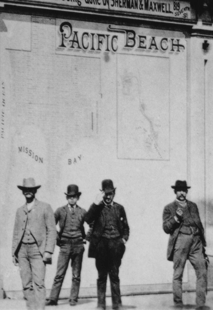
The History Center card catalog entry for the photocopy (M1669) indicates that the original map was stored in the archives but not cataloged because of its ‘unmanageable’ size, and that the photocopy was supplied in 1987 by Mr. John Fry of Pacific Beach, who obtained permission to make the copy (John Fry is the long-time president of the Pacific Beach Historical Society). When I asked John about the map he could only recall trucking something up to Kearny Mesa where they put it on a wall and took a picture of it, so the provenance of the map and its accession to the History Center in Balboa Park remains a mystery. A photo in the center’s photo collection of the Pacific Beach Company’s downtown office in 1888 includes a large map of Pacific Beach, but the details of that map do not match the 1887 Wheeler map.

Outside the Pacific Beach Company office, 1888.
Outside the Pacific Beach Company office, 1888. (SDHC #3797)

One thing that does seem certain is that Zelma Bays Locker, despite her years at the California Room and the Historical Society, never saw the actual original 1887 Pacific Beach subdivision map by H. K. Wheeler.

A Distinguished Address

OLYMPUS DIGITAL CAMERA

The quaint cottage at 2104 Diamond Street, overlooking the corner of Diamond and Noyes, is one of the first houses ever built in the Pacific Beach subdivision and may be the oldest one still standing. It is also associated with some of PB’s most distinguished early-day residents.

In 1887, at the height of San Diego’s great boom, a ‘syndicate of millionaires’ bought up the property we now know as Pacific Beach, incorporated as the Pacific Beach Company and, in October 1887, filed a map for the Pacific Beach subdivision. In December 1887 they held an opening sale which the San Diego Union called the most successful in the history of San Diego real estate transactions, with over $200,000 worth of lots ‘disposed of’. Not only that but the paper reported that the buyers were all legitimate investors, many of them intended to improve their lots and five handsome residences were to be erected immediately.

For some reason, perhaps because the lots were sold on an installment basis, the first deeds were not actually recorded until April 1888, but one of the first deeds that was recorded, on May 18, 1888, was for lots 39 and 40 of Block 140, the property under what is now 2104 Diamond Street (on the 1887 map it was Alabama Avenue, at the corner of Thirteenth Street). The grantee was Madge Morris Wagner and the consideration was $250 gold coin of the United States of America.

Madge Morris Wagner was the wife of Harr Wagner, editor of the Golden Era, a literary magazine established in San Francisco in 1852. Wagner had purchased the Golden Era in 1882 and in 1887 he moved it to San Diego, explaining to his subscribers that San Diego was destined to become a great city and the Golden Era was determined to contribute to and benefit from the city’s growth. In a May 1887 editorial he explained the benefits to a city of an institution of higher learning and suggested that San Diego was large enough to support one. To implement this vision, Wagner convinced the Pacific Beach Company to include a college in the plans for their new community. The October 1887 subdivision map did set aside a four-block College Campus in the center of town, where Pacific Plaza is now, and the Pacific Beach company deeded it to the college company founded by Wagner and his partners, C. S. Sprecher and F. P. Davidson. The cornerstone for the San Diego College of Letters was laid in January 1888 and the original college building was completed and opened for 37 students in September 1888.

San Diego College of Letters and student body, Pacific Beach, 1888.
San Diego College of Letters with student body, faculty and staff, Pacific Beach, 1888 (San Diego History Center #9800).

As a founder and professor at the college Harr Wagner would have been one of the first residents of Pacific Beach, and the house built on the Wagners’ property at the corner of Alabama and Thirteenth, a short walk from the college, may have been one of the handsome residences expected to be erected immediately, possibly as early as 1888. Although they had lived at 2229 E Street downtown when the 1887-88 San Diego City Directory was printed, their residence was listed as Pacific Beach in the 1889-90 directory.

From 1888 to 1892 John D. Hoff’s Asbestos Company was located near the present-day intersection of Garnet Avenue and Soledad Mountain Road in Pacific Beach. Hoff’s asbestos works manufactured paints, boiler coatings and other products incorporating asbestos. A March 1889 ad in the San Diego Union listed some well-known persons having Hoff’s asbestos goods in use and one of these well-known persons was Harr Wagner. Although the ad doesn’t specify what goods were in use or where they were being used, several of the other references on this list were located in Pacific Beach, including the College of Letters and the Presbyterian Church. It may be that Harr Wagner had used Hoff’s asbestos paint to protect and fire-proof his house, just a few blocks down the street from Hoff’s factory, sometime before March 1889.

There was certainly something there by the end of 1889. A U. S. Coast and Geodetic Survey map of the Pacific Coast from False Bay to La Jolla, dated 1889, covered Pacific Beach and included cultural features such as buildings and roads. One of the buildings that showed up on this map was at Alabama and Thirteenth, presumably the Wagners’ home. The map also shows two buildings labeled ‘University Buildings’ a few blocks to the west. The original college building had been built in 1888 but a second building, Stough Hall, was begun in September 1889 and completed in January 1890. On the map, the western-most of the two university buildings is in the appropriate location for Stough Hall, but in the wrong orientation, aligned with the original college building. Stough Hall was actually aligned with College (now Garnet) Avenue and at an angle to the original building. Apparently the cultural features on the map, which included the house at Alabama and Thirteenth, had been field-checked in late 1889 when the location of Stough Hall was apparent but its final footprint was not.

1889Map

Madge Morris Wagner was a successful writer in her own right who had long contributed articles and poems to the Golden Era. In 1889 she began work on a novel, A Titled Plebian, which was completed in July 1890 and published in the December 1890 issue of the Golden Era. An ad for Hoff’s asbestos company in the same issue of the Golden Era said that the author had written the narrative at her Villa Home, Pacific Beach – made attractive and beautiful – both interior and exterior – by Hoff’s Glossy Asbestos Paints. ‘The Mirror Walls through her open casement windows reflect on the shores of the Bay – a net-work of buildings – alive with busy men Amalgamating, Packing and Shipping Hoff’s Asbestos Paints and Lubricants’. The house at 2104 Diamond, on a bank above the street, still has a view of the shores of Mission Bay that would have included the site of the asbestos works, alive with busy men in 1889 and 1890.

The development of Pacific Beach and the establishment there of the San Diego College of Letters had anticipated that the population growth seen during San Diego’s great boom would continue indefinitely. Unfortunately for the developers, and for the college, the boom suddenly ended in 1888, a few months after the Pacific Beach Company’s opening sale and before the college had even opened. In addition to the grant of the College Campus itself, the company’s endowment to the college had included hundreds of lots to be sold by the college to fund future operations. The end of the boom, however, caused a collapse in the San Diego real estate market, including Pacific Beach lots, drying up this expected source of funding. The college managed to stay open for two years but in the summer of 1890 Harr Wagner and his fellow founders, Sprecher and Davidson, transferred their interest in the college company to ‘eastern parties’, presumably with deeper pockets. Wagner and Sprecher resigned their positions on the faculty to devote their time to the Golden Era, where Wagner was Editor and Sprecher became Associate Editor. Davidson remained at the college to represent the new owners.

In November 1890 Harr Wagner was elected County Superintendent of Schools and Madge Morris Wagner took over as editor of Golden Era. Wagner’s tenure as superintendent was notable for his progressive educational policies, but he was defeated for reelection in 1894 and eventually decided to take the Golden Era back to San Francisco.

In October 1891 the San Diego Union reported that Harr Wagner had moved his household goods from his home in Pacific Beach to the corner of Walnut and Albatross, and that Mr. Havice had moved into the house vacated by Mr. Wagner (George Havice was married to Harr Wagner’s sister Jennie). The Havices also owned an entire block, Block 213, a few blocks to the south, between what are now Garnet Avenue and Noyes, Hornblend and Morrell Streets. In 1892 the San Diego Union reported that Havice had set out lemon trees on his property, introducing the lemon industry that was to revive the economy of Pacific Beach and sustain it over the next decade.

Although the Wagners had moved to the Bankers Hill area, they still owned the property in Pacific Beach where in 1893 city records listed improvements assessed at $240, presumably the value of the house at the corner of Alabama and Thirteenth. In 1894 the Wagners sold the property to Elizabeth Dunn of Columbus, Ohio, and from 1895 to 1904 city records listed it under her name, with improvements continuing to be assessed in the range of $175 to $200. Miss Dunn, however, remained in Ohio and the property, and the house, has always been associated more with her sister, Dr. Martha Dunn Corey, a Pacific Beach pioneer who was also the region’s first resident physician.

In 1892 the Pacific Beach Company had begun selling ‘acre lots’ in the outlying areas of the community, tracts of about 10 acres intended for agricultural development. One of the first acre lots to be sold, in February 1892, was Acre Lot 19, granted to Lucien Burpee in trust for Martha Dunn Corey and her children (Acre Lot 19 is now C. M. Doty’s Addition, south of Kate Sessions Park and surrounded by Kendall, Beryl and Lamont streets). Dr. Corey and her husband, Col. George H. Corey, followed George Havice’s example and developed Acre Lot 19 into one of the first lemon ranches in Pacific Beach. In 1895 the city leased George Corey an additional 20 acres of the city land adjoining their property (that became Kate Sessions Park) on the condition that he clear it. While operating their lemon ranch the Coreys presumably lived in the ranch house on the property, while the cottage on Block 140 was rented out (the Evening Tribune reported in 1898 that Mr. and Mrs. Conover had leased Dr. Corey’s house on Alabama Street).

In 1900 the Coreys moved to Marion, Ohio, where Dr. Corey practiced medicine, but in 1906, by then a widow, she returned from Ohio and established a medical practice in La Jolla, with a home and office at 7816 Girard Street. She also formally acquired the property and the home at the corner of what had become Diamond and Noyes streets from her sister. City records show Martha Dunn Corey as the owner beginning in 1905; the deed transferring the property was recorded in 1908.

Dr. Corey lived and worked for nearly twenty more years in La Jolla, which she was said to have considered her only true home, but she also retained the house on Diamond and apparently even occupied it intermittently. The San Diego city directory for 1913 listed her address as Diamond ne cor Noyes, Pacific Beach (other directories from 1908 to 1924 listed her La Jolla address) and the San Diego Union reported that for Christmas 1913 Dr. Corey and her three sons motored to their home in Pacific Beach and prepared dinner for Mrs. S. C. Dempsey and her family (Sally Dempsey had a real estate office at 7818 Girard, next door to Dr. Corey and presumably her tenant).

Dr. Corey occasionally took time off to be with her sons, and some of that time was spent in Pacific Beach. In 1914 the Evening Tribune reported that Dr. Corey would accompany her sons Gardner and Fred Corey to university at Berkeley and would probably remain with them until Christmas. Her La Jolla residence would be leased and Dr. F. H. Parker had come to La Jolla to practice in Dr. Corey’s place. In December, 1914, the news was that she had returned from Berkeley to occupy her cottage in Pacific Beach where her sons Fred and Gardner were expected to spend the holidays. She would resume her practice in both La Jolla and Pacific Beach. In February, the report was that Dr. Corey ‘who now resides in Pacific Beach’ had opened a new office at the corner of Girard and Prospect. In May, her sons were expected to return to La Jolla and Pacific Beach to pass their vacation with their mother.

In 1917, after war was declared again Germany, she accompanied her son Dunleigh, also a physician, to Honolulu, where he was surgeon aboard the USS Schurtz (the Schurtz was a former German cruiser interned since 1914 and seized by the navy in 1917). They were said to have a pleasant apartment in town, with Lt. Corey commuting to his ship each day. Back in La Jolla, in 1923, her son Fred Corey married Miss Ruth Richert, who had grown up in the house that still stands at the other end of Block 140, at the corner of Diamond and Olney. Gardner Corey was also married in 1923, to Miss Mary Scripps, daughter of Fred and Emma Scripps who lived in Braemar Manor on Mission Bay where the Catamaran Resort Hotel now stands.

When Dr. Martha Dunn Corey retired in 1925 she moved back to Pacific Beach, not to Diamond Street but to the house on Grand Avenue at Bayard that is now the Needlecraft Cottage. Her former home in La Jolla is also still standing, although no longer at its original location on Girard Street, in the ‘downtown’ La Jolla business district. It was moved, first to Draper Street and then to The Heritage Place property at the corner of La Jolla Boulevard and Arenas Street.

Dr. Martha Dunn Corey's cottage, now at The Heritage Place in La Jolla.
Dr. Martha Dunn Corey’s cottage, now at The Heritage Place in La Jolla.

In 1922 Dr. Corey had sold the house at 2104 Diamond to Ed Ritchie, a construction supervisor for the San Diego and Arizona Railway who went on to supervise construction of the San Diego Electric Railway line through Mission Beach and Pacific Beach to La Jolla in 1924. From 1928 to 1930 his wife Josephine served as president of the Pacific Beach Women’s Club (formerly the PB Reading Club), following in the footsteps of its other illustrious leaders like founder Rose Hartwick Thorpe and Mary Stoddard Snyder. In 1926 the Ritchies added a garage and in 1928 the house was re-roofed.

When Ed Ritchie died in 1937 the house was already nearly 50 years old. At that time there were still only three other homes on the same block of Diamond Street (one of which was the Richerts’), and only 40 on all of Diamond Street. Mrs. Ritchie moved in with a daughter, also at a Diamond Street address two blocks away, and her former home was rented out, mostly to aircraft workers working at Consolidated Aircraft or Rohr during World War II. Many more aircraft workers were housed in the hastily constructed federal housing projects surrounding Block 140 on the north and east, and many of these workers remained in Pacific Beach after the war, contributing to the housing boom that has never really stopped. Today there are hundreds of homes, condominiums, town houses and apartments on Diamond Street, but the cottage at the corner of Diamond and Noyes may have been the first.

Raymond Chandler’s Esmeralda

Raymond Chandler was an author and screenwriter best known for his mystery novels featuring the ‘hard-boiled’ private detective Philip Marlowe. His first novel, The Big Sleep, was published in 1939 and was followed in the 1940s by four others, Farewell, My Lovely, The High Window, The Lady in the Lake and The Little Sister. The Long Goodbye, probably his best novel, was published in 1954.

Chandler’s publishing career began in Los Angeles and his novels were mostly set in the Los Angeles area, where Chandler and his wife Pearl Eugenia (better known as Cissy) had lived since the 1920s. In 1946, the Chandlers moved to La Jolla where they lived in a home overlooking the beach on Camino de la Costa. Cissy Chandler was much older than her husband and she died in 1954 at the age of 84. Raymond Chandler was devastated by her death; he resumed his heavy drinking, attempted suicide, and engaged in increasingly erratic behavior, which included marriage proposals to numerous women. His writing also suffered, although he did manage to publish a final novel, Playback, in 1958.

Playback was another Philip Marlowe mystery but it differed from his previous work in that much of the action took place away from Los Angeles, in a suburb of San Diego that he called Esmeralda but which is easily recognizable as La Jolla. Although not his best literary work it is interesting for his observations of the town that had been his home for the preceding decade.

In the novel Marlowe was hired to tail a young woman after her arrival at Union Station in Los Angeles, but instead she got back on a train and continued to San Diego where she hired a taxi. Marlowe, who had followed her on the train, also hired a taxi and his driver learned from the dispatcher that the girl’s cab was going to Esmeralda, twelve miles north on the coast. Their destination was a hotel joint called Rancho Descansado, which consisted of bungalows with car ports, some single, some double, with rates that were pretty steep in season.

They headed north on Highway 101 to Torrance Beach, where they swung out toward the point. After passing through a small shopping center, some expensive houses and a 25 mile zone, his driver cut to the right, wound through some narrow streets and slid down into a canyon with the Pacific glinting off to the left beyond a wide beach. They stopped at a sign that said “El Rancho del Descansado” where Marlowe got out and checked in.

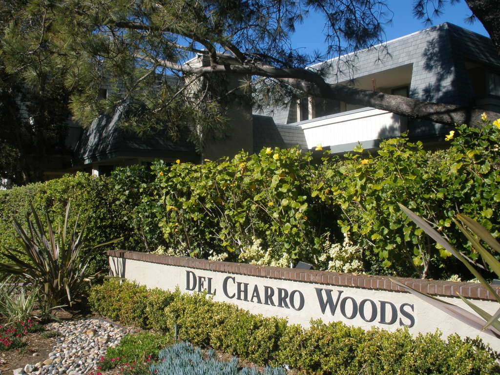
This drive traces a route through Pacific Beach, Bird Rock and the back streets of La Jolla to Torrey Pines Road. Beyond La Jolla Shores, where the Pacific would be visible beyond a wide beach on the left, and where Torrey Pines Road enters La Jolla Canyon, they would have found Rancho del Charro. Originally a riding stable and practice ring, it had been enlarged in the late 1940s and early 1950s into a motor hotel with riding facilities and guest cabanas. The site, where La Jolla Parkway merges with Torrey Pines Road, has since been redeveloped and is now a condominium community.

OLYMPUS DIGITAL CAMERA

At Rancho Descansado Marlowe learned that his subject, Betty Mayfield, was being blackmailed. He went to her room where she threatened him with a gun and knocked him out with a whiskey bottle while he was trading punches with the blackmailer. However, Marlowe had learned that she was to have dinner that evening at the Glass Room, and of course Marlowe made it his business to be there too.

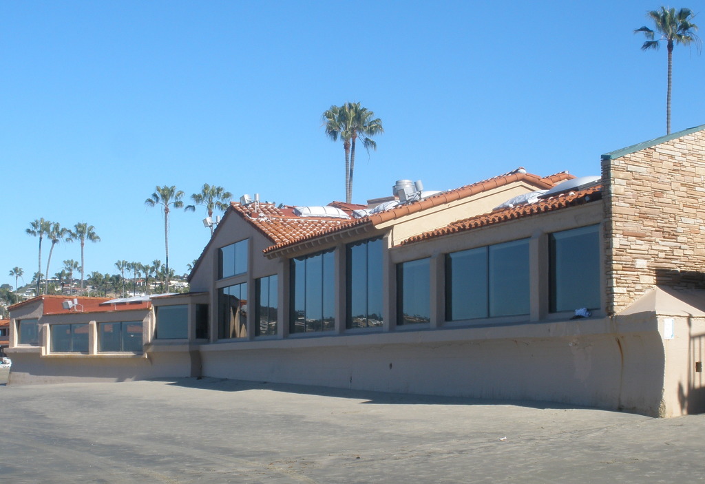
The Glass Room was on the beach, the entrance lobby was on a balcony which looked down over the bar and a dining room, and on one side was an enormous glass window where the view would have been sensational on a clear night with the moon hanging over the water. This is a perfect description of the Marine Room, open since 1941, where the enormous glass window still looks out over the ocean from the La Jolla Beach and Tennis Club.

OLYMPUS DIGITAL CAMERA

At the Glass Room the blackmailer, Larry Mitchell, behaved boorishly, Betty called him a drunken slob, he slapped her face and was asked to leave. Betty told him in a voice the whole joint could hear that the next time he did that he should wear a bullet-proof vest, never a good idea in a murder mystery where the subject may turn up dead, like Mitchell did later that night.

Betty had checked out of the Rancho Descansado after the scene in her room and checked in to the Casa del Poniente. Later that night she found her way back to the Rancho and knocked on Marlowe’s door to ask for help; Larry Mitchell’s body was lying across a chaise on her balcony. She showed him her gun, which was missing one cartridge. They drove to the Casa where Betty entered through the lobby and Marlowe went in through the garage and climbed up the fire stairs. Betty popped sleeping pills and dozed off while Marlowe checked the balcony and found no body. After searching her bag and removing the rest of her pills Marlowe decided to return home to Los Angeles, taking the two-car diesel job that makes the run to L.A. non-stop.

The Casa del Poniente was set on the edge of the cliff, separated only by a very narrow walk, so Betty’s balcony hung right over the rocks and the sea. It was set in about seven acres of lawn and flower beds near a bathing beach with a small curved breakwater where people would lie around on the sand and kids ran around screaming. Betty’s room was on the twelfth floor, and there was another floor above it. Apparently it was very exclusive; a typical room rate was $14 a day, $18 in season.

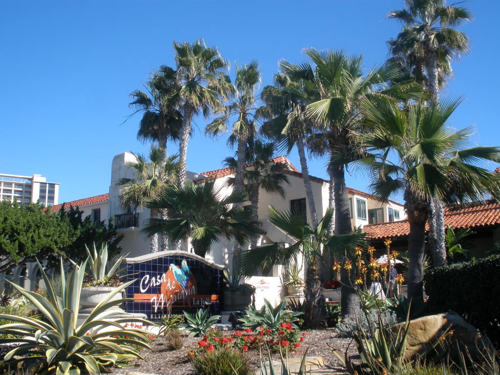
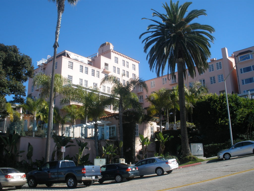
No hotel in La Jolla fits this description but a blend of two hotels from the 1950s might have served as a model. The Casa de Mañana was built in 1924 near Seal Rock, separated from the cliffs not by a narrow walk but by the width of Coast Boulevard. It occupies an entire block which may be around seven acres and has a lawn and flower beds, but its low-lying Mission-style architecture did not rise above three stories. An exclusive hotel in its day, the Casa de Mañana is still there but has been a retirement home since 1953. And kids no longer scream at the the bathing beach with the curved breakwater just across Coast Boulevard from the Casa; today the Children’s Pool is reserved for sea lions to lie around on the sand.

OLYMPUS DIGITAL CAMERA

The La Valencia Hotel on Prospect Street, also built in 1920s, is nowhere near the edge of the cliff but it is built into the side of a hill and from the bottom of the hill to the top of the tower may have thirteen floors. A luxury hotel then and now, the La Valencia would probably have been the model for Marlowe’s observations of the guests in the lobby; dedicated hotel lounge sitters, usually elderly, usually rich; women with enough ice on them to cool the Mojave Desert and enough make-up to paint a steam yacht and their men looking gray and tired, probably from signing checks.

OLYMPUS DIGITAL CAMERA

The next day Marlowe drove back to Esmeralda and the Casa del Poniente and again made contact with Betty. They decided to drive up into the hills for a talk and their route took them down a dead-end street with old streetcar tracks still in the paving. They turned left up the hill at the high school. This would have been the corner of Fay and Nautilus Streets, east of La Jolla High School, where the tracks of the former San Diego Electric Railway line to La Jolla remained embedded in Fay Street into the 1960s. Between 1924 and 1940 the streetcar line had run from San Diego to La Jolla via Mission Beach, Pacific Beach and Bird Rock, and along Fay Street from the high school to a terminal on Prospect. The portion of the right-of-way between Nautilus Street and Camino de la Costa in Bird Rock is now the La Jolla Bike Path.

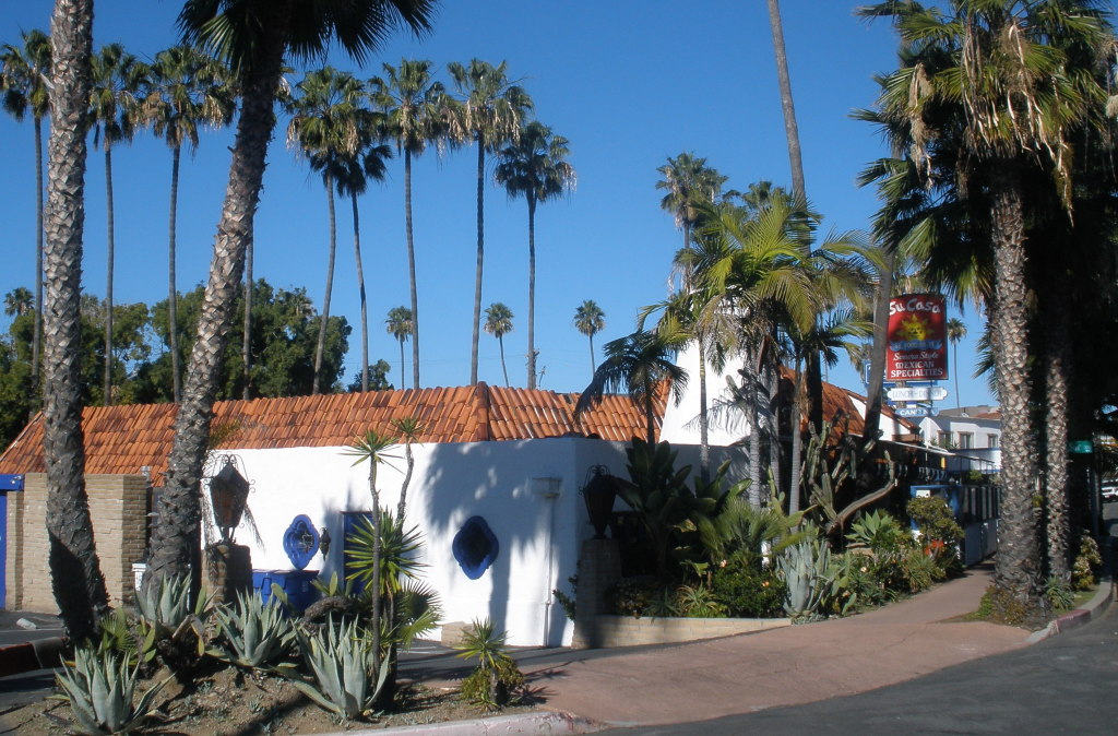
While Marlowe was following Betty Mayfield around Esmeralda, he himself was being shadowed by another private investigator, Goble, a middle-sized fat man in a dirty little jalopy. To find out why, Marlowe allowed Goble to tail him, taking it easy so he wouldn’t blow a gasket. About a mile from the hotel there was a restaurant, The Epicure, with a low roof, a red brick wall to shield it from the street, and a bar. The entrance was at the side. Marlowe parked and went in and when Goble joined him they traded wisecracks over drinks and the plat du jour, meat loaf. Su Casa, a restaurant on La Jolla Boulevard between Playa del Norte and Playa del Sur, about a mile south of ‘downtown’ La Jolla, has a low roof, a wall, a side entrance and a bar, and in the 1950s it was called The Connoisseur (update, the building that had been The Connoisseur and Su Casa was demolished in 2022).

OLYMPUS DIGITAL CAMERA

The night when Marlowe had entered the Casa del Poniente through the garage he had come across the parking attendant passed out in a Packard surrounded by the honeyed reek of well-cured marijuana. The next day Marlowe returned to question him and posed as a pusher. The attendant told Marlowe where he lived; a flea bag of an old frame cottage on Polton’s Lane, an alley behind the Esmeralda Hardware Company. Later, when Marlowe went to Polton’s Lane, he found the man dead, apparently having hanged himself. The La Jolla Hardware Company was located on the west side of Girard Street in the 1950s, between Prospect and Silverado. The alley behind it is actually called Drury Lane and even today there is a frame cottage there, although hardly what one would call a ‘flea bag’.

OLYMPUS DIGITAL CAMERA

Chandler’s Esmeralda not only looked like La Jolla but what he described of its heritage was recognizable as well. In one chapter, Marlowe recalls what he was told by a man who had been there for thirty years. Originally it had been so quiet that dogs slept in the middle of the boulevard and you had to get out and push them out of the way. Then the town began to fill up, first with old women and their husbands and then, after the war, by guys that sweat and tough school kids and artists and country club drunks and them little gifte shoppes. The town was dominated by a wealthy family, the Hellwigs, and especially by Miss Patricia, who gave the town the hospital, a private school, a library, an art center, public tennis courts and God knows what else. In the actual La Jolla Miss Patricia Hellwig would have been Miss Ellen Browning Scripps, who donated Scripps Memorial Hospital, The Bishop’s School, and many other La Jolla landmarks, sometimes in association with her wealthy brothers and sisters. The list of landmarks donated by the Scripps also includes the Scripps Institution of Oceanography, which became the nucleus of the University of California San Diego.

Chandler’s characters also expressed opinions on Esmeralda society. During their dinner at The Epicure, Goble told Marlowe that he was smart, got around and found things out. One of the things he found out was that Esmeralda was one of the few places left in our fair green country where dough ain’t quite enough. In Esmeralda you got to belong, or you’re nothing; you got to have class. A guy had made five million fish in the rackets and built some of the best properties in town, but he didn’t belong to the Beach Club because he didn’t get asked. So he bought it (the same guy, Brandon Clark, also owned the Rancho Descansado and the Casa del Poniente).

In the end Betty Mayfield’s pursuers really had nothing on her. Larry Mitchell was dead; not shot but fallen from Clark’s terrace on the floor above Betty’s balcony and his body removed to where no-one would ever find it. He wasn’t likely to be missed. Marlowe rescued Goble from a hired thug who was also lying in wait for Marlowe. After a showdown with Clark, who was apparently responsible for Mitchell’s death and the disappearance of his body, Marlowe drove home to Los Angeles, not doing more than ninety except he may have hit a hundred for a few seconds now and then.

Raymond Chandler died in 1959 at Scripps Clinic in La Jolla and was buried at Mount Hope Cemetery in San Diego. As his life had unraveled after Cissy’s death in 1954 one of the many loose ends he failed to tie up was having her buried; she had been cremated but her ashes were left in storage at Cypress View Mausoleum. After nearly sixty years this omission was finally corrected on February 14, 2011, Valentine’s Day, when her ashes were buried next to his grave at Mount Hope.

OLYMPUS DIGITAL CAMERA

The Collins and the Petrel

The Collins - Wallace monument at Mount Hope.
The Collins – Wallace monument at Mount Hope.

Mount Hope Cemetery in San Diego contains the graves of many early residents of the city, some marked by notable monuments. One monument is particularly notable for its intimations of tragedy; a young mother, her two children and another young lady share the same death date. Carved in a side panel is an explanation; Frances J., Mary E., and John C. Collins, and Margaret G. Wallace ‘drowned by capsizing of yacht Petrel, near Roseville, Sept. 1, 1890’. The name of the husband and father, John W. Collins, with a death date a year and a half later, is also carved in the monument.

Epitaph on Collins - Wallace monument
Epitaph on Collins – Wallace monument

The Collins family had come to San Diego from Wyoming in 1887 where J. W. Collins and D. D. Dare had been in the banking business. In January 1888 they opened the California National Bank with prominent local citizen William Collier as president, Dare as vice-president and Collins as cashier. In early 1890 a subsidiary, the California Savings Bank, was also opened, with J. W. Collins as president. The Collins family lived, appropriately, on Bankers Hill, in the magnificent Victorian home at the corner of First and Kalmia streets now known as the Long – Waterman Residence. J. W. Collins had purchased the house from John Long in June 1890 and sold it to Jane Waterman in November (Jane Waterman’s husband, Robert Waterman, was then governor of California and owner of the most profitable gold mine in San Diego County; his term as governor expired two months later and three months after that he himself expired at his new home and was also buried in Mount Hope Cemetery).

The Long - Waterman Residence
The Long – Waterman (and Collins) Residence

The Petrel was built in Boston and had reportedly won five races there before being brought to San Diego on the bark Wildwood in July 1888. That fall she competed in a series of races on San Diego Bay which apparently captivated the public, receiving front-page coverage in the San Diego Union. The Petrel, a sloop, and the Volunteer, a catboat, winners of their respective classes in a San Diego Yacht Club race, then raced each other in what the Union called one of the most exciting races ever sailed on the bay. The Volunteer won, but the winning margin of 14 seconds over a fifteen mile course was considered so trifling that the honors were said to be even.

The Petrel then faced off against the catboat Teaser in what was to be a series of three races. The Petrel was a sloop, ‘built for speed’, and could carry, in addition to a mainsail and jib, a club gaff topsail and jib topsail and a spinnaker for running before the wind. To balance all this canvas the Petrel also carried five tons of lead ballast. She was 25 feet long overall with a beam of 9 feet. A catboat like the Teaser had only a single mainsail and a wider beam. To compensate for these differences in class the Teaser was granted a time allowance 5 ½ minutes for the first race; conditions for the second race would be based on the results of the first. There would be no other restrictions on sail or ballast.

In their first race the Petrel crossed the finish line nearly 7 minutes ahead of the Teaser, winning even after taking the 5 ½ minute allowance into account. In the second race, held a month later, the Petrel won easily but it was not considered a fair race owing in part to light winds. The third race was apparently never held; in August 1889 the Union complained ‘What is the matter with a race between the Teaser and the Petrel? These crack little yachts should make a gallant race and all San Diego would turn out and watch the struggle for supremacy’.

By 1890 the racing frenzy had apparently cooled, or at least was no longer front page news in the San Diego Union, but the Petrel remained at Hunt’s boatyard on the bay where her owner, John Young, took her out sailing most Saturdays. On the last Sunday in August Captain William P. Hay, a local shipping agent, approached Mrs. Collins at the United Presbyterian Church and remarked that he intended to take Mrs. Hay for a sail on the bay Monday if he could get a suitable yacht. He asked Mrs. Collins if she would like to join them and when she replied that she would Capt. Hay told her to meet him at Hunt’s boatyard at 10 o’clock in the morning and to bring her children Mary and Johnny and a picnic lunch. Capt. Hay also invited Miss Maggie Wallace, the pastor’s daughter, and she also accepted. Mr. Collins was away at the time, on a business trip to San Francisco.

At about 8 o’clock Monday morning, September 1, 1890, Capt. Hay telephoned Mrs. Collins to tell her that he had secured the Petrel, ‘a yacht well known in San Diego waters’, and that everything was in readiness for a delightful sail on the bay. Mr. Hunt brought the Petrel in from her mooring and the party sailed away about 10 o’clock. Conditions on the bay were not ideal; according to the Union there was a pretty stiff breeze blowing and ‘white caps flashed like puffs of steam from a million factories’. Hunt was concerned enough to suggest to Capt. Hay that he take in some of the sail but Capt. Hay replied ‘Oh, I guess not. I’m a pretty good hand at sailing anyway. I guess she’ll go all right’.

About noon a group of Portuguese fishermen at Roseville, on the west side of the bay near Ballast Point, saw a yacht sailing down the channel. Suddenly they saw that ‘a gale had struck the cloud of canvas’ and the yacht suddenly careened, tipped her nose and went straight down. The fishermen jumped into boats and pulled out to where the yacht had gone down but found no trace of the yacht or her occupants so they returned. A German fisherman returning to the bay later reported that he was startled to see a woman’s body floating in the water and he began to retrieve it when another body came to the surface nearby. This shocked him enough that he released the woman’s body and departed, ‘abandoning the drowned persons to the mercy of the sharks and fishes’ and ‘incurring much public censure’. Rumors of a disaster reached San Diego about 3 o’clock and search parties converged on the scene but found nothing that evening except for a coat which was identified as belonging to Capt. Hay and a fruit jar and other items which may have been part of a picnic lunch. The Union reported the following morning that all that was certain was that the party of six had drowned and no bodies had been recovered.

In the immediate aftermath and in the absence of any real evidence of what had occurred, the Union reported the speculation of other members of the waterfront community (all of whom were also apparently called ‘Captain’). A Captain Kehoe said he had seen the party depart from Hunt’s boatyard and that he would not have gone out in that yacht with such a sail in so strong a gale. She was not safe under so much canvas and only the most experienced sailor should have attempted it. ‘A boat built as she was will tip very easily, and she had so much lead in her that once full of water she was bound to go down like a stone’. The Petrel’s owner, Captain Young, said that he had only agreed to allow Capt. Hay to use the boat because he understood that another experienced Captain would also be aboard, and that it would not be safe for one man to take out a party of women and children.

The next day searchers hired the tugboat Santa Fe and returned to the site of the sinking. A weighted line was dragged along the bottom and soon snagged an obstacle which was raised far enough to identify as the sunken yacht. When it had emerged far enough for its mast to be lashed to the tug it was brought back to the docks where a crane would be used to raise it out of the water the following morning. Meanwhile, the body of Mrs. Collins had been found floating in the channel. A message was dispatched to friends of Mr. Collins in San Francisco conveying as many particulars of the calamity as necessary and requesting them to break the intelligence to Mr. Collins so that he might receive it as gently as possible. Apparently this was done and word was received that he would be in San Diego on Wednesday evening.

The Union also began a campaign to place some of the blame on what it perceived to be the inadequate efforts of the first responders, who were conspicuously identified as foreigners. The Portuguese, who had actually witnessed the accident and responded immediately but found no survivors or wreckage, were now said to have made no effort whatever to rescue the drowning and drowned, nor to locate the sunken yacht. ‘They are a churlish and unsentimental lot, to be sure, but even the most superlative boorishness is not accepted by the people as sufficient reason why they should have manifested such supreme and inhuman indifference to the fate of the party’. The German fisherman who had attempted to recover the body of a women but then released her upon the appearance of another corpse was ‘not a popular individual at present’. The Union inferred from his description that it was probably Mrs. Collins that he had begun to recover and that the second body was one of her children, based on the fact that ‘he intimates as clearly as his incomprehensible stupidity will permit that it was the body of a child’. ‘Who knows? Perhaps there might still have been a spark of life in that mother or her child; perhaps they had not been long in the water; perhaps had they been towed at once to shore resuscitation would not have been impossible’.

At the dock the Petrel was raised and although it had been expected that one or more of the bodies would be found on board the only vestiges of the picnic party were three parasols, those of the women on board, a small jar of jelly and a few other articles. The yacht itself had received comparatively little damage and could soon be repaired, although the Union speculated that her owners would probably ‘not be compelled to refuse many requests for her service hereafter’. Also, an accident like this would revive her past record; ‘before she came to this coast she carried a party of four to the bottom of the Atlantic ocean and at another time a party of eight and that in a race in Pacific waters a year or more ago she dipped enough to create consternation among her occupants and compel them to bail her out with hats’. The search for the other bodies continued; the bay in the vicinity of the sinking was dragged, and cannon were fired over the water and dynamite dropped into the bay in the belief that this would raise drowned bodies.

Although it was at first intended for Mrs. Collins’ funeral to be held at her late home, at the corner of First and Kalmia, it was deemed more appropriate to hold it at the Presbyterian Church, where friends and relatives gathered to pay their respects to the only recovered victim of ‘the most horrifying calamity that ever happened in the bay of San Diego’. After the service Mr. Collins and Rev. Wallace entered a closed carriage and the cortege moved away to Mount Hope Cemetery.

The bodies of the other victims turned up over the next few weeks. Mrs. Hay’s body was found floating in the surf about three miles south of the Hotel del Coronado on September 5. Her beautifully engraved gold watch had stopped at 11:39, presumably the very instant the capsizing had occurred. Also found nearby were two straw hats, one black, evidently the headgear of an elderly woman, and one white with a black-headed shawl pin thrust through it ‘in the fashion that ladies usually pin their hats to their hair’. The one was thought to have belonged to Mrs. Hay and the other to Miss Wallace. These findings were cited as evidence that the bodies would probably be found south of the bay, but on September 9 searchers dragging the channel found the body of William Hay almost on the spot where the yacht had disappeared.

On September 17 fishermen recovered a body of a child about two miles south of the head of Point Loma and returned it to San Diego. This turned out to be the body of Mary Collins, which was soon conveyed to Mount Hope. Miss Wallace’s body was found by a fisherman inside the bay on September 25 and a graveside funeral was held at Mount Hope. Finally, on October 6, the body of 9-year-old Johnnie Collins was found off Ensenada and after the necessary permits had been obtained from the Mexican consul and the Collector of Customs the body was returned and also interred at Mount Hope.

A few weeks later the news was that Dr. Bowditch Morton had bought the ‘famous yacht Petrel’ and proposed to have her put in first class order. He claimed to not have the least fear in using her when she is in proper repair. He would cut down her sails, put in airtight compartments and reduce the ballast.

Three years later, on October 26, 1893, a Captain Maitland of the British ship Valkyrie took two friends for a little cruise in the Petrel. In the stream, abreast the Santa Fe wharf, in a choppy sea caused by an ebbing tide and west wind, a sudden squall struck the sail and almost capsized the sloop. Capt. Maitland slacked the line and righted her but the boom swung around and struck the water and ‘in a twinkling the treacherous old craft was lying on her side, with Capt. Maitland and his friends in the bay’. The Union noted that there had been doubts expressed about Capt. Hay’s seamanship in the Collins tragedy but since Capt. Maitland’s seamanship could certainly not be called into question this accident demonstrated that the craft herself was unseaworthy and luckless. ‘The Petrel is regarded as a hoodoo along the waterfront. She has been remodeled and trimmed since the Collins tragedy, but she is built upon the wrong plan and won’t stand up if she has half a chance to lie down’.

John W. Collins had been out of town on September 1, 1890, and had not been directly involved in the Petrel disaster, but he was soon to be involved in a tragedy of his own making. In January 1891 he had become president of the California National Bank (and relinquished the presidency of the California Savings Bank). On November 12, 1891, customers were surprised to find the bank closed, with a note on the door explaining that ‘owing to continued shrinkage in deposits and our inability to promptly realize on our notes and accounts, the bank is temporarily closed’. The next day the subsidiary California Savings Bank also closed. A day later a national bank examiner assumed charge of the California National Bank and announced that the results of his examination would be forwarded to the comptroller of the currency and any further information would have to come from Washington. A few weeks later, based on his report, the comptroller of the currency appointed a receiver to oversee operations of the bank with a view to resumption of business within three months.

The resumption of business never occurred. On February 25, 1892, J. W. Collins was arrested at his rooms at the Brewster Hotel on a charge of embezzling and appropriating to his own use $200,000 of the funds of the bank. Bail was set at $50,000 and ‘in order to not create any excitement by Mr. Collins appearing on the street in charge of an officer’, he was confined to his rooms at the Brewster in custody of an officer while his friends attempted to secure the bond. On March 3, when the bond had still not been raised, a United States Marshal was sent to bring him to Los Angeles until his preliminary hearing. While the authorities waited outside Collins went into his bedroom as though to pack his valise. A shot rang out, officers burst into his bedroom, which was empty, then into the bathroom, where they found him stretched on the floor alongside the bathtub, blood pouring from his mouth and a smoking revolver in his hand. A doctor was summoned and pronounced him dead.

The Union accompanied the front-page news of Collins’ suicide with an editorial recalling the Petrel disaster; ‘The crash of the bullet that closed the chapter of the life of J. W. Collins yesterday afternoon was the last act in the tragedy that wiped the unhappy man’s wife and children out of existence two years ago on the bay. Even the most implacable enemy of Mr. Collins must admit that, embezzler of other people’s money though he may have been, the memory of his drowned babes and his wifeless home must have been strong upon him in that desperate extremity when he determined to escape further misery by the avenue of the suicide. The capsizing of the Petrel, the failure of the bank, the suicide of Mr. Collins – they make up the most tragic story ever chronicled in the history of San Diego county’.

On March 5 the body of John W. Collins was buried alongside his wife and children at Mount Hope. On April 4 the report of the receiver of the California Savings Bank revealed that it had been a front, operated as a ‘mere receiving depository’ of the California National Bank. Cash had been transferred from the California National Bank or simply entered in the books when necessary to make a good showing on reports. The July 1892 report of the receiver for the California National Bank was even more shocking, revealing that Mr. Collins had embezzled nearly $800,000 from the bank. ‘Although there have been published from time to time the most sensational statements regarding his methods of doing business and conducting the affairs of the bank, nothing has caused such undisguised astonishment as the facts brought to light yesterday’, the Union reported. ‘Just what methods Mr. Collins employed to bring about such a condition of affairs it is impossible to even conjecture. It will be apparent, however, to everybody in the least conversant with banking rules or business customs that they must have been decidedly irregular, if not actually criminal’. D. D. Dare had also looted about $400,000, making the total amount chargeable to them nearly $1,200,000, a staggering sum in the 1890s (Collins’ mansion at First and Kalmia had cost him $17,000). The Union concluded that ‘What has become of this vast sum of money is not known and probably never will be. Mr. Collins is dead and Mr. Dare is enjoying a secluded life in some obscure spot in Italy. Neither are in a position to explain, and probably would not if they could’.

The affairs of the defunct bank were unwound in dozens of legal actions over the next decade. A final auction of the bank’s assets was held in 1899; notes and other securities with a face value of over a million dollars were sold for $3350. San Diegans were occasionally reminded of the California National Bank fiasco when news of D. D. Dare filtered back from Europe; in 1894 he was said to be a portrait painter in Athens, Greece; in 1914 he applied to have his indictments withdrawn so that he could return to his beloved California, but his request was denied; in 1922 he was reported to be in Constantinople, Turkey, supporting himself selling prayer rugs. His indictments finally were dismissed in 1926, but by then he was thought to have died in Greece.

According to the San Diego Union, these reports called to mind a remarkable theory which was current in San Diego at that excited time and which received some credence; that President Collins, who was supposed to have killed himself after his arrest at the Brewster Hotel had actually escaped and joined Dare in Europe. A plaster cast was said to have been given to an undertaker who was ‘in on the deal’ and that this was buried as Collins’ body.  Whatever lies in his grave, John W. Collins’ memory is preserved along with the Petrel victims on their monument at Mount Hope.

4275 Cass Street

4275 Cass Street, now the Earl & Birdie Taylor Library
4275 Cass Street, the Earl & Birdie Taylor Library

4275 Cass Street is now the address of the Earl and Birdie Taylor – Pacific Beach Branch Library. My wife remembers 4275 Cass as the address of her school, Martha Farnum Elementary. My Dad tells me that 4275 Cass was my first home address, when we lived at the De Luxe Trailer Park.

This address actually represents the entire block, surrounded by Thomas and Reed Avenues and Cass and Dawes Streets, and before its uses as library, school and trailer park the block had been known as the Collins place. Charles Collins had been a newspaperman in Sioux City, located on the Missouri River in western Iowa. In 1870 Sioux City was on the frontier, a center for trade with the Great Sioux Reservation further up the Missouri. Collins believed that Sioux City was the natural gateway to that region and would prosper if the Indians could be pushed out and the territory opened to whites, particularly the Black Hills, which were rumored to contain gold.

In 1872 Charles Collins began a campaign in his Sioux City Weekly Times to attract gold seekers to the Black Hills, and he organized parties of explorers to travel there from Sioux City. Initially the army prevented these parties from trespassing on the reservation, but ultimately it gave in to the continuous agitation promoted by Collins. In 1874 George Custer led a reconnaissance mission to the Black Hills and returned with confirmation of the presence of gold. The government attempted to negotiate with the Indians to purchase the hills, but the Indians were unwilling to sell. Tensions mounted, Indians left their reservations, the army set out to find them and force them back, and when they eventually met, at the Little Bighorn River in June 1876, the Indians annihilated a battalion of the Seventh Cavalry under Col. Custer. It is no exaggeration to say that Charles Collins set the stage for that epic battle.

The Indians were eventually returned to diminished reservations, the Black Hills were opened to mining, and Collins moved to Deadwood in the mining district where he continued to publish newspapers and, in 1878, a History and Directory of the Black Hills. After a few more years, his biography notes, he moved on again, to California, where he reportedly made a fortune in real estate ‘no doubt by using the same promotional and persuasive methods he had used in promoting the Black Hills’.

Since there were no rumors of gold on Mount Soledad it is unlikely that Charles Collins actually used the same methods as he did in the Black Hills when he joined J. R. and R. A. Thomas, D. C. Reed and others to form the Pacific Beach Company in 1887. This ‘syndicate of millionaires’ already owned considerable property in the area; Collins, for example, had acquired 20 acres in 1885 and later added another 40 acres. The Pacific Beach Company purchased most of the remaining property in the area, christened the community Pacific Beach, drew up a subdivision map and offered lots for sale in December 1887.

The Pacific Beach subdivision map divided the area into residential blocks separated by east-west avenues and north-south streets. Some of the avenues were named for principals of the Pacific Beach Company, including Thomas, Reed and Collins (Collins Avenue has disappeared but was about where Roosevelt Avenue in Crown Point is now). The blocks were numbered; the block between Thomas and Reed Avenues and the streets that became Cass and Dawes was Block 264. Block 264 was within the area of Collins’ original holdings and in 1888 he bought it back from the Pacific Beach Company and apparently built a cottage.

In 1891 the San Diego Union reported that Captain C. C. DeRudio, on leave from the Seventh Cavalry, had moved his family to Pacific Beach to test its many merits as a residence quarter. The DeRudios had leased the Collins cottage, which occupied a tract near both Mission Bay and the ocean (then-Lieutenant Charles Camilus DeRudio had survived the Little Bighorn battle, having spent two days concealed in bushes while surrounded by Indians). Capt. DeRudio spent his time in Pacific Beach experimenting with gardening to ascertain what will grow so near the ocean before returning to his regiment at Fort Sill. It may have been Capt. DeRudio’s agricultural experimentation that left Block 264 surrounded by eucalyptus trees, which made it stand out in early aerial photos and which were still prominent in the 1940s.

When Charles Collins died in 1893 the Union noted that he had been a leader in the pioneer movement that opened the Black Hills of Dakota to settlement, and that he owned considerable real estate in and around San Diego.  Ownership of Block 264 passed to his widow Annie and in 1900 it was acquired by Lida Clarkson who, a few months later, passed it on to her sister and brother-in-law M. J. and C. G. Akerman. Over the next few years Block 264 changed hands several more times until in 1904 the north half was sold to Mrs. Anna Byford Leonard and Miss Josephine Wells, and in 1905 the south half was sold to Miss Wells and her sister Ada.

Mrs. Anna Byford Leonard was an ardent Theosophist who lived at the international Theosophical headquarters at Lomaland on Point Loma. Before coming to San Diego she had been the first woman sanitary inspector in Chicago, in 1889, and is credited with improving the lives of children by initiating enforcement of the eight-hour work day for children under 14. The Wells sisters were pioneer San Diego business women who came to San Diego about 1894 and owned and operated a tourist home at Sixth Ave and Broadway. Josephine Wells died in 1913 but Ada continued to own the south half of Block 264 and a half-interest in the north half, and Mrs. Leonard the other half-interest in the north half, until the 1920s.

Earl Taylor and his wife Birdie came to Pacific Beach in 1923 with their son Vernon and daughter Erma and soon became involved with the local real estate community. An October 1923 article in the San Diego Union reported that Taylor was one of a group of former mid-westerners who had acquired 120 acres in the heart of Pacific Beach and planned a new high-class subdivision with ‘race and building restrictions which would make it highly desirable’ (this tract became the Congress Heights No. 2 and North Shore Highlands subdivisions, and also included the existing Congress Heights subdivision minus the six lots that had already been sold).

The Union article also reported that Taylor had bought more than 100 lots between Cass Street and the ocean, most fronting on Garnet Avenue, which Taylor planned to turn into the Pacific Beach business district. In 1923 the main Coast Highway between San Diego and Los Angeles passed along the east side of Mission Bay, then west on Garnet Avenue to Cass. An alternative route, also paved, ran around the other side of the bay to the bridge between Ocean Beach and South Mission Beach, then along Mission Boulevard to Pacific Avenue (now PB Drive), east to Cass, and north to Garnet (Mission Boulevard did not continue through Pacific Beach and was not paved north of Pacific). From the intersection of these two routes at Garnet and Cass, the Coast Highway continued north on Cass to Turquoise Street, then west on Turquoise, where it became La Jolla Boulevard and continued north through La Jolla, Torrey Pines, Del Mar and other coast cities to the north.

Earl Taylor estimated that 25,000 people passed through Pacific Beach daily in 6000 automobiles and 70 ‘auto stages’ and that these thousands would observe the developments of this beautiful locality, particularly the business district he was planning along Garnet from Cass to the ocean. He began developing the business center of what he called New Pacific Beach beginning with the two-story Dunaway Pharmacy building, still standing at the northwest corner of Garnet and Cass.

The 1923 Union article on Pacific Beach development had also mentioned other improvements planned for the area, including an auto camp to occupy a full bock near ocean and bay. Dewitt and Kizzie Martin, also recent arrivals from the mid-west, had apparently anticipated the potential value of property passed by thousands of automobiles daily. Block 264 was vacant, it fronted on the western branch of the coastal highway and was only a few blocks south of its intersection with the eastern branch at Garnet and Cass. In 1924 the Martins bought both halves from Miss Wells and Mrs. Leonard and began developing the Mission Bay Auto Camp at 4275 Cass.

Over the next few years the Martins, and his father James, developed their auto camp into more than just an overnight stop for passing automobiles but also a destination for what today would be called ‘snowbirds’. In the winter of 1928 the Union reported that Martin ‘rounded up’ the visitors stopping at his camp and took them to the Mission Beach bathhouse and beach where they enjoyed the warm mid-winter sun and sparkling water, in sharp contrast to the plight of the friends and relatives they had left behind in the grip of King Winter (Mr. and Mrs. Earl Taylor were mentioned as hosts on one such party from the Martin Auto Camp, where dancing was enjoyed and refreshments served).

In July 1928 an ad for ‘income property’ appeared in the San Diego Union:

AUTO CAMP FOR SALE, AS GOING CONCERN

A whole block, 40 lots; only 2 blocks from ocean, 1 ½ blocks from bay. Boating, fishing and bathing the year around. Located in the city limits of San Diego; 270-foot frontage on main highway between La Jolla and San Diego. 33 buildings, 29 rentals, 1, 2 and 3-room cabins; gas, electric lights, large lobby, store and lunch counter, gas station; cabins all newly furnished. One of the newest and finest sanitary systems in any camp in San Diego county. Many large trees; ½ of property vacant. Camp needs more cabins. Property all newly fenced. Doing better than $2000 per month. This property is one of the best camp locations between Los Angeles and San Diego. And anyone who can adapt themselves to this kind of business, can obtain increased returns. Buildings insured for $15,000; taxes, $660. Price $45,000, $7500 to $10000 cash, balance arranged to suit. Owner might consider partner, or leasing property. Owner, 4275 Cass blvd, Pacific Beach.

In subsequent years the auto camp at 4275 Cass went through a series of owners and names before being sold in 1938 to E. J. Ellis, who also owned the De Luxe Trailer Park in Cathedral City. The Union reported that the new De Luxe Trailer Park 2, 4275 Cass Blvd, Pacific Beach, proved the increasing interest and investment in trailers. The property consisted of an entire city block and was surrounded by eucalyptus trees.

The De Luxe Trailer Park was still in operation in 1947 when my parents moved from Iowa City to San Diego, where my Dad was to begin a career at the Naval Electronics Laboratory on Point Loma. They had lived in a trailer in Iowa and hired a neighbor to tow it to San Diego while they followed in their car. When they arrived in San Diego they found the De Luxe, where their trailer was assigned a space in the northeast corner.

On March 1, 1948, the Union reported that the calculations of Julius Caesar’s astonomers, made in 49 BC, had affected the lives of 15 babies born the previous day in seven San Diego area hospitals. According to the Union, these leap year arrivals, ten boys and five girls, would technically have to wait until 1952 to mark their first birthdays. Among the parents of these leap year babies were John C. and Mary Webster of 4275 Cass St., a son, in Mercy Hospital.

John C. Webster (and son) at the De Luxe Trailer Park, 4275 Cass Street, in 1948. The trailers and eucalyptus trees are long gone but the house across Dawes Street is still there.
John C. Webster (and me) at the De Luxe Trailer Park, 4275 Cass Street, in 1948.
The trailers and eucalyptus trees are long gone but the house across Dawes Street is still there.
The trailers, the wall and the eucalyptus trees at 4275 Cass are long gone but the house with the chimney across Dawes Street is still there.

Later in 1948 the Union reported that the sale of De Luxe Trailer Park at 4275 Cass St., Pacific Beach, for $100,000 plus, had been announced. Kenny Ellis, who operated the park for 11 years, had sold the park to R. J. Bragg. The Union noted that the park embraced an entire city block.

Martha Farnum attended Coronado High School, acted in school plays and was guard on the girls’ basketball team which lost to Anaheim in the Southern California championship game in 1923. She graduated from San Diego State College in 1928 and taught school in Oakland before returning to the San Diego school system, where she taught in a number of schools before becoming principal of the Ocean Beach and Logan elementary schools. In 1934 she was put in charge of a special project to make textbooks more relevant to students. She became curriculum coordinator, then director of elementary school education and finally assistant superintendent of city schools, in charge of elementary education. When she died in 1952, while still in her 40s, the Board of Education announced that she would be honored with a school named after her.

The opportunity to name a new school would not be long in coming. San Diego had experienced tremendous growth during World War II, particularly among defense workers and military personnel, many of whom had settled in Pacific Beach. The post-war ‘baby boom’ added even more to the numbers of school-aged children. My wife’s parents, for example, had worked at Consolidated Aircraft in San Diego during the war, building bombers, and after the war they moved to Reed Avenue in Pacific Beach where their two daughters were nearing school age in the 1950s.

The federal government had built Bayview Terrace Elementary school as part of a public housing project for defense workers in 1941 and Crown Point Elementary had been built in 1946, the first school built in San Diego after the war. Still, it was apparent that more schools would be needed to keep pace with the growth in the school-aged population. The Union wrote in 1950 that enrollment of city school children had increased 50% in the past decade and school officials predicted it would almost double the 1940 count by 1954.

In 1950 San Diego voters passed a $11 million bond issue to fund a building program which included plans for a new elementary school in the Crown Point-Pacific Beach area. In 1951 the Board of Education applied for federal funds for school projects in parts of the city most heavily impacted by the war effort, including a new elementary school in southwestern Pacific Beach. In 1952 the San Diego Union reported that residents in that trailer court on Cass St. near Garnet St. had been asked to find another spot to park their trailers. The entire block had been purchased by the Unified School District, which planned to build a school there.

On November 30, 1953, four hundred Pacific Beach children and their teachers moved into the new Martha Farnum Elementary School at 4275 Cass Street (my wife was one of the new kindergartners, after starting the school year at Crown Point). The Union reported that the school was federally financed under the defense impact area program and was built for $337,450. It would relieve crowded conditions in other PB elementary schools.

Martha Farnum Elementary represented the latest trends in school constructions; classrooms were built back-to-back with sheltered outdoor walkways, eliminating noisy interior corridors. It included 16 classrooms, an administrative and health unit and a cafeteria-auditorium. The new school was dedicated in April 1954 and presented with a portrait of Miss Farnum as part of its dedication ceremony. The Union noted that she was the first woman to hold a top administrative position in the local school district.

Martha Farnum Elementary had been built in the 1950s with federal impact money to address a serious overcrowding situation in Pacific Beach elementary schools. By the 1980s, even though the Pacific Beach area continued to grow by expanding up the slopes of Mount Soledad and the population density increased when single-family homes were replaced with apartments and condominiums, the population of school-aged children in PB had actually gone into decline. At the same time, new communities of San Diego like Mira Mesa and Scripps Ranch required schools, and California’s Proposition 13, passed in 1978, severely restricted property taxes necessary to fund school districts.

The San Diego school district proposed a plan to close schools with declining enrollments and then lease the properties, using the proceeds to fund new school construction elsewhere. Local committees in Pacific Beach, Point Loma and La Jolla were given the task of deciding which schools in their areas to close. In Pacific Beach, the choice was between Martha Farnum or Crown Point. The committee decided that Crown Point occupied a larger area and could be expanded if necessary in the future, so Martha Farnum was selected for closure (despite further population growth, the population of school-aged children in Pacific Beach has continued to decline and Bayview Terrace was also closed as a community elementary school in 2013).

Martha Farnum Elementary was closed after the 1983 school year and in the summer of 1983 the school district offered it for lease. The property apparently was leased, but the proposal to build apartments and condominiums on the property was unpopular with Pacific Beach residents and that development was blocked. In 1987 an alternative proposal to use the site for parkland and a library was negotiated by the school district and the city, but the city manager removed the funds necessary to purchase the site from the city budget in the interest of economy.

In 1988 the Union reported that city school trustees had approved an agreement to sell Farnum Elementary School to the city, which planned to convert it into a library and a park. The agreement involved cash, land improvement and property worth roughly $3.3 million. The Union explained that city and school officials had negotiated for years over the fate of Farnum until donors appeared, who turned out to be Erma O’Brien and her brother Vernon Taylor, who wanted the library and park to be a monument to their father Earl Taylor. After years of design and construction, the Earl and Birdie Taylor – Pacific Beach Branch Library opened to rave reviews in May 1997.

Earl & Birdie Taylor Library, 4275 Cass Street


The MacFarland Legacy

The MacFarlands Pacific Beach Home
The MacFarlands’ Pacific Beach home today

Andrew F. and Ella C. MacFarland only occupied it for two years but they left Pacific Beach with a grand edifice that has looked over the community for more than a century.  Behind the doors, however, their lives were a comedy of errors that eventually played out in courtrooms and newspapers across the state.

A. F. MacFarland had been an insurance agent in San Francisco and then vice-president and manager of an insurance company in Spokane. In September 1907 the MacFarlands paid a visit to Pacific Beach, staying at the Hotel Balboa, the building originally built for the San Diego College of Letters. They apparently liked what they saw; within weeks Ella had purchased 4 lots at the northeast corner of Lamont and Beryl Streets. In October the San Diego Union reported that they planned to build a $4000 house there and they moved into their new home in February 1908.

While living in their handsome house on the hill Mr. MacFarland became active in San Diego city affairs. He served on the executive board of a committee of 100 prominent citizens campaigning for amendments to the city charter. Closer to home, he filed petitions with the city clerk to have streets graded in Pacific Beach. In February 1909 he was one of the organizers of the Pacific Beach Country Club, which sub-leased space in the Hotel Balboa.

In August 1909 the Union reported that Mr. and Mrs. A. F. MacFarland had traveled to Los Angeles for Elks week. They had made the trip overland in their Maxwell runabout, making the distance between Los Angeles and Pacific Beach in only eight hours. A month later MacFarland was in the news again; this time burglars had ‘jimmied’ a window in his home with an axe and stolen a quantity of wearing apparel, seven suits of clothing worth $700 (although police did not expect to learn the exact amount of the ‘depredations’ until MacFarland returned from the north, the estimate of $700 would be a substantial proportion of the value of his home).

The MacFarlands’ residence in Pacific Beach turned out to be brief; by the end of 1909 they had moved out and returned to San Francisco, where he organized the San Francisco Life Insurance Company. It was also there where he became notorious as the ‘Bluebeard Mate’ and ‘Hymeneal Champ’, known for his ‘unparalleled demonstration of frenzied matrimony’ and ‘spectacular matrimonial tangles’.

According to the San Francisco Call, the history of his ‘hymeneal ventures’ began with his marriage to Leona Mayval more than 25 years before, at his old home in Genoa, Ohio. A year or two later he had moved to Kansas where, in 1896, he married Minnie Gerard, his previous wife forgotten although never divorced. After a few months he found that Minnie had another husband living so he left her and, in 1898, married Ella Clem in Oklahoma.

In early 1911 Ella found out about his marriage to Minnie and at his suggestion sought an annulment, ostensibly to leave him free to have the Kansas marriage annulled. Ella apparently understood that after this ‘tangle’ was straightened out they would then be remarried. Her annulment was granted on January 14, 1911 and the annulment of his previous marriage on January 28. However, Ella had her annulment vacated on March 17, alleging fraud and conspiracy. She claimed to be the victim of a plot by MacFarland and one ‘Jane Doe’ to deprive her of her share of community property worth $30,000.

On January 31, 1911, while temporarily free of his two most recent wives, Andrew MacFarland entered into a fourth marriage, this time with his former stenographer, Ethyl Groom, who herself had lately secured an annulment from her husband because he had another wife living in the east. When the annulment of his marriage to Ella was set aside, making MacFarland again a bigamist, Ethyl had her marriage to him annulled, on March 23, again with the understanding that he would divorce Ella and then remarry her. However, according to the Call, he then ‘seems suddenly to have recalled his first love in Ohio’ and returned there before dropping out of sight.

The San Francisco Call estimated Andrew MacFarland’s private fortune to be in the six figures, and all in cash. Miss Groom, although no longer married to MacFarland, claimed some of that cash as her own, saying that he had given her $10,000 in banknotes as a wedding gift and then stolen it. She had him charged with grand larceny and he was tracked down and arrested in Colorado Springs, where, according to the Call, he was on the point of leaving for Puerto Rico in the company of Ella.

At his trial in San Francisco, Ethyl made a ‘picturesque witness’ but the wealthy insurance promoter denied he ever gave her money and claimed she was merely seeking notoriety with a view to going on the stage. That jury could not reach a verdict, but he was acquitted in a second trial, on September 24, 1912.

By this time Andrew F. MacFarland was living in San Diego again, at the corner of B and Edgemont streets, and by 1914 the city directory indicated that Ella C. MacFarland also resided at that address. They later moved to 29th Street near Beech in South Park. Andrew was again involved in city politics and was mentioned as a candidate for appointment as City Manager. Ella was remembered as a popular South Park hostess.

However, their marital relationship apparently never recovered, and in August 1918 Andrew MacFarland again returned to the courts. His complaint for divorce from Ella stated that his employment made it necessary for him to be in Los Angeles during the week and when he returned to his wife and home in San Diego for weekends she acted in a cold and unaffectionate manner and visited upon him a continuous tirade of abuse, denouncing him as untrue to her and spending his money in riotous living during his absence from home. He begged her to cease but her actions remained the same; she pursued a studied and continuous course of nagging, vilifications, and denunciation. He added that all of her accusations were untrue.

Ella MacFarland’s cross-complaint denied these allegations and instead claimed that he had deserted and abandoned her and continued to live separate and apart from her against her will and without her consent. She prayed for judgment of the court that the bonds of matrimony between them be dissolved and that he take nothing under his complaint and be required to pay a reasonable sum for court costs and counsel fees. Judge Marsh ruled in September 1918 that all the allegations in the cross-complaint were true and granted Ella a divorce and $300 for court costs and attorney’s fees.

A week after his divorce from Ella, 51-year-old Andrew F. MacFarland married a 25-year-old stenographer and they apparently went on to lead an uncharacteristically quiet life in Los Angeles. Ella MacFarland also moved to Los Angeles, occasionally returning to visit friends in San Diego.

Madie Arnott Barr & Turner

Madie Arnott Barr

In the first years of the twentieth century Madie Arnott Barr held title to a substantial portion of the land in Pacific Beach as well as a good deal of other property around the San Diego area. In 1905, for example, the city Lot Book listed her as owner of 5 acre lots as well as portions of other blocks in Pacific Beach totaling over 60 acres. Mrs. Barr was also named in almost daily real estate transactions recorded by the San Diego county recorder, many of them in Pacific Beach.

Madie Arnott Atkinson had been born in New Jersey but moved to California in 1862 when she was five years old. Records show that she married a Mr. McFadden and had two sons about 1880. Then she married Edward Henry Byrons and was divorced from him in about 1897. She came to San Diego and apparently met Frank M. Barr, who had originally arrived in San Diego in irons to serve a sentence in the San Diego County Jail for sending improper letters in the U. S. Mail. In April 1898 they sailed two miles off the coast of California where they were married on the high seas by a Methodist minister with the boat’s captain and crew as witnesses. Back in San Diego, Barr entered into a real estate partnership, Turner & Barr, with Marcus C. Turner. Mr. Barr later explained that, for convenience, all the the firm’s purchases were recorded under his wife’s name.

By 1907, however, Frank Barr’s relationships with both his business partner and his wife had deteriorated. In February 1907 he embarked on a voyage to the Orient, supposedly for his health. Before leaving he executed a deed granting his wife all right, title and interest in any and all property, real or personal, which he owned or had any interest in. Turner & Barr, the partnership with M. C. Turner, had also apparently been terminated before his departure. Soon after he sailed, Turner, Madie Arnott Barr and her son Ward E. McFadden incorporated a new real estate business, the Turner-Barr Company.

When Barr returned a few months later he initiated an action in superior court demanding one-half interest in the properties held in the name of Madie Arnott Barr, contending that the property purchased by Turner & Barr was recorded in her name for convenience only and the February blanket deed to all of his property was made solely for the purpose of facilitating any transfers of property, without any consideration. In July, Barr upped the ante, commencing an action against Turner for having an undue and improper influence over his wife; wrongfuly, wilfully, wickedly, unlawfully and maliciously depriving him of her comfort, affection, fellowship, society and assistance. For all of this he asked for $50,000 in damages.

Both of these complaints were dismissed and the parties apparently agreed to a division of property, but in October Barr was back in court to complain that his wife and former partner had failed to convey the agreed-upon real property. Mr. Barr also initiated a separate action against Mrs. Barr claiming that she had ‘inveigled’ him to go through a bogus wedding ceremony on the boat two miles out to sea with the intent of evading California marriage laws, when she had not actually been divorced from her previous husband. In this action he asked that their ‘pretended’ marriage be annulled and that she be denied any interest in what she claimed to be community property.

The parties reached a settlement on the property issues in November 1907, but problems with the Barrs’ marriage continued. Frank Barr filed an amended complaint; he said that their marriage was not legal because no license had been issued and that it should be annulled. Madie Arnott Barr answered with a cross-complaint; she said that Barr represented to her that he had complied with the law in reference to marriages and if he failed to obtain a license, if such licenses were necessary, he was at fault. She also denied that she had induced or persuaded him to go to sea and be married off California. She added that the publication of the false and slanderous statements contained in his complaint caused her suffering in mind and body, her health had been impaired and her peace of mind destroyed, and her marital relations rendered intolerable. She also asked that their marriage be dissolved, but that he take nothing. This complaint was also dismissed, in January 1908.

Despite her alleged suffering, impaired health and destroyed peace of mind, Madie Arnott Barr still held title to a great deal of real estate, including substantial holdings in Pacific Beach, and she soon put it on the market. In March 1908, she was the seller in what the San Diego Union called the largest transfer of Pacific Beach property for several years, 366 lots, a portion of her holdings of Acre Lots 7, 8, 9 and 10. The deal was made by J. M. Asher of Asher & Littlefield and was understood to be for about $40,000. The buyer was the Folsom Bros. Co. These acre lots were between Agate, Gresham and Loring Streets and a line halfway between Everts and Dawes

Although Madie Arnott Barr and Frank Barr had apparently separated, their marital status remained unresolved. In 1908 she was advised that the state supreme court had ruled that even a marriage on the high seas required a license, or as the Los Angeles Herald put it, ‘made it absolutely necessary that a license should be secured before two persons can settle down to the enjoyment of matrimonial bliss or contend with the trials of wedded life’. Apparently feeling that her marriage had become more trial than bliss she left San Diego, moved in with her sons in Los Angeles to establish residence, and in September 1908 filed suit asking that her marriage be annulled, and also that her maiden name of Madie A. Atkinson be restored. The marriage was annulled in superior court on January 8, 1909, and on January 13, less than a week later, a marriage license was issued in Los Angeles for Marcus C. Turner, age 54, and Madie A. Atkinson, age 50, both residents of San Diego.

Back in San Diego Marcus C. and Madie Arnott Turner continued their real estate activities, with a particular emphasis on Pacific Beach. In July 1909 they filed a subdivision map for Turner’s Sea Shell Park, basically the block surrounded by Riviera and Moorland Drives, Haines Street and La Playa Avenue plus a couple of lots on the north side of La Playa, which they owned in the Crown Point area of Pacific Beach. In 1910 they filed a subdivision map for Hollywood Park, incorporating their property within Acre Lots 7, 8, 9 and 10, the same tract they had agreed to sell to Folsom Bros. Co. in 1908. Folsom Bros. Co. agreed to ‘release and forever quitclaim’ the property back to the Turners in 1910.

The Turners, and her sons Ward and Joseph McFadden, continued to be active in the San Diego, and Pacific Beach, real estate market for years but Mrs. Turner played a less visible role and Mr. Turner eventually shifted his interest to mining and minerals. He became known as a champion of local ‘industrial minerals’, especially Otaylite, used in refining the finest grade of oil.

Overtaken

Between her real estate activities and courtroom appearances Madie Arnott Barr also found time to write. When the USS Bennington blew up in San Diego Bay on July 21, 1905, with the loss of 65 lives, she commemorated the tragedy with a poem, Overtaken, ‘dedicated to the boys of the U.S.S. Bennington’, and distributed it in San Diego bookstores. A January 1907 Union ad for Turner & Barr, the ‘Sleepless and Tireless’ realty firm, was also written in verse and credited to Madie Arnott Barr. It featuring such thoughts as ‘We read of San Diego of its climate and its bay, Its sunshine and its flowers and its winter months like May. We hear the tourists speaking of its charming city homes, Where wealth and prosperity smile on banks and money loans’, and odd verses like ‘The city hall and court house where the politicians meet. Where the hands of enemies come in contact as they greet, Are records of our city as its pulse beats warm or cold. And its there that divorces separate the young and old.’

In 1908 she had offered a $10 reward, no questions asked, for the return of her white Pomeranian (Spitz) dog, ‘Rowdy’, lost or stolen. When Rowdy was run over and killed by an automobile in 1911 she wrote a tribute which was published in the Union (‘Dead Dog’s Virtues Extolled by Woman’): Rowdy was probably as near human in his intellect as any dog ever attained, he fully understood conversation, his vocabulary was unusually large, love and fidelity were synonymous with all his actions, he knew every mood of his mistress and in health or sickness showed his beautiful nature.

Madie Arnott Turner died in 1932. Marcus C. Turner died in 1934.

Postscript:
In May 1909 the San Franciso Call reported that a reputed wealthy San Diegan had settled in the French possession of Tahiti in order to acquire legal residence so that he could marry a Tahitian girl under French laws. Under the headline ‘Remains in Tahiti to Wed Dusky Maid’, the paper said that the man, who went under the name of A. J. Stephens, had arrived on the liner Mariposa and had scheduled a return on its next voyage, but shortly before it sailed he tried to charter it for a cruise beyond French jurisdiction and on the high seas have the captain perform the marriage ceremony. The captain refused and Stephens decided to remain, establish legal residence, and ‘have the swellest wedding that Tahiti ever saw’.

The Call followed up this story by contacting the only A. J. Stephens living in San Diego, who said he had never been in Tahiti, or even out of San Diego for years, and that he believed the man in Tahiti was Frank M. Barr, a formerly well known real estate man and at one time quite wealthy, but who had left San Diego about five months previously after becoming mixed up in a number of shady transactions. Stephens said that Barr had left a trail of worthless checks from Los Angeles to Seattle and was known to be in Tahiti.

Barr’s trail of worthless checks and shady transactions continued to grow. A June 1909 Call article reported:

Bride is Deserted on a Southern Isle

A. J. Stephens, or Frank M. Barr, Gets Money and Flees

The romance of A. J. Stephens, or Frank M. Barr, as it is thought he should be called, has terminated in a gorgeous wedding with the Tahitian belle he left California to wed, the acquisition by the groom of some $2000 on the strength of the marriage, the abandonment of the bride on one of the south sea islands, and the disappearance of the mysterious adventurer with his ill acquired wealth in the direction of Australia.

The Call explained that Stephens, or Barr, had obtained money from an aunt of his bride and various other wealthy persons, then took his bride on a little junketing trip to Raratonga, where he left her to make her way home as well as she could and shipped on a steamer for Auckland.

In September 1909, Frank Barr was finally ‘run to earth’. The San Diego Union reported that ‘with an alleged criminal record extending the length of the coast and to the South Sea islands,and involving clever manipulations with negotiable paper and bigamous marriages as its salient points, Frank M. Barr, the fugitive San Diego real estate man, has at last been run down. He is under arrest at Ashland, Oregon’.

The Union recreated his recent history: After engaging in the real estate business for years, Barr left San Diego on January 1, 1909, abandoning Mrs. Jennie Duffey-Barr, his bride of two months, whom he had married after his legal separation from the present Mrs. Turner. From San Diego, Barr went to Los Angeles and after his departure from there numerous bad checks turned up and his San Diego operations also came to light. In February he was in Seattle under the name of Joe Thomas. Then he went to Tahiti as A. J. Stephens, a San Diego capitalist on vacation, where his elegant manners gained him entrance to the best society on the islands and he entertained his new-found acquaintances with many tales of his experiences, which were for the most part the grossest fabrications. One of his new acquaintances was Edouard Droullet, a retired French planter, who possessed a considerable income and a beautiful young daughter, Mademoiselle Elina Droullet. The imposter ‘had no trouble appearing well in her eyes’ and secured her father’s consent in her marriage. They were married in Papeete and left for Auckland, New Zealand, on their wedding tour, but not before the groom had secured $1000 on two bogus drafts endorsed by members of his new family.

Barr abandoned the French girl in Raratonga, robbing her of her jewelry and leaving her penniless. He next appeared in Salinas, in July, where he passed bad checks and remarked to an acquaintance that he was headed for San Diego where he had some old scores to settle. In San Diego he was disguised; stooped and walking with a cane and with his head swathed in bandages, explaining that he had been burned in an automobile accident. He told friends he was in San Diego to kill M. C. Turner, who by then had married his former wife, and he asked his current wife, the former Mrs. Duffey, for money and threatened to kill her if she let his presence be known. He was finally identified by a local druggist who recognized his voice when he telephoned from his store.

The police were notified but he made his escape, taking the ‘Owl’ train toward Los Angeles. He got off at Oceanside, then got an automobile ride to his destination. San Diego police chief Keno Wilson eventually tracked him to a hotel there but he had ‘taken boat’ for the north. He was finally located in Ashland and arrested. Apparently the crimes he could have been tried for in San Diego involved forging Madie Arnott Barr’s name on negotiable notes and would have required her testimony in court, but since she had been his wife at the time she would not be allowed to testify if he objected. Instead he was tried on the more recent forgery in Los Angeles.

In December 1909 Frank Barr was convicted of forging Madie Arnott Barr’s signature on a check to a Los Angeles jeweller for a $525 diamond ring. In January 1910 he was sentenced to five years in San Quentin; ‘Ordered to the Rock Pile’, according to the Union. Mrs. Duffey-Barr filed for divorce.