All posts by OriginallyPB

Calvary Cemetery

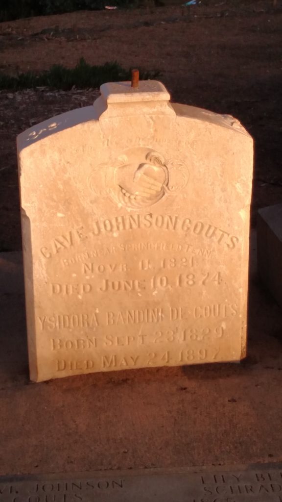
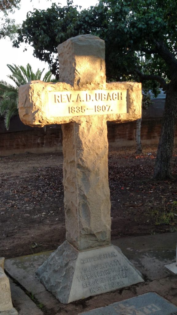
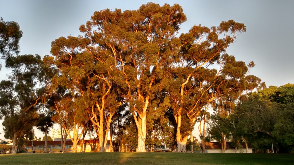
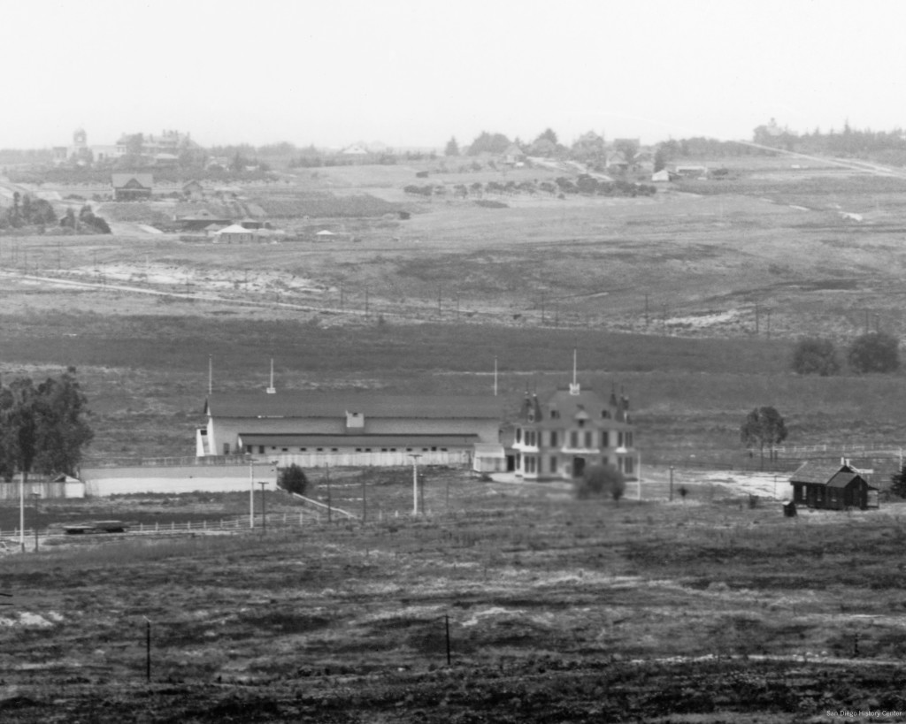
In the 1960s, Richard Pourade, then editor emeritus of the San Diego Union, began a 7-volume history of San Diego. In The Glory Years, the fourth book in the series, published in 1964, he introduced the ‘people who started it all’, who built Southern California in the ‘boom and bust’ years between 1865 and 1900, by visiting an old graveyard ‘where are buried so many of the pioneers who helped to found and build San Diego’. While many headstones were broken or lying on their side, names eroded by the weather, others were well-marked, if seldom visited. The grave of Father Antonio Ubach, the last of the padres, born in Spain in 1835, was marked with a stately monument. Nearby was the grave of Cave Johnson Couts, born in 1821 and a graduate of West Point, and lying beside him his wife, Ysidora Bandini de Couts, daughter of a Spanish Don, the names telling of the ‘melting together of two peoples’. Other names – Ames, O’Brien, Lyons, McCoy, Clark, Hinton, Warnock – told of the great tides of humanity that flooded across a continent in the later 1800s, ‘to find their resting places under eucalyptus trees on a barren hill overlooking a harbor that few people in the world had ever heard of’.

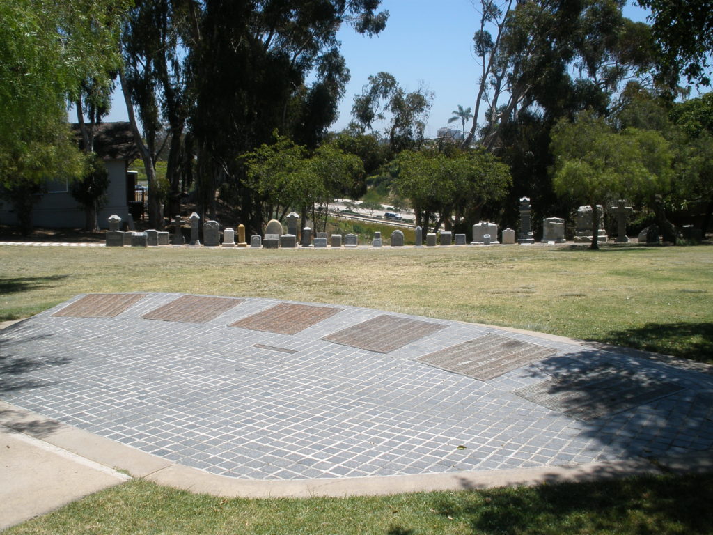
The graveyard Pourade visited was Calvary Cemetery, the old Catholic burial ground next to U. S. Grant Elementary School in Mission Hills. However, even before Pourade had finished his final volume in 1977 that old graveyard had been transformed. The pioneers’ resting place under the eucalyptus trees was no longer a barren hill but a grassy park. No headstones were broken or lying on their sides; most had been removed and dumped at the city’s Mount Hope Cemetery while others, including the monuments of Father Ubach and the Couts family, had been spared and were lined up in a corner of the park in grudging recognition of the park’s original purpose. The names of those believed buried in the cemetery were inscribed on six bronze panels ’dedicated to the memory of those interred within this park’. Those interred within the park remained, beneath the new lawn, sidewalks and parking lot.

The story of Calvary Cemetery began in 1873 when the city purchased ten acres of land near Old Town from J. S. Mannasse ‘for Cemetery purposes’. In October 1873, after the City Attorney had prepared the necessary papers and the City Engineer had made a survey of the grounds and submitted a plat, the Board of Trustees adopted Charter Ordinance No. 46, ordaining that the real estate purchased by the city from J. S. Mannasse for cemetery purposes, containing ten acres, ‘is hereby set apart, dedicated, donated to and reserved as and for a Cemetery’. A second section of the ordinance specified that the west half of the property, containing five acres, ‘is hereby placed under the free and exclusive control of the Parish of the Immaculate Conception . . . to be held in trust and to be used and controlled exclusively by the parish forever, for Cemetery purposes only’. However, the land being found impractical for such purposes, in March 1876 the trustees repealed Ordinance No. 46 and adopted Charter Ordinance No. 78, exchanging the property for a different ten-acre tract owned by J. S. Mannasse after the Pastor of the Parish, A. D. Ubach, relinquished the church’s claim to the property. Ordinance No. 78 likewise set apart and reserved the ten-acre tract for a Cemetery and placed the western five acres under the control of the Parish forever for Cemetery purposes. Curiously, the Catholic cemetery, which became known as Calvary Cemetery, actually occupied the southern, not the western five acres of the cemetery tract; the northern five acres, shown on early maps as the Protestant Cemetery, was never used as a cemetery and was reclassified as a park in 1909.

Cave Johnson Couts attended United States Military Academy at West Point, class of 1843, where he was a classmate of Ulysses S. Grant, later Commanding General of the Union army during the Civil War and President of the United States. A cavalryman, Couts was posted to California in the aftermath of the Mexican War and met Ysidora Bandini, daughter of Don Juan Bandini, one of the most prominent residents of Alta California, while stationed at the San Luis Rey mission in 1849. According to California writer George Wharton James, Miss Bandini had visited the mission with some friends and while wandering around the building had fallen from a parapet. The young lieutenant, observant of the maid whose bright eyes had already penetrated his heart, dashed forward and caught her, averting a catastrophe. They then and there fell mutually in love and when they were married in 1851 she was given the Guajome rancho near San Luis Rey as a wedding present by her sister and brother-in-law. James claimed that Helen Hunt Jackson, author of the popular novel Ramona, spent time at Guajome and absorbed much of her understanding of life at a California rancho from what she observed there. Late in life Col. Couts converted to Catholicism, receiving his first communion shortly before he died in 1874. When Mrs. Bandidi de Couts died in 1897 the San Diego Union reported that the ‘lady of unusual intelligence and noble qualities’ would be buried beside her husband at the Catholic cemetery. However, since Col. Couts died in 1874 and the cemetery was not established at its present site until 1876, and its previous site had been found ‘impractical’, it is unclear how her husband came to be buried there.

Father Antonio D. Ubach’s burial in the Catholic cemetery, by contrast, was witnessed by thousands of mourners in what must have been the most notable day of its existence. Father Ubach was born in Catalonia and came to San Diego in 1866 where he took charge of what was then a small Catholic parish. He served as Pastor for 41 years and was greatly respected and admired, particularly by his Indian and Mexican parishioners. He is generally considered to have been the model for the Father Gaspara character in Ramona, and in later life confirmed that he did perform a marriage ceremony for an Indian couple much as described in the novel, although at his chapel, not in the building that has become known as Ramona’s Marriage Place. As Pastor of the Parish of the Immaculate Conception Father Ubach was given responsibility for the cemetery and is assumed to have supervised its planning and development. When he died in 1907 his funeral at St. Joseph’s Church was described as the largest ever held in San Diego, attracting an estimated four thousand people. After the service, the Union reported a line of carriages over a mile and a half long followed the hearse and that hundreds of poor Mexicans and Indians, who could not afford the luxury of riding, walked the four miles from the city to the Catholic cemetery.

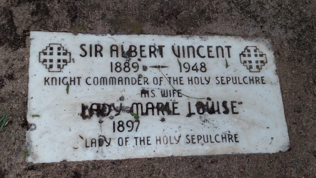
In January 1919 a new Catholic cemetery, Holy Cross, was opened on Hilltop Drive, near Mount Hope Cemetery and Greenwood Memorial Park, and in 1920 the church ended the sale of plots in the old Catholic cemetery, although burials were still permitted in plots that had already been purchased. With few new burials and no budget for perpetual care, the old cemetery, which began to be referred as Calvary Cemetery, soon begin to show signs of neglect. In 1935 Albert Mayrhofer, president of the California State Historical Association, presented plans to the City Engineer for improving Calvary Cemetery. Mayrhofer had been instrumental in the restoration of Mission San Diego in 1930-31, for which he and his wife had been dubbed Sir Albert and Lady Marie, Knight Commander and Lady of the Holy Sepulcher, by Pope Pius XI (he also designed the San Diego flag, still in use today). The plan for Calvary Cemetery was to build an adobe wall with gates around the cemetery to deter trespassing and vandalism.

Sir Mayrhofer had secured funding for the adobe wall as a Works Progress Administration project and the WPA required that the city take ownership of the site and agree to sponsor the project. Work on the wall began in November 1938 and was completed in October 1939. A rededication ceremony was held in November 1939 with religious services and a civic program, after which Mayrhofer presented the key to the gates to Bishop Buddy and the bishop unveiled a large granite boulder on which the names of those who contributed to the restoration of the cemetery were carved. While the city retained ownership of the cemetery, the expectation was that it would be maintained by the church.

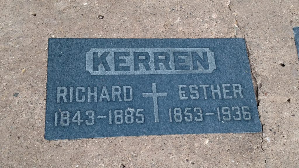
Even though Calvary Cemetery was virtually abandoned after 1920, some San Diego pioneers still chose to be buried in family plots located there. The San Diego Union reported in 1936 that by special arrangement, the body of Mrs. Ester Smith Kerren would be buried in her ‘ashes-of-roses’ wedding dress beside her husband at Calvary Cemetery, in a plot given to her by Fr. Antonio D. Ubach. She was a San Diego resident since her birth in 1853, daughter of Albert B. Smith and Maria Guadalupe Machado. She sang in the first choir that Fr. Ubach organized in the adobe chapel in Old Town. Her father had become famous when he spiked two Mexican cannons and climbed a flagpole in Old Town to attach an American flag in October 1846.

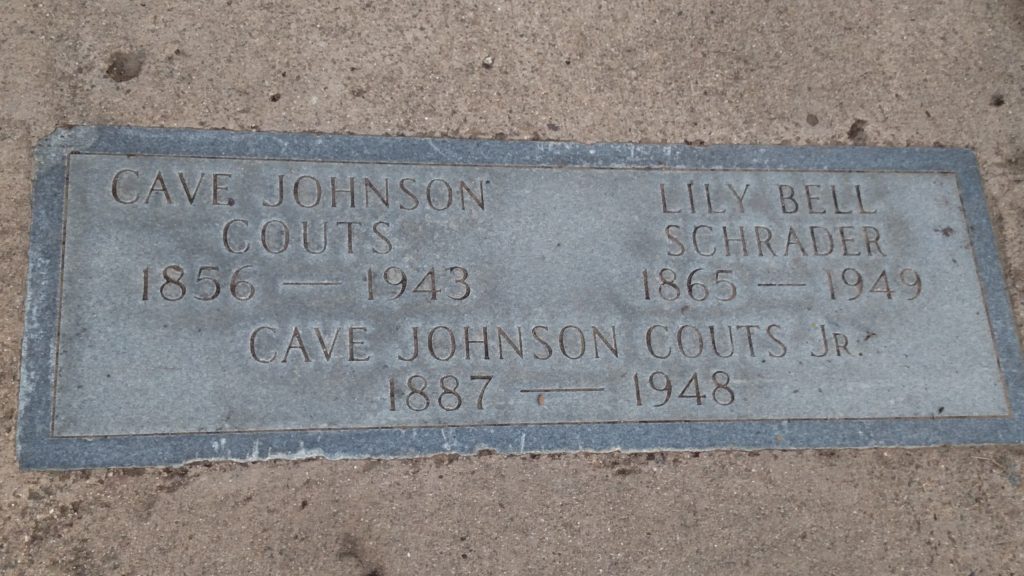
Cave Couts II, considered the last of the San Diego Dons, died in 1943. According to the Union, ‘In the old Catholic cemetery, rarely used any more and only recently rescued from years of neglect and vandalism, the old don was buried beside the almost legendary first Cave Couts and his beautiful Ysidora’. In 1949 Lily Bell Schrader, his first wife, was also buried at Calvary Cemetery.  Altogether 46 burials were recorded in the cemetery after 1920, the last occurring in 1960.

Also in 1949, the San Diego Union noted the continuing deterioration of Calvary Cemetery under the headline Broken Monuments, Maimed Statues Desecrate Sleeping City of Dead. ‘Desolation broods uneasily over historic Calvary Cemetery in Mission Hills’, the Union story began. ‘Headstones have been broken and overturned; rusted metal railings, which once protected burial plots of distinguished citizens, have been twisted, torn away and looted’. Perhaps most dramatic was a photo of the stone cross marking the grave of Father Antonio Ubach, who the article described as the founder of Calvary Cemetery, and the adjoining grave of Albert Mayrhofer, for whom there was no marker of any kind. The Union explained that Mr. Mayrhofer had been deeply interested in Calvary Cemetery and worked tirelessly to resist its growing neglect, but although he had died 10 months earlier his grave was without a marker and a visitor would be able to find the spot only through instructions from Mrs. Mayrhofer. She had been so disturbed by the evidences of vandalism and lack of care and protection for the cemetery that she had been unwilling to risk setting up the kind of memorial she would want (a marker was eventually erected over Sir Mayrhofer’s grave, and as Lady Mayrhofer had anticipated, it had been vandalized, but she had not anticipated that by the time of her death in 1993 she could not be buried next to her husband under the marker that already bore both of their names).

Other photos in the 1949 Union story showed a ‘wooden cross torn from its grave by vandals’, ‘solid granite headstones torn from their bases and flung sprawling on graves’, ‘stone monuments which had developed a list by reason of the ground underneath settling’ and an ‘old grave in a sad state of dilapidation brought about by repeated, prankish acts of desecration’.

Not much had changed by 1962 when the Union again reported on Calvary Cemetery: Where History Lies Abandoned. This article noted that since the 1939 restoration there had been no full-time caretaker and left unguarded the burial ground had become a rendezvous and playground for vandals with graves desecrated and headstones toppled, broken and carried away. However, a recent state law gave the city authority to convert abandoned cemeteries into memorial parks, and this was being considered by the Park and Recreation Department. Some relatives of those buried in the tract said they would prefer a well-grassed park properly marked with a monument to the present condition.

With no caretaker and no perpetual care funding, maintenance was left to community service groups. In 1963 and 1964 a Boy Scout Explorer post spent weekends cleaning up trash and debris and straightening and resetting toppled headstones. However, most community interest in Calvary Cemetery had turned to the proposal to convert it into a ‘pioneer park’. A letter to the editor of the San Diego Union in 1967 noted that funds for the Calvary Cemetery project had been approved in a park bond election the previous year but that development was tentatively scheduled for 1971-72 and that was too long to wait; ‘Calvary Cemetery, the target of vandals and the scene of nightly beer parties, is an unwholesome situation to be left so long’. Also in 1967, Hillcrest and Mission Hills residents told the Union that Calvary Cemetery was dangerous and a neighborhood eyesore. It had been run down for years and was a disgrace to the neighborhood and the city. It was filled with weeds, bottles and tipped-over headstones and ‘ghosts would be afraid to go in there at night’. They also asked for more police patrols and more cleanup work.

In 1968 the city initiated the legal process of transforming the cemetery into a memorial park by passing a resolution that whereas Calvary Cemetery was a nonendowment care cemetery, and that no human dead bodies had been interred for at least five years, and that the cemetery and all its ‘copings, improvements and embellishments’ were a threat and danger to the health, safety, comfort and welfare of the public, that the cemetery ‘is hereby abandoned’. The City Manager was directed to remove all the copings, improvements and embellishments. The resolution was unopposed.

An architectural firm hired by the city for design work proposed grouping the individual monuments together as one large memorial. An alternate plan proposed moving all the monuments to the city’s Mount Hope Cemetery and building a large central memorial. Some descendants of the pioneers expressed opposition to any plan that would disturb the monuments marking the graves of their ancestors. Descendants of the Pedrorena and Altamirano families wrote city officials to say that while they were not opposed to the idea of a park, they thought their ancestors’ monument should be left intact as part of a central memorial. These wishes were disregarded, and the contract for converting the old Calvary Cemetery into a pioneer memorial park awarded in February 1970 required that the headstones be moved. According to the City Manager, some would be relocated in the park but the others would be stored at Mount Hope. A group of Mission Hills residents had agreed to work with the city to select headstones of historical significance that would be retained in the park.

However, when the Mission Hills – Hillcrest Improvement Association selected 600 headstones to be retained for their historical importance, other Mission Hills residents protested. In May 1970, the day after workmen had started the improvement project, placard-bearing demonstrators, including children carrying signs reading ‘Creepy’ and ‘Spooky’, picketed the site to demand the removal of all the tombstones. Work was resumed after the two sides met with city officials and agreed to a compromise in which 142 of the most historically important stones would be retained, clustered in the south-east area of the park. The anti-stone group’s agreement was halfhearted; according to their spokesman, Albert A. Gabbs, the concept of a park would be utterly destroyed by the somber sight of a graveyard superimposed upon the landscape. The tombstones would present a ‘morbid attraction’ to the ‘sick, witchcraft and spook-oriented element of our society’. Parents would think twice about allowing their children to visit the park and the elderly and retired who live nearby would find the markers a ‘constant reminder of the grim reaper’. The improvement association spokesman, however, noted that the markers are ‘part of our history and our heritage’ and the park is a ‘historically interesting site’. The improvement association also turned over the records and materials they had accumulated and photos of the headstones to the San Diego Historical Society.
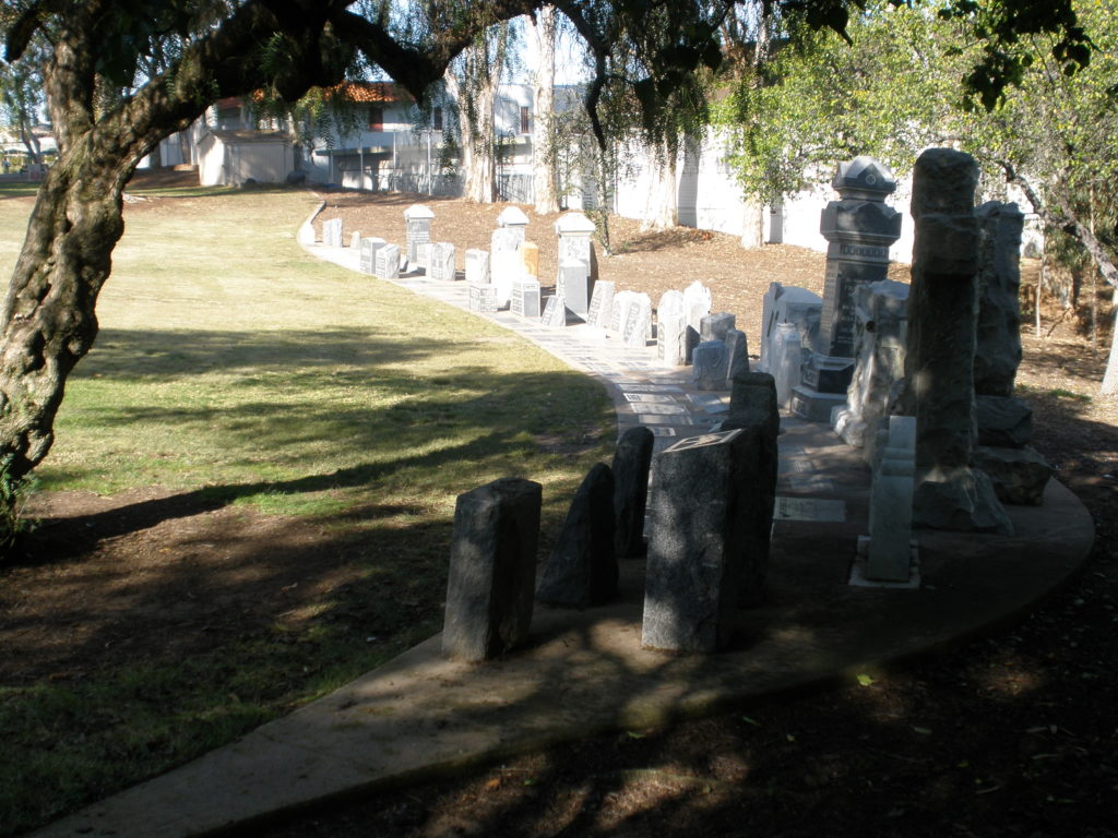
A few of the tombstones from Calvary Cemetery were spared and are lined up in a corner of what is now Pioneer Park.

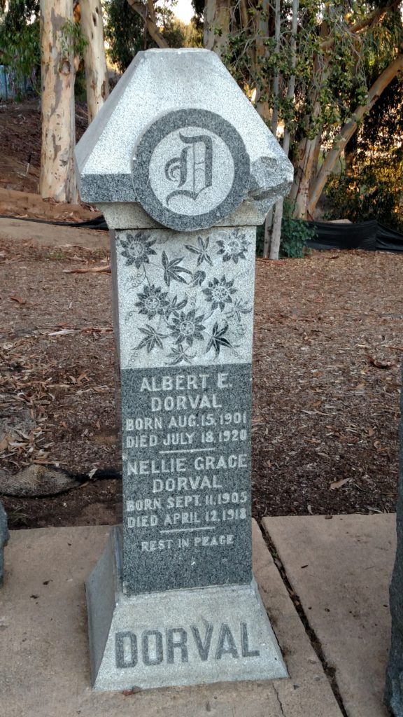
Landscaping was finished and Pioneer Park was opened to the public in April 1971, although not officially dedicated until December 1977, but the controversy over the tombstones continued. In July 1977 the Union had published photos of 7- and 8-year old brothers playing on the relocated monuments at the edge of the park, one stepping from one former grave stone to another and the other sitting on top of a grave stone inscribed with the name of Nellie Grace Dorval, a child who died in 1918. This prompted an angry letter to the editor from a reader who had known Miss Dorval and still remembered her suffering and death, calling the photos sacrilegious and disrespectful and wondering why parents would allow children to jump on the grave stones (an editor’s note clarified that these were not technically grave stones, having been removed from their original sites over graves years previously and lined up along one side of the park). Albert A. Gabbs took the opportunity to again warn of the attraction the former tombstones presented for those interested in the macabre, claiming that the area was littered with ‘things better not described left over from unusual gatherings which take place during the night’, and all because the Park and Recreation Board appeased the Historical Society by allowing the tombstones to remain.

In 1983 the San Diego Union published an article about a ‘graveyard of tombstones’ dumped near a railroad track in Mount Hope Cemetery (by one account the tombstones had been noticed by then-mayor Roger Hedgecock while inspecting the proposed route of the East Line of the San Diego Trolley, which would eventually operate over that track). These were some of the 400-500 tombstones from Calvary Cemetery which had been sent to Mount Hope, and the Union reported that although they had been put in a small canyon for ‘indefinite storage’, many of the ‘chipped and battered grave markers’ were covered in weeds and dirt and gradually disappearing into the undergrowth while their importance faded from memory. The Evening Tribune followed up with a report in July 1985 that there were 288 cracked or shattered gravestones haphazardly strewn near the proposed route of the East County extension of the San Diego Trolley.

The rediscovery of the discarded tombstones at Mount Hope and their undignified treatment there revived the debate about their proper disposition. The San Diego Historical Society asked that the gravestones be stored in a dignified manner or moved, but the City Manager’s office recommended that the area in which the gravestones were piled be fenced off for five years to allow the stones to be claimed by descendants of the deceased, or otherwise disposed of. The city Historical Site Board, an advisory board to the city council, voted unanimously not to support the City Manager’s plan and expressed support for relocating them back to Pioneer Park. The directors of the Save Our Heritage Organization also voted unanimously in favor of moving the gravestones back to Pioneer Park, where ‘at least they’ll be in the right cemetery’. The National Society of Colonial Dames of America pledged to contribute $500 toward placement of the stones, saying ‘the stones belong with the bones’.
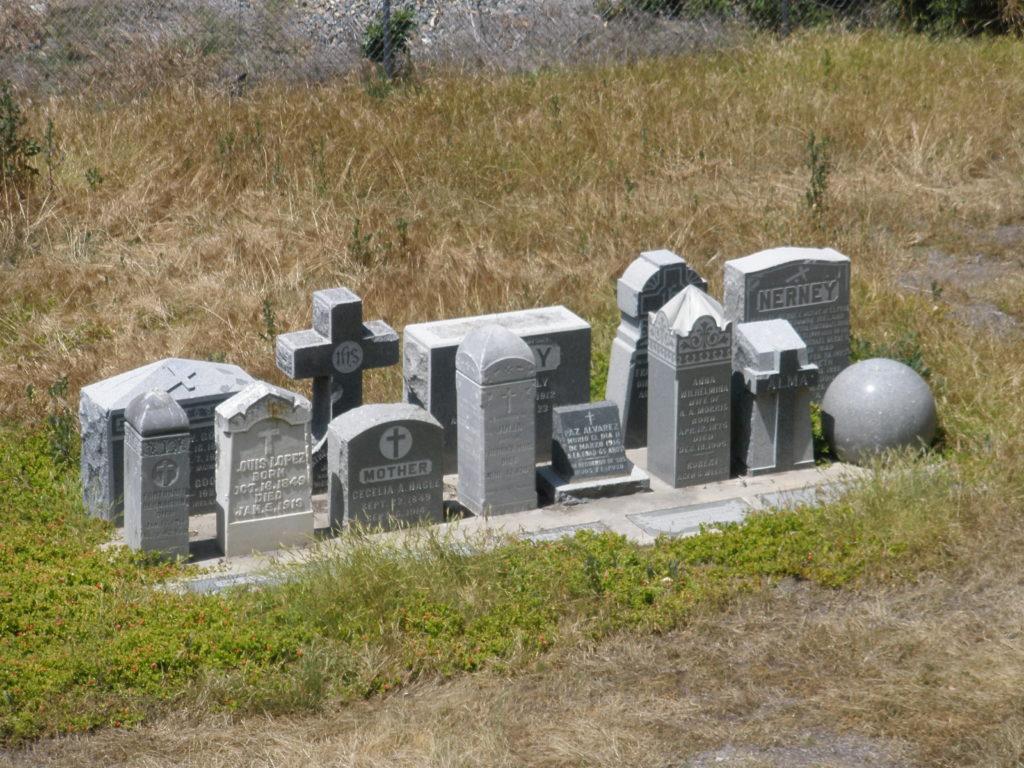
Monument made up of the few tombstones from Calvary Cemetery salvaged from their ‘mass grave of gravestones’ at Mount Hope.

In January 1986 the matter came to the attention of the city council where ‘shocked’ members of the Public Facilities and Recreation Committee voted unanimously to restore the tombstones and move them back to the Mission Hills site; the tombstones ‘had been given no more respect than discarded beer cans . . . this is really quite shameful’. However, despite the committee’s vote, the move never happened. The tombstones taken to Mount Hope in 1970 remain there, although they are no longer strewn haphazardly along the trolley tracks. Most were buried in a ‘mass grave of gravestones’ while a group of about twenty stand beside the tracks on a concrete base, much like the 142 that remained at what was once Calvary Cemetery, where so many of the pioneers who helped to found and build San Diego are still buried under the eucalyptus trees.
Crown Point

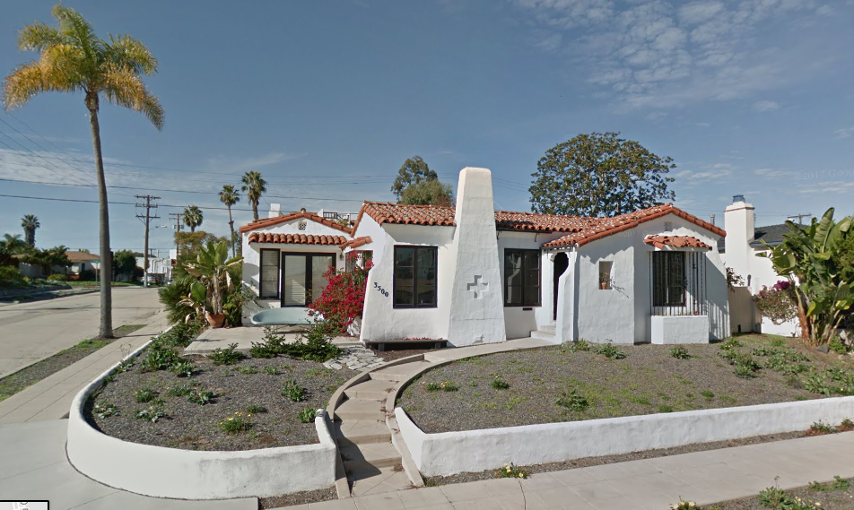
E. G. Anderson’s 1927 home, one of the first in Crown Point. Screen grab from Google Streetview 2017.

The peninsula extending south from Mount Soledad into Mission Bay, dividing the northern portion of the bay into Sail Bay on the west and Fiesta Bay to the east, is generally known as Crown Point. Actually, that name properly refers to the subdivision occupying the southernmost portion of the peninsula, including both sides of Moorland Drive and the residential blocks to the south. Like other subdivisions in the Pacific Beach area, Crown Point began as a pueblo lot, No. 1802, part of the legacy of the Mexican Pueblo of San Diego which was inherited by the City of San Diego when California became a state in 1850.

Although San Diego’s Board of Trustees had the power to sell pueblo land, there was little demand and few pueblo lots were sold until 1867, when Alonzo Horton visited San Diego, visualized a great city on what was then vacant land next to San Diego Bay, and bought seven pueblo lots totaling 960 acres. In 1869, Charles B. Richards, perhaps imagining a future community on Mission Bay (then called False Bay) purchased Pueblo Lot 1802, 92 acres, as well as Pueblo Lot 1801, another 31 acres that extended north and west around Sail Bay. Richards paid $150 in gold coin of the United States, or a little more than one dollar per acre. But while Horton’s Addition soon developed into the heart of downtown San Diego, Richards’ purchase remained undeveloped for decades.
In 1887 a group of San Diego bankers and real estate operators formed the Pacific Beach Company, bought a number of pueblo lots north of what became Pacific Beach Drive and created the Pacific Beach subdivision. In 1902 and 1903 another pair of developers bought most of Pueblo Lot 1800, in the northern portion of the peninsula between Pacific Beach and Pueblo Lot 1802, and subdivided it as Fortuna Park (the eastern half) and Second Fortuna Park (the western half). Development of Pacific Beach and the Fortuna Park additions with graded streets, concrete curbs and sidewalks, and water mains encouraged residential growth in these sections. Pueblo Lot 1802, however, remained entirely undeveloped and unpopulated.

In 1912 C. B. Richards, described by the Evening Tribune as ‘aged, wealthy and eccentric’, contracted to sell all his San Diego real estate holdings, which included 370 acres in La Jolla and property downtown in addition to Pueblo Lots 1801 and 1802. His friends and family intervened, claiming that he had been defrauded and accepted far less than the property was worth, and petitioned for a competency hearing before the superior court. While on the witness stand Richards testified that he had made discoveries for the prevention of all accidents and allaying all pain, that insurance companies were after him because his discoveries would put them out of business, and that the government had sent secret service men to protect him. He also had discovered the ‘Elixir of Life’. Judge Guy immediately issued an order declaring Richards an incompetent person and appointed a nephew, J. H. Richards, as guardian. The property transfers were canceled.

In 1913 J. H. Richards, the duly appointed, qualified and acting guardian of Charles B. Richards, an incompetent person, did sell Pueblo Lot 1802 to A. T. Sullenberger and Lawrence Sullenberger for $65,000. The San Diego Union reported that the Denver lumbermen had purchased the peninsula extending into Mission Bay and intended to transform the tract into a high class, exclusive residential section. While the subdivision plans were not far advanced, the owners were said to be planning to pave the streets in addition to installing all other modern improvements. However, the Sullenbergers’ plans never did advance and in November 1916 they sold Pueblo Lot 1802 to M. L. Ward, then a state senator.

Charles Richards had died in 1915 and in October 1916 his heirs incorporated the Richards Heirs Company to carry on with his real estate business. In one of its first transactions, the company reacquired Pueblo Lot 1802 from Ward in December 1916. Pueblo Lot 1802 remained under the ownership of the Richards Heirs Company until April 1923, when it was sold once again, to S. L. Tripp. The San Diego Union reported that Tripp, a bank president from Illinois who had spent the last few winters in San Diego and expected to make it his home, intended to subdivide the tract and place it on the market in the next few weeks.

Tripp’s subdivision of Pueblo Lot 1802 did occur, but not in the next few weeks. In December 1925 the Union announced that the city council would visit a proposed new subdivision known as Crown Point, which extends into Mission Bay from Pacific Beach. The question to be determined was whether the bay front all around the point must be left open to the public. Crown Point was one of the prettiest spots around Mission Bay and some of the officials wanted the bay front left to the people.

The map of Crown Point, a subdivision of Pueblo Lot No. 1802, excepting therefrom that portion lying below the mean high tide line of Mission Bay, was accepted by the council in March 1926. The issue of reserving the waterfront for the people was satisfied with a 60-foot public boulevard at the edge of the bluffs surrounding the point: Crown Point Drive on the east and The Riviera (now Riviera Drive) on the west. The other streets in the Crown Point subdivision were not laid out in the typical rectangular grid but instead conformed to the shape of the peninsula, converging on Ingraham Street, the southern extension of one of the main streets of Pacific Beach. The Crown Point streets were narrow, 50 feet wide compared to the 80-foot streets of Pacific Beach and 75-foot streets of the Fortuna Park additions, and there were no alleys. The size of the lots varied, but most were about 60 feet wide and 90 feet deep. Building restrictions were also announced; houses on all lots south of La Cima Drive, and all waterfront lots, would have to cost at least $5000. North of La Cima Drive, the minimum cost was $4000.

Sunday, March 7, 1926 was ‘Discovery Day’ at Crown Point, the ‘Venetian Promontory on America’s Riviera’, the day that San Diegans would get acquainted with a new and unknown residential district ‘the beauty and perfection of which simply beggar description’. Coastlands Company, the developer, wished the public to visualize the fairyland possibilities of Crown Point, when Mission Bay is transformed, as it would be, into a lagoon of sheer romance. The festivities would feature vaudeville stars and radio personalities, and the entire performance would be broadcast from one of the largest portable radio stations on the Pacific Coast. A report in the Tribune a few days later said that Discovery Day drew 7500 enthusiastic San Diegans in 1900 motorcars who purchased $150,000 worth of Crown Point home sites, believed to be an opening day sales record for San Diego real estate.

Advertisements for Crown Point emphasized that it was a ‘highly restricted’ subdivision. In addition to the $4000 or $5000 minimum cost of houses built on the lots, deed restrictions included setbacks from the street and lot lines and a prohibition on pepper and eucalyptus trees, or cypress other than dwarf or shrub cypress. Buildings could only be one story, excepting that a solarium could be above the first story. The lot was to be used for residence purposes only, and only one house or duplex could be put on the lot. No animals other than dogs or cats were allowed, and no poultry other than for domestic use, and then only if confined in a building having four walls and a roof. Finally, the premises could not be conveyed or transferred to any person not of the White or Caucasian race, or even occupied by such a person as a tenant unless in the capacity of a servant.

Despite its beauty and perfection, and an opening day sales record, real estate activity in Crown Point was disappointing at first. Only 39 of the 470 lots were sold and only six houses built in the Crown Point subdivision in its first two years. One of those houses, a stucco cottage and garage valued at $5500, was built for E. G. Anderson in the summer of 1927. Anderson had been president of the American Bronze Corporation in Pennsylvania and invented the four-tube door chime before moving to San Diego. In 1926 he joined John Austin and Frank Rood to form the Austin-Rood Company, which took over final completion of improvements and sale of lots in Crown Point from the Coastlands Company. Like most early Crown Point residences, the Anderson home at the corner of La Cima and Jewell streets was in the Spanish style. Another associate of the Austin-Rood Company, R. E. Struve, also built a Spanish-style home on Crown Point Drive in 1927.

The 1927 Struve home on Crown Point Drive today.

One early Crown Point residence that was definitely not in the Spanish style was built for Paul and Iva Valle in 1929. In 1930 Mrs. Valle opened a tea room in their home called Gray Gables Inn that became popular for luncheon and bridge parties and was particularly in demand for sorority initiations. In 1935 the Valles moved the tea room downtown to be closer to the San Diego Exposition in Balboa Park, and in the 1940s and 50s expanded to become one of San Diego’s most successful restaurant operations. The home on Promontory Street where it all began is still standing, marked with a San Diego historical landmark plaque.

Gray Gables Inn today.

Crown Point’s position at the tip of a peninsula extending into Mission Bay made it relatively remote from central Pacific Beach and, with the bay on three sides, even more remote from downtown San Diego. E. G. Anderson originated a proposal in 1927 that would correct this situation by building a causeway across Mission Bay connecting Crown Point to the downtown area. The causeway would be funded by bonds issued under the Acquisition and Improvement Act of 1925, also known as the Mattoon Act. Although it faced widespread opposition because of its cost and potential impact on Mission Bay, the causeway project was approved in 1929 and completed in 1931.

Although Anderson and other real estate promoters emphasized the benefits of improved access to and from San Diego, the causeway project initially had a negative effect on Crown Point property. Under the Mattoon Act, bonds funding an improvement project were to be paid for by assessments on property in districts benefitting from the project. Crown Point was included in the causeway district, and the assessments added to property taxes to repay the nearly $750,000 construction bond both raised the cost of ownership and reduced the value of property, making some owners unable or unwilling to pay. The Mattoon Act also required that any shortfall in collections for the bond payments was to be ‘pyramided’ or added to the next year’s assessment, which led to further delinquencies and a ‘death spiral’ of ever increasing assessments and delinquencies.

By 1935 the causeway district was over 50% delinquent, including over 300 of the 470 lots in Crown Point (more than 200 of them still owned by Tripp). Faced with a financial crisis, the county engineered a bailout for property owners in the causeway assessment district, issuing new bonds to be repaid by more reasonable district assessments, general property taxes and gasoline taxes, and using the proceeds to buy up and retire the existing causeway bonds at a 50% discount. Final approval of the settlement was voted in June 1937 and on July 4 a ‘bond-fire’ at Pacific Beach celebrated ‘Independence Day’ from Mattoon Act ‘bond-age’.

1937 Cape Cod home in Crown Point today.

A San Diego Union article from July 11, 1937, reported that the week had witnessed the predicted start of home building on a big scale throughout the entire North Shore district, particularly Crown Point. The activity was anticipated following official o. k. of the district by title insurance companies, as the result of the lifting of the Mattoon bonds. Construction had started on a picturesque, two-bedroom building of the Monterey-Cape Cod classic design, financed by the San Diego Savings & Loan Association, which announced that it was completing arrangements for many buildings in Crown Point. According to E. G. Anderson, who had become the prime developer for Crown Point as well as the North Shore Highlands and Congress Heights subdivisions in Pacific Beach, the section had been approved for insured loans by the Federal Housing Administration and nine more builders would be in action within a few days. The Dennstedt Company started a ‘Blue Ribbon’ home, Stallard & Oates an ‘S & O All-American’ home and B. M. Torgerson a ‘Miracle Home’, all in the 3500 block of Yosemite Street. By October 1937, Anderson reported that 42 homesites had been sold and 18 new homes were either being built or planned. The Union published drawings of the new homes, many of which are still recognizable today.

A Dennstedt ‘Blue Ribbon’ home today.

Even with the upswing in building activity in the late 1930s, the Crown Point subdivision was still mostly vacant in 1940, with only 57 addresses listed in the city directory. This was about to change, however. In 1935 Consolidated Aircraft Company had relocated from Buffalo to new manufacturing facilities along Pacific Highway in San Diego, just a few miles from Crown Point over the causeway. Production of B-24 Liberator bombers began in 1940 and increased as the country prepared for a war which eventually came at the end of 1941 and lasted until 1945. Tens of thousands of aircraft workers moved to San Diego, far more than could be accommodated in the existing housing supply. In 1941 the Federal Public Housing Authority stepped in to acquire land and develop temporary housing projects for defense workers in Linda Vista, Frontier (the area south of the causeway, now known as the Midway district), and in Pacific Beach (the public housing project in Pacific Beach, between Olney Street and Rose Creek, was never returned to private ownership and has become the Admiral Hartman Community for military families).

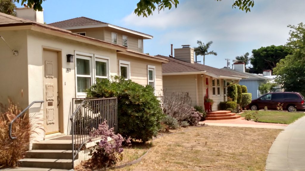
The Federal Housing Authority also made funds available to insure loans for war workers to buy commercially-built homes. These loans were limited to $5400 and were only available in defense areas, like San Diego, and in zones with adequate transportation facilities to workers’ place of business, like Crown Point. In 1943 builders Alden C. Palmer and Alex Oser formed Palmer-Bilt Homes and began buying vacant lots in Crown Point and building their signature three-bedroom homes. In October 1943 they announced that new homes on Crown Point were available to qualified war workers under FHA financing. A model home was open for public inspection. By February 1944 the Union reported that there were 169 Palmer-Bilt homes in picturesque Crown Point, only eight minutes from the Consolidated Aircraft plants. A number were still available and the builders planned to construct 50 more. Each home had a spacious living room with a real, built-in fireplace.

A row of Palmer-Bilt homes today.

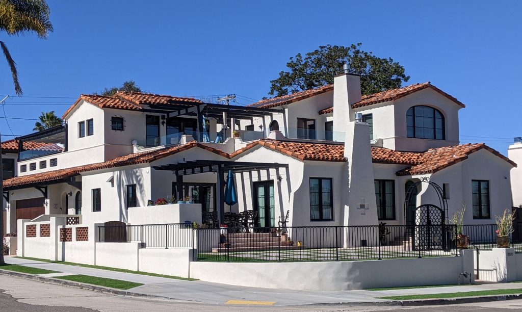
By the end of the war in 1945 Crown Point had grown to include over 300 addresses, most of them Palmer-Bilt Homes. Home construction continued after the war and Crown Point, like the rest of the Pacific Beach area, was essentially built out during the 1950s. The 1950s also saw the dredging of the bay and development of Mission Bay Park into a popular recreation area, greatly increasing the desirability of Crown Point real estate. Spanish, Cape Cod and Blue Ribbon homes from the 1920s and 1930s, and rows of the Palmer-Bilt Homes of the 1940s with their distinctive square chimneys, can still be seen along the narrow streets but many of original homes have been extensively remodeled to reflect their added value. The E. G. Anderson home is now one of these, the 1927 Spanish-style cottage was stripped down to its original framing and chimney before being restored and included in a major expansion at La Cima and Jewell.

The E. G. Anderson home after its remodel

Switzer Creek Conduit

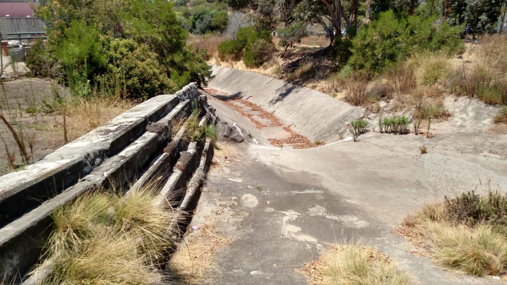
Switzer Creek below Balboa Park Golf Course, before entering conduit under the city leading to San Diego Bay.

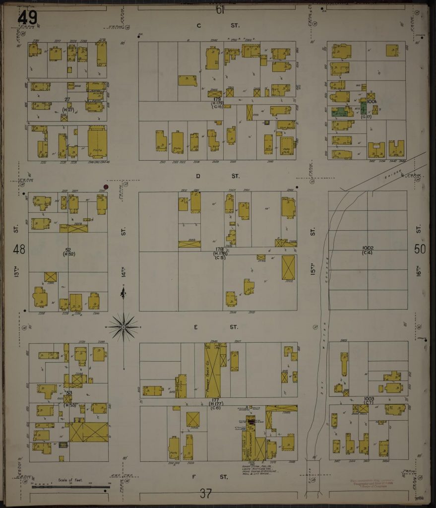
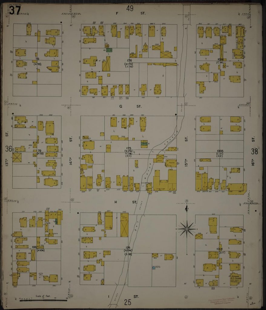
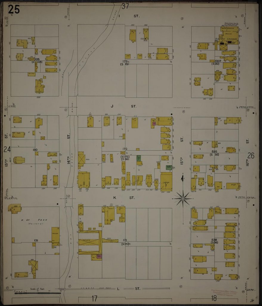
One of the natural geographical features of the area that became the city of San Diego was a seasonal stream that rose in the mesa east of what became Balboa Park. After flowing through the park the stream entered what is now the downtown area at 19th Street and ran in a generally southwesterly direction before emptying into San Diego Bay near what is now the 10th Avenue Marine Terminal. The stream became known as Switzer Creek, after a family that operated a farm on its banks near the southern boundary of Balboa Park, and the canyon it carved in the mesa east of the park is called Switzer Canyon. As San Diego’s population expanded eastward from the bay in the late nineteenth century city streets, including D Street (Broadway) and H (Market) Street, were extended across Switzer Creek over wooden bridges.

During San Diego’s summers Switzer Creek was normally dry, but winter rainstorms could send enormous amounts of water from its upstream catchment area to the channel running through the city. In January 1886 the San Diego Union reported that a cloudburst on the mesa brought a flood of water pouring down through ‘Switzer’s Cañon’ that ‘created consternation among the denizens of the low lands along Fourteenth Street from D Street well down towards the bay’, not a gradual rise but a ‘tumultuous body, with a roar that appalled and a force that tore up the soil and sand and carried boulders and everything before it’. The worst damage occurred at H Street, where a house carried away by the flood struck the H Street bridge, tearing it loose and washing it downstream. Another storm in December 1889 also washed away a small house in the vicinity of 14th and H streets. The house floated several blocks before colliding with another house which was loosened from its foundations but was too large to float away.

After several days of rainfall In January 1895 the bridges across Switzer Creek at C, D, G, I (Island) and J streets were closed, and some swept away, while the bridge at K Street was saved by several hundred sandbags piled along the channel to hold the stream in place. The bridge at H Street ‘continued strong’ during that storm, but by 1902 it had weakened considerably. The Superintendent of Streets reported that the job of repairing the H Street bridge between 14th and 15th streets turned out to be a more serious matter than thought as many of the direct supporting beams and braces were rotted almost in two.

In May 1906 the Board of Public Works recommended replacing the wooden bridges over Switzer Creek at D, F and H streets with concrete conduits, but only the H Street project was actually approved by the city council. Ordinance No. 2487 authorized a reinforced concrete conduit on H Street between 14th and 15th, provided the cost not exceed $5,847, and provided further that the San Diego Electric Railway Co. contribute $2000 to the cost of construction (a SDER streetcar line ran on H Street from the waterfront to 16th Street, then down 16th to Logan Avenue and Logan Heights). The contract was awarded to W. C. Jacobs and work began in July 1906. According to the San Diego Union, the new H Street concrete culvert, to take the place of the damaged wooden bridge, was planned to take care of all the water that will ever come down Switzer Canyon and ultimately to form part of a conduit extending the entire length of the creek bottom. It would be 102 feet long, 18 feet wide and 10 feet high, the form being that of a perfect arch, the crown of which will be about two feet below the street. Construction of the concrete culvert was completed by November but the fill dirt laid over it to bring the street up to grade was considered too damp and in need of additional time to become properly packed. H street was finally paved over the culvert in April 1907.

In January 1907 the city held a special election to approve a bond issue to pay for public works, including water mains, reservoirs, a road to Mt. Hope and a sewer system for La Jolla. The bond issue would include $50,000 to fund seven reinforced concrete culverts to be built under C Street at 18th, D at 16th, F at 15th, G at 15th, I between 14th and 15th, J at 14th, and K at 14th, replacing the old wooden bridges over Switzer Creek which had continued to deteriorate (the south half of the D Street bridge had been fenced off and declared unsafe for travel). The election was held on March 12 and voters approved the bond issue for culvert construction (they also approved the La Jolla sewer system, intended to end pollution of the ocean there and clear the way for the biological station which became the Scripps Institution of Oceanography and ultimately UCSD).

However, before any steps had been taken toward construction of the culverts, a group of citizens who owned property in the vicinity petitioned the city to consider a more comprehensive flood control proposal for Switzer Creek; a concrete conduit running all the way from 18th and C streets to the bay. This alternative would not just replace the wooden bridges but would enable the property owners to ‘fill up the creek and use its bed for building lots’. The $50,000 already approved for the culverts could be reserved and applied to the construction of the conduit. The council considered variations of this idea for over a year before finally passing a resolution in March 1909 authorizing the city engineer to prepare plans and specifications for a reinforced concrete culvert, running in the bed of Switzer Creek from the south line of the public park to the intersection of K and 14th street. Where streets then crossed the creek on wooden bridges, C Street at 18th, D at 16th, F and G at 15th, I between 14th and 15th and J and K at 14th, the full width of the creek bed would be graded to street level (E Street was not yet graded east of 14th Street and did not have a bridge). The project would also include a dam on the south line of the park to temporarily hold flood water that might exceed the capacity of the conduit.

The council advertised for bids for construction of the conduit project in May 1909 but when the bids were opened in June the lowest bid, by C. H. Julian, was nearly $61,000, exceeding the $50,000 that the city had on hand for construction. After considering whether to reopen bids or to award the contract to the lowest bidder on condition that a portion of the work be delayed until additional funds could be secured, the mayor recommended that the difference could be found in the general fund and the council decided that the contract should be let.

The normally dry creek was mostly private property and it required some time to secure right of way from the property owners but by the end of July work on the Switzer Creek conduit had begun. The San Diego Union reported in August 1909 that a large force of men under C. H. Julian were at work on the conduit which would extend from Switzer Canyon to the water front. The first stretch of the conduit was to be from E Street north past the C Street bridge and operations were then in progress in the vicinity of 15th and D streets, where the walls of the ditch were continually caving in and workers narrowly escaped being crushed and buried. Other men were tearing out the D Street bridge; after the conduit had been laid the gap would be filled with dirt to the level of the street. Cement workers had begun making sections of the huge concrete pipe for the conduit.

A story in the Union in September 1909 described the construction of the sections of concrete pipe. Each section was three feet long and five feet inside diameter. The concrete was reinforced with steel bands and rods, and was six inches thick, making the overall diameter of the conduit six feet. The sections were removed from their molds after one day but then waited fourteen days to be laid. The concrete contractor could make thirty sections a day. Sections were laid in the ditch by a steel derrick and connected with steel bands. After sections had been laid they were cemented, making a continuous pipe. This round reinforced concrete pipe would extend about a mile from the park to around I street; from I street to the bay the conduit would become a channel, ten feet wide and five feet deep, with greater capacity.

Contractor Julian had expected to finish the conduit within 90 days, before the normal beginning of the rainy season, but the project fell behind schedule and early in November he received permission from the council for an extension of time to complete the project. Changes in alignment and gradient were also approved by the council. By late November, however, the conduit had only been completed between the park and H Street, and a heavy downpour caused considerable damage below the completed section. A dam had been constructed at the lower end to prevent bay water from running back into the trench at high tide but instead floodwaters coming down the completed conduit were backed up by the dam and filled the trench, causing portions to cave in. Julian required another contract extension in January 1910 but by April the conduit had been completed and was accepted by the city.

C. H. Julian’s contract had required filling in the creek bed to street level where bridges had previously crossed the creek, but other sections of the creek bed would also be filled in over time. In April 1910, the same month that the conduit had been accepted, a contractor asked the city council for a permit to grade 15th Street from E to G streets by private contract at the request of nearby property owners. G. E. Gabrielson estimated that it would take a long time, 12 months or more, to complete the project because of the vast amount of filling that would be required. The fill dirt would come from street paving and basement excavations. Gabrielson added that property owners between D and E streets were also arranging to have the street graded in that block, which would open up 15th Street from D Street south. It had never been graded before because there was no conduit to carry off the flood waters of Switzer Creek.

Even with a conduit, the flood waters of Switzer Creek were not always carried off rapidly enough. In April 1926 a storm dumped about 3.2 inches of rain and caused an ‘avalanche of water’ emptying from Switzer Canyon and over the large dam there. According to the San Diego Union, the huge weight of water racing from the canyon threatened the Switzer dam and all available police and fire department reserves were rushed there. Below the dam the intersections were ’huge lakes into which poured roaring rivers’. This and other similar incidents led the city to build and maintain additional storm drains under city streets to add to the drainage capacity. In 1986, for example, the city budgeted $175,000 for replacement or restoration of the Switzer Creek storm drain system to ‘improve the flow of the aging network’.

In 2000 the San Diego Union-Tribune reported that city workers replacing aging water mains had stumbled upon what appeared to be a tunnel under the 1400 block of Market Street, an inverted U-shaped concrete and steel arch about 12 feet wide and 9 feet high with a dirt floor. A drainage pipe ran beneath the dirt floor and a variety of old items including bullets and bullet-riddled cans were recovered from what was evidently still open space under the arch. A 1909 city map found in a drawer at the city operations building was said to describe the subterranean structure as an arch of the Switzer Creek conduit. In all likelihood, the ‘Market Street tunnel’ was actually the concrete culvert built to replace the H Street bridge in 1906 (H Street was renamed Market Street in 1915), and the ‘drainage pipe’ was the Switzer Creek conduit, constructed in 1909. Once Switzer Creek had been diverted into the conduit, the bridges over which other streets had crossed the creek were replaced by dirt embankments, but at H Street the conduit ran through the existing culvert under the street and no fill was necessary. The culvert would have remained open and accessible and apparently was visited by local residents, some of whom used it as a shooting gallery.

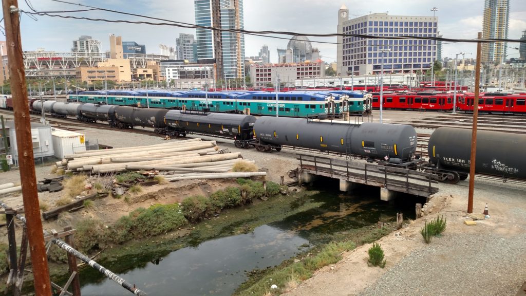
In the 100-plus years since the completion of the Switzer Creek conduit, what remained of the creek bed has been filled in and the area developed, burying the H Street culvert and every other sign of Switzer Creek in the East Village area of San Diego. The creek still flows beneath the streets, however, and is ‘daylighted’ in a few spots around Harbor Drive before it empties into San Diego Bay. No longer considered a threat to flood areas of the city, it is monitored today for the pesticides, metals and other toxic substances that it may carry from the yards and streets of its catchment area into the bay.

‘Daylight’ section of Switzer Creek near Harbor Drive, between the conduit under the East Village and San Diego Bay.

PB’s Japanese Truck Farmers

In the first years of the twentieth century Pacific Beach was a semi-rural community with few houses or other structures and a lot of open land, much of which was used for agricultural purposes. From 1892 to about 1905 the primary agricultural activity had been lemon ranching, but by 1910 the lemon economy had collapsed and most of the groves had disappeared. In some areas, like on Hornblend Street between Lamont and Jewell streets, the former lemon ranches were being converted to residential blocks, with graded streets, paved sidewalks and new house construction. Other areas remained agricultural but adopted different crops and methods, like truck farming – vegetables grown for shipment to distant markets. Folsom Bros. Investment Co. advertised a whole block of 40 lots in Pacific Beach as ‘suitable for chicken ranch or small truck farm’ in 1912.

Among those who moved to Pacific Beach to become truck farmers were immigrants from Japan. Yataro Yamaguchi was born in Japan in 1865. Census records indicate that he arrived in the United States in 1890 and in 1910 was working as a fruit farmer in El Cajon. By 1915 he had been joined by Matsu, apparently a ‘picture bride’ who had arrived in the United States in 1912, and the couple moved to Pacific Beach where the 1916 city directory described him as a rancher living at the northeast corner of Diamond and Olney streets (the house on that corner was the ranch house built in 1896 for lemon rancher Thomas Marshall, and then owned by the Baker family).

Mr. Yamaguchi made news in 1915 when he retained an attorney and threatened a criminal libel suit against the San Diego correspondent of the Los Angeles Japanese Daily News for writing an article (in Japanese and English) that accused the ‘Pacific Beach vegetable dealer’ of treating his young wife with great cruelty after he had induced her to come to California to marry him following an exchange of photographs. According to the Evening Tribune, Mr. and Mrs. Yamaguchi both emphatically denied the charges and claimed that no couple ever had more harmonious relations. In the end, the journalist agreed to publish an apology and denial of his former story, in two languages, and displayed as conspicuously as the original article.

By 1920 the Yamaguchis had three children and had moved to the northeast corner of Lamont and Diamond streets (again a lemon ranch house, built in 1895 for the Coffeens). Apparently they intended to move to a new home in July 1924 but after Mr. Yamaguchi had spent the Fourth of July cleaning and painting it he arrived with his belongings the following morning to find only a ‘heap of ashes and charred lumber’. According to the local papers, the home of Y. Yamaguchi on Jewell Street, across the street from a schoolhouse, was totally destroyed. No alarm had been received and no effort made to stop the fire. Neighbors reported that they had seen the fire but thought it was a bonfire celebrating the national holiday, and speculated that a skyrocket may have been responsible. Presumably this was the property near the southeast corner of Jewell and Law streets where an improvement assessed at $30 until 1924 was ‘gone’ in 1925 (the $30 value also suggests a very small building; houses in the vicinity ranged in assessed value from about $150 to over $500). This lot was a few blocks from the Pacific Beach school, which opened in 1923 on Ingraham between Emerald and Diamond streets and is now the PB middle school, but at the time they would have been separated only by open fields and Ingraham Street.

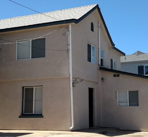
The 1920 census also listed two other Japanese households along Lamont Street. A. J. Yamaguchi (apparently no relation to Yataro), his wife Tomoye and daughter Yuriko lived 4775 Lamont, south of Chalcedony Street (also a former lemon ranch house, built in 1904 for the Roxburghs). The Morimoto family, Chonosuki, his wife Masuye and four children were listed as living on Lamont, near Beryl. The heads of these households were each described as truck farmers. The Japanese families rented these homes and presumably rented the land that they farmed, located east of Lamont along the intermittent creek that is now a storm drain under Academy Street.

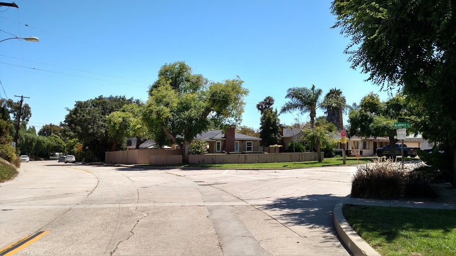
Academy and Law streets, formerly Japanese truck farms, now Lamont Terrace subdivision.

Further to the east, near Rose Creek, Aizo and Komuma Sogo and their two daughters lived at 2480 Garnet. He was described as a garden laborer, and possibly worked at Kate Sessions’ nearby nursery.

Another group of Japanese lived in the area at the northwest corner Pacific Beach. The 1920 census listed 31-year-old Toshitaro Yamashita as manager of flower gardens in Bird Rock, along with his 33-year-old wife Tome. Eight Japanese men ranging in age from 17 to 61 at the same address were listed as helpers. Yonesuke Nakata, a farmer, and his brother Yozo, a laborer, with his wife Kataye and their month-old daughter Riuo, lived next door. Two other adjacent residences housed another seven Japanese men described as truck farmers or truck farm laborers. A note on the census form stated that this group of Japanese ‘speak English a little’. Two other residences housed Japanese truck farmers, their wives, relatives and helpers, 13 in all, nearby on Turquoise Street. These residents were said to ‘speak English very poorly’.

In March 1923 the Yamashitas bought three blocks of land north of Turquoise Street, across from what is now Pacific Beach Elementary School. Apparently the California Alien Land Laws of 1913 and 1920 prevented Mr. Yamashita, an ‘ineligible’ alien, from purchasing the property directly. Instead, an American citizen, Charles Butler, acquired the land for $8000 and then the ‘contract and all right, title and interest in the land’ was ‘assigned, transferred and set over’ to Shigeru Yamashita and Shizu Yamashita, ‘native born citizens of the United States of America’ (the Yamashita’s son, 3, and daughter, who would turn 1 in another week). A year later, in March 1924, a building permit was issued to T. Yamashita for a ‘frame cottage and garage, 1166 Turquoise, $2700’. In January 1925 he received another permit for a board house at 1254 Turquoise Street, Pacific Beach, valued at $200.

By 1930 the Yamaguchis had three more children and were paying $40 a month to rent the house at 4775 Lamont Street. Another family of Japanese-Americans, Kimitaro and Hatsuyo Nakamoto and their four children, were boarding at a house a block north at 4807 Lamont, north of Law Street (this was also a former lemon ranch house, built in 1893 for R. C. Wilson). The 1930 census described the heads of these households as truck ranchers and noted that they were able to speak English, although their wives were not. Across Pacific Beach, the Yamashitas lived with their four children and four Japanese boarders at 1166 Turquoise Street, on the property they had acquired in 1923. In the census, Mr. Yamashita and the boarders were listed as gardeners at truck and flower farms and everyone except one of the boarders could speak English. Another Japanese family, Tokubei and Yone Ono, with two daughters, lived nearby at 1186 Tourmaline. According to the census, both parents were gardeners at truck and flower farms and Mrs. Ono did not speak English. Strawberries were apparently the main crop in this area; a Journal of San Diego History article about the electric railway line to La Jolla noted that in the 1930s the open country, truck garden land, between Turquoise and Colima streets consisted of strawberry fields then commonly called by a culturally insensitive abbreviation for Japanese.

The Yamaguchi family was still living in Pacific Beach in 1940, at 1871 Grand Avenue, where Mr. Yamaguchi was described as a farmer and Mrs. Yamaguchi as a farm laborer. It is not clear whether their farm was near their home on Grand or whether they traveled up Lamont to Chalcedony Street and the same plot they had worked in previous years. Their son Alfred, 25 years old at the time, still lived with the family and was listed as a gardener for a private home. Daughter Yone, or Lois, 24, had moved to Los Angeles and worked as a cosmetologist in a beauty shop. The Yamashitas still lived at the 1166 Turquoise address with three of their children, and five Japanese and five Mexican hired hands. Their oldest son, Edward, 31, had married and lived on E Street in downtown San Diego, where he was a wholesale florist.

Although PB’s Japanese residents initially clustered together in neighboring homes and had a limited ability to communicate with the larger community, they were certainly aware of current events and on occasion showed a remarkable level of pride in their adopted country. In August 1923, after United States President Warren Harding died and was succeeded by his vice-president Calvin Coolidge, the San Diego Union reported that San Diego was believed to bear the distinction of having the first baby named after the new president. The distinguished youngster was Samuel Coolidge Yamaguchi, son of Pacific Beach truck gardener Yataro Yamaguchi (the ‘Samuel’ was said to be taken from ‘Uncle Sam’).

The children of the Japanese immigrants attended local schools and participated in community activities. 11-year-old Yone Yamaguchi received a silver star for 90 percent attendance in Big Chief Troop of Pacific Beach girl scouts in 1928.  Her 9-year-old sister Edith joined the troop in 1934. Third-grader Yuriko Ono played an Indian in a Thanksgiving play at the Pacific Beach school in 1929. Alfred Yamaguchi was in the first class to graduate from Pacific Beach Junior High School in 1932. Several of the Yamaguchi and Yamashita children graduated from La Jolla High School, where Ed Yamashita played football and wrestled for the Vikings and Kiku Yamashita was vice president of the Girls’ Athletic Association. Shigeru Yamashita was a champion model yacht racer in the mid-1930s and went to the University of California at Berkeley in 1940.

The assimilation of Japanese residents into Pacific Beach came to an abrupt end in 1942 after the United States declared war on Japan following the December 7, 1941 surprise attack on Pearl Harbor. Fearing that some members of the Japanese immigrant community could engage in subversive activity on behalf of their former homeland, the military declared the coastal areas of the western states exclusion zones and planned to evacuate all Japanese aliens and their Japanese-American children to relocation or internment camps outside of the coastal areas.

Restrictions on ‘enemy aliens’ began soon after war was declared. Japanese were required to surrender cameras, short-wave radios, firearms and other ‘contraband’. Beginning in February 1942 they were subject to a 9 P.M. curfew and only allowed to travel between home and work. Voluntary evacuation began in March, when 1000 Japanese from the Los Angeles area agreed to go to Manzanar in the Owens Valley to help set up a reception center there, and authorities made it clear that evacuations would continue with or without such cooperation.

In San Diego County, operators of Japanese controlled farms were registered and required to list details of their acreage and crops to assist in their transfer to American ownership with minimal effect on the food supply. They were told they must be ready move out ‘very shortly’, and advised to make preparations to transfer their properties and wind up their other affairs prior to their projected move inland. The first mass evacuation of 1150 Japanese and Japanese-Americans from the south half of San Diego County, including Pacific Beach, occurred on April 7. The evacuees departed from the San Diego union depot on two 16-car trains for an assembly center at the Santa Anita race track near Los Angeles. The San Diego Union noted that the departing Japanese left behind many farms and truck gardens, which the county agricultural department was seeking to staff with citizens to prevent loss of food.

Most of the former Pacific Beach residents ended up at the Colorado River Relocation Center, also known as the Poston Internment Camp, near Parker on the Arizona side of the Colorado River. The camp was built in early 1942 on the land of the Colorado River Indian Reservation, over the objections of the tribal council, and opened on June 1, 1942.

The Yamashitas; Toshitaro, Tome and three children, arrived at Poston from Santa Anita on August 27, 1942. The parents remained at Poston for the duration of the war, returning to San Diego in September 1945 after more than three years at Poston. Since the internment program was nominally intended to remove Japanese from coastal areas, some internees could obtain ‘indefinite leave’ from the camps, under certain conditions, as long as they went to non-coastal destinations. Shigeru Yamashita, 22 years old when interned, received indefinite leave by ‘community invitation’ and left for Chicago in April 1943. Shizu, or Elizabeth, 20 years old in 1942, left for Milwaukee in February 1944, also by community invitation. The youngest Yamashita daughter, Kikuya or Kiku, who was 18 when she arrived at Poston, married fellow evacuee Nobuo Kawamoto in February 1943 and their daughter Christine was born at Poston in December 1943. Nobuo received indefinite leave for employment at Salt Lake City in September 1943 but Kiku and Christine Kawamoto remained at Poston until July 1945, when they departed for San Diego.

The Yamashitas’ oldest son Edward, who had married and was living in downtown San Diego in 1942, also went to Poston via Santa Anita, arriving with his wife Florence and daughter Mildred on August 28. His wife and daughter received leave to join family in Colorado in April 1943 and he received leave for employment in Colorado in July 1943. They also returned to San Diego after the war, living in Lemon Grove.

The Yamaguchis; Yataro, Matsu and five of their children were sent directly to Poston on August 3, 1942, avoiding the Santa Anita assembly center. Their oldest son, Alfred, 27 in 1942, had also been sent directly to Poston, on May 15, 1942. Yataro, Matsu and their youngest daughter Jane, who was 15 years old in 1942, remained interned for the duration of the war, departing on September 19, 1945 for San Diego. The other Yamaguchi children did receive indefinite leave from Poston; Alfred joined the U. S. army and left in May 1943, Yone (Lois), 26 in 1942, departed to Chicago for employment in March 1943, Manuel and Edith, 20 and 17, also went to Chicago to join family (presumably Lois) in October 1943 and February 1944. Samuel Coolidge Yamaguchi, who turned 19 a week after arriving at Poston, went to Smithfield, Utah, by community invitation in June 1943. He later enlisted in the army and was deployed to Italy as a member of the famed all-Japanese 442nd Regimental Combat Team, where he was wounded in July 1944.

Several Japanese families who had lived in Pacific Beach in the 1920s but who lived elsewhere in San Diego in 1942 were also reunited, first at Santa Anita and then at Poston. Aizo and Komume Sogo, with six daughters and a son arrived at Poston on August 27, 1942. The parents and youngest daughter, 13 when she was interned, remained until 1945 but the other children, ranging in age from 15 to 25, were given indefinite leave and departed for eastern cities in 1943. Chonosuke and Masuye Morimoto and two of their children arrived on August 28. Chonosuke and Masuye remained for the duration, leaving for San Diego in September 1945. A 30-year-old son and 27-year-old daughter received indefinite leave for employment in 1943. Seiichi and Ekino Matsumoto, who had lived on Turquoise Street in 1920, arrived at Poston with three children on August 27 and remained with their youngest daughter, 13, until August 1945. Two other children, 15 and 21 when interned, received indefinite leave in 1944.

Yonesuke Nakata, his wife Haruno, and his brother Yozo, wife Kataye and their three children, who had moved from Turquoise Street to Solana Beach, were sent directly to Poston on May 17, 1942. The adults remained for the duration, returning to San Diego at the end of October 1945. One of Yozo and Kataye’s children went to Chicago in 1944, another returned to Encinitas in September 1945. The oldest daughter married another internee in September 1943 and the couple remained until they were released and returned to Monterey in September 1945.

Not all of the former PB residents sent to relocation camps went to Poston. Tokubei and Yone Ono, gardeners who had owned a home at 1186 Tourmaline Street in 1930, had moved on to Gardena by the 1940s and after assembly at Santa Anita they were sent to Arkansas, to the Rohwer Relocation Camp, with their two daughters, Lillie (Yuriko), 24 and Mary (Meriko), 23, arriving on September 30, 1942. Another 23-year-old from Gardena, James Ichiya Yoshida, also arrived at the same time and when he received leave for employment in April 1943 he and Meriko were married. She then also received indefinite leave and the couple moved to Chicago, where Lillie also went to ‘join family’ in October. The adult Onos remained until March 1945 when they also left for Chicago.

Kimitaro and Hatsuyo Nakamoto and their three children had lived on Lamont Street in Pacific Beach while working a nearby truck farm in 1930 and had moved to a farm on Torrey Pines Road in La Jolla by 1940. In 1942 the family was first sent to the Santa Anita assembly center and then to the Heart Mountain relocation center in Wyoming in September 1942. A year later, in September 1943, they were transferred to the Tulelake segregation center in California. Although the circumstances of their transfer are not clear, Tulelake was the center with the highest level of security and more armed guards and was where internees considered less loyal to the United States were segregated. It was also the last camp to close after the war; Kimitaro and Hatsuyo and their daughter Chieko (Katherine), 14 years old in 1942, remained at Tulelake until January 1946. The older children, Kenichi (Ken), 22, and Kimiye (Kay), 19, did not leave until March 1946.

Back in Pacific Beach, the war years had brought thousands of defense workers from the huge Consolidated Aircraft plant downtown to federal housing projects which in many cases were built on the site of the displaced Japanese residents’ former homes, farms and gardens. The Los Altos Terrace project, 428 homes, was built on land surrounding the Pacific Beach Junior High School (now PB Elementary), covering the former farmland and homes of the Japanese families who once lived there. When the federal government filed suit to condemn and acquire the tract in July 1942, Shigeru and Shizu Yamashita, the 22-year-old son and 20-year-old daughter of Toshitoro Yamashita, were among the defendents; the ‘apparent and presumptive owners’ of three blocks around Everts and Agate streets, across Turquoise from the school. Another large housing project, Bayview Terrace, with 1127 homes, occupied almost all of Pacific Beach east of Olney Street, including what had been Kate Sessions’ nursery property where a number of Japanese gardeners had formerly worked.

Although the land between Lamont and Academy streets was not taken over by housing projects during the war years, population growth in Pacific Beach had made it far more valuable for residential development than for truck farming and it was soon subdivided, as Lamont Terrace between Chalcedony and Beryl streets, in 1947, and Picard Terrace on the south side of Chalcedony, in 1950. The developers of Lamont Terrace cleared the entire subdivision, including the ranch house at 4807 Lamont where the Nakomoto family had boarded in 1930 (only sparing a large Moreton Bay fig tree still standing in front of 1922 Law Street). The former ranch houses at 4775 Lamont and 1932 Diamond, occupied by the Yamaguchis in the 1920s and 1930s, are still there but are surrounded by newer construction and barely visible from the street. With Pacific Beach transformed during their absence, former residents who had spent the war years in internment camps settled elsewhere; the Yamaguchis in the Shelltown area of Southeast San Diego and the Yamashitas in Lemon Grove.

The former ranch house at 4775 Lamont where Japanese truck farmers lived in the 1920s and 1930s.


PB Bars – Some History

The San Diego Union-Tribune reported in February 2017 that the city of Encinitas has been struggling with regulation and control of alcohol-serving establishments. According to the U-T, residents there have argued that downtown Encinitas ‘is in danger of becoming the region’s next Pacific Beach, with late-night bar fights, vandalism, drunken driving and noise complaints’. Although Pacific Beach residents might object to the characterization of their community as the model for alcohol-fueled debauchery, there is no denying that ‘alcohol-serving establishments’ have become a prominent part of the landscape in recent years. So, how did Pacific Beach get on this ‘road to ruin’?

When Pacific Beach was founded in 1887 it was notably ‘dry’. The community was originally based around the San Diego College of Letters, one of whose directors was also the preacher at the nearby Presbyterian Church. The college’s promotional materials noted that in Pacific Beach there were no saloons. Deeds for all property sold by the Pacific Beach Company included a covenant that if at any time the purchaser, heirs, assigns or successors ‘use, or cause to be used, or shall allow or authorize in any manner, directly or indirectly, said premises or any part thereof to be used for the purpose of vending intoxicating liquors for drinking purposes, whether said vending shall be directly or under some evasive guise’ the title would revert to the Pacific Beach Company.

The college failed in 1891 and from 1892 to about 1905 the community became a center for lemon ranching. Many of the ranchers were Methodists who perpetuated the dry tendencies of the college community (the lemon ranchers also could rely on their own product for drinking purposes; one of the main uses of lemons was in making lemonade). When most of the property in the community was bought up in 1903 by Folsom Bros. Co., the new owners announced that the liquor selling restrictions of the old Pacific Beach Company would still be enforced.

Restrictions against liquor did not necessarily mean it wasn’t available. When national prohibition from 1920 to 1933 eliminated the open sale of alcoholic beverages anywhere in the country people could still obtain alcohol illicitly from bootleggers or moonshiners. In Pacific Beach, a federal prohibition agent raided a home at 4068 Honeycutt Street in April 1923 and found two 10-gallon stills in operation. Eighteen gallons of ‘white mule’ were found in a cave under the house reached by a trap door in a bedroom. Another raid by ‘dry’ officers a few days later at Olney and Thomas streets netted a 20-gallon still, 5 gallons of finished liquor and 100 gallons of mash.

When prohibition ended in 1933 Pacific Beach was still a sparsely settled suburb. The coast highway, paved in 1919, ran through Pacific Beach on Garnet Avenue and Cass Street and the intersection of Garnet and Cass became the community’s new business center, anchored by the 1926 Dunaway Pharmacy building. Garnet Avenue also continued west from Cass to Crystal Pier, opened in 1926 to attract pleasure-seekers to an ocean-front entertainment district. Mission Boulevard had been paved in 1929 and was also the route of the electric railway line between downtown and La Jolla via Mission Beach. The 1933 San Diego city directory showed a total of 39 addresses along these paved streets in the new business/entertainment zone; 28 on Garnet Avenue in the six blocks between the ocean and Fanuel Street, and another 10 on Cass Street and one on Mission Boulevard within a couple blocks of Garnet. None of these addresses were identified in the city directory as ‘liquors’, establishments that primarily sold or served alcohol.

Pacific Beach underwent a dramatic increase in population during the war years as thousands of aircraft workers flooded San Diego to work at Consolidated Aircraft and other war industries, and many found homes in the federal housing projects or purchased ‘standard built’ homes in Pacific Beach. Growth also occurred along the streets of PB’s business district, where 62 addresses were listed on the main streets in the 1945 city directory; 42 on Garnet Avenue, and 13 on Cass and 7 on Mission Boulevard near Garnet. In 1945, two of these addresses were identified as ‘liquors’; M. S. Kraus at 1038 Garnet and Morris Feldman at 1159 Garnet.

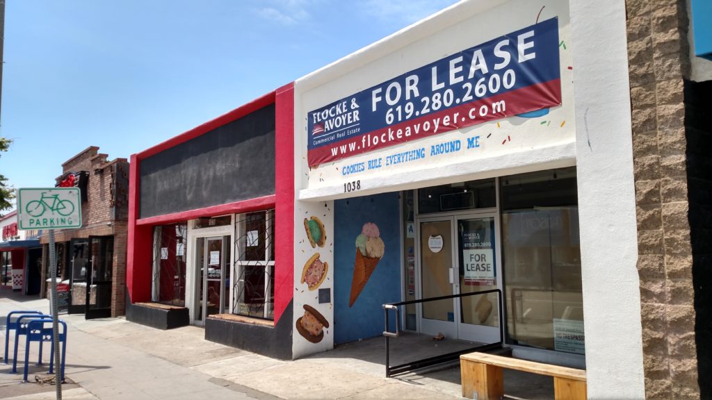
1038 Garnet Avenue, the Ten Thirty Eight Club in the 1940s, vacant in 2017

The storefront at 1038 Garnet is vacant today but as the Ten Thirty Eight Club (1947), Kay’s Club (1953), Jay’s Club (1971) and Stinger’s Tavern (1975-2001), it was the forerunner of the bars that now line Garnet Avenue, particularly on this block. The Ten Thirty Eight Club moved a few doors down to 1060 Garnet in 1953 and went on to become the Gay ‘90s Tavern (1957), Green Door (1963), Two Jays (1972), Maynard’s (1974), Cap’n B’s Old Place (1977), Plum Crazy (1988) and, since 2014, PB Avenue. And although alcohol is no longer served at 1038 Garnet, it is readily available at a pair of larger bars located on either side; Bub’s Dive Bar & Grill, at 1030 Garnet, was opened in 1999 in a former Barbecue Pit restaurant and Cabo Cantina, 1050 Garnet, replaced El Comal restaurant in 2006.

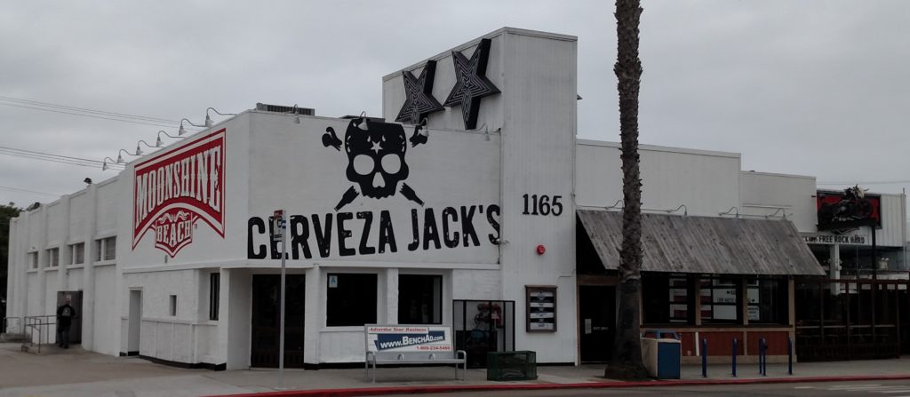
Moonshine Beach in the former Victory Lanes building, 2017

Morris Feldman’s establishment at 1159 Garnet was part of the Pacific Beach Amusement Center at the southwest corner of Garnet and Everts, which became the Victory Lanes bowling alley in 1948. In 1971 the building, with 6000 square feet of floor space, was transformed into a concert venue and dance hall called Earth, then, with the addition of a large pipe organ, Organ Power Pizza (1975) and the Spaghetti and Pizza Pavillion (1977). It has since been the Chicago Mining Company, Steamers, Moose McGillycuddy’s, Big Bertha’s, Typhoon Saloon, Cerveza Jack’s and is now Moonshine Beach, a country bar and live music venue. Diagonally across Garnet and Everts, The Tavern at the Beach, at 1200 Garnet since 1997, had been a television salesroom in the early 1950s but then became the Green Room (1955), Flamingo (1960s), Pink Phink (1970s and 1980s), and Daily Planet (1990s). A vacant storefront at 1152 Garnet was My Brother’s Place in 1968 and, from 1973 to 2013, the Tiki House, one of the last live rock and roll venues in PB.

1152 Garnet was the Tiki House until 2013

Sections of Garnet Avenue closer to the beach also have a history of ‘alcohol-serving establishments’. The 1952 city directory listed Bert’s Place, beer, at 714 Garnet Avenue, in the short block between Crystal Pier and Mission Boulevard. The following year the Elbow Room joined Bert’s at 710 Garnet, and remained in business until the mid 1980s, when it was replaced by Mary’s Hang Up (1986), Bangers by the Pier (1988), Blind Melons (1990) and, since 2008, 710 Beach Club. Meanwhile, Bert’s Place became John’s Place (1957), Monkey Inn (1964), and Casey’s Pub (1978) and since 1994, a sportswear shop, Ananas. Maynard’s Tavern, at 701 Garnet, the corner of Garnet Avenue and Ocean Boulevard, was popular during the 1960s and 1970s, but that corner has since been redeveloped into a condominium block.

Between Mission and Cass, 832 Garnet Avenue, originally the real estate office of Earl Taylor, the promoter behind the ‘new’ Pacific Beach business district, was repurposed as CK’s Cocktail Lounge in the early 1980s. In 1985 it became the first Improv comedy club franchise. In 1995, after Improv closed, Moondoggies expanded to 832 Garnet from its original location on Everts Street just south of Garnet (which then became The Dog). The new Moondoggies on Garnet was itself taken over and reopened as the Backyard Kitchen & Tap in 2015 (and now claims to be the top Lyft and Uber destination in San Diego). One of the first buildings ever built on Garnet Avenue, a two-story residence dating from 1913, once stood next door to the Backyard, at 860 Garnet. In 1965 it was purchased by Albert Jones and converted into Aljones Mexican Restaurant, which became Diego’s Café y Cantina in 1981 and Pacific Beach Bar & Grill and Tremors dance club in 1994. PB Bar & Grill closed in 2015 for extensive remodeling, which included removing the historic building, and has yet to reopen (2018 update; it is now open as Mavericks Beach Club). Once a Woolworth’s store, the building at 945 Garnet was Mom’s Saloon in the 1970s, Mannikin in the 1980s, Emerald City in the 1990s, then, in 1998, Plan B, a disco club. It is now Johnny V, a nightclub with two dance floors. A few doors down the street, the ‘cozy hangout’ Crushed opened at 967 Garnet, a former pizza restaurant, in 2014.

Cass St. Bar & Grill

Although Garnet Avenue is generally considered the epicenter of the PB bar scene, the two other arteries of the original PB business district, Cass Street and Mission Boulevard, also have their fair share. Historically, the 1950 city directory listed a pair of ‘liquors’ on Cass a block north of Garnet; Mayers Liquors, on the west side of the street at 4612 Cass (then next door to the Roxy Theater) and Fay Shockley Liquors, across the street at 4629 Cass. 4612 Cass went on to become the Circus Room from 1952 to 1974, then the Tender Trap, Z & Me Bar & Grill and Eddies Bar & Grill, and, since 1986, the Cass St. Bar & Grill. The building at 4629 Cass housed the Kokomo Club from 1952 to the early 1980s.

4629 Cass, now a shipping center, was the Kokomo Club from the 1950s to the 1980s

On Mission Boulevard, Tony Criscola’s liquor store, still in business at 4641 Mission, was listed in the 1950 city directory. Across the street at 4614 Mission, Swede’s Inn had opened by 1952 and continued in operation as the Seaside Inn from 1953 until the 1970s, although it has since become a sandwich shop. 4302 Mission Boulevard was the Encore Room in 1955, then the Club Lido in 1957, Jose Murphy’s Irish Pub in the 1970s and 1980s and has been The Open Bar since 1994. 4656 Mission was the Quiet Village Tavern in the 1960s, then a restaurant until 2005 when it opened as Daddio’s Superior Bar & Grill. Since 2010 it has been Dirty Birds. 4633 Mission Boulevard was the Breeze Inn Tavern (1964), Towne Pump Tavern (1970) and Matador (1975-1999), and since 2000 has been Thrusters Lounge. The Duck Dive at 4650 Mission was Tug’s Tavern in 1970s and early 1980s, then Hennessey’s Bar until 2012.

Thrusters Lounge at 4633 Mission Boulevard in 2017

Not all of PB’s alcohol-serving establishments have historic roots. Craft beer did not even exist until the 1980s and Pacific Beach AleHouse, a craft brewery at 721 Grand Avenue, San Diego TapRoom, with 50 different beers on tap at 1269 Garnet and Barrel Republic, at 1261 Garnet, with craft beer at self-service taps, have all opened within the last ten years. Open-air beach bars like Pacific Beach Shore Club, at the ‘intersection of Grand and the Sand’, Lahaina Beach Club at the foot of Oliver and Baja Beach Café at the foot of Thomas go back over thirty years. But bars, cocktail lounges and other sources of intoxicating liquors have existed on the major streets of the historic Pacific Beach business center for more than 60 years.

Sidewalking Pacific Beach

The original 1887 subdivision map divided Pacific Beach into residential blocks separated by streets that were all 80 feet wide except for Broadway (now Ingraham Street), which was 100 feet, and Grand Avenue, which was 125 feet wide and included the right-of-way of the railway to downtown San Diego. The streets were set aside for public use and became city property, but were not initially developed or improved other than what was necessary to lay the railroad tracks on Grand Avenue. At the end of the nineteenth century Pacific Beach was primarily a lemon ranching area and the few residents got around on foot or horseback or in horse-drawn conveyances that didn’t require prepared roadways.

All of that began to change at the beginning of the twentieth century with the arrival of the Folsom brothers, Murtrie and Wilbur, and their brother-in-law A. J. Dula. In 1902 Dula and a partner purchased a tract of land south of what is now Pacific Beach Drive, subdivided it as Fortuna Park, and commissioned Folsom Bros. Co. to sell the lots. In 1903 Folsom Bros. also purchased most of the Pacific Beach subdivision, over 600 acres consisting of around 100 blocks and 4000 lots. To market this huge inventory of lots Folsom Bros. initiated a campaign to transform the semi-rural area into a residential community through a program of development and improvement. A full-page ad in the Sunday San Diego Union in December 1903 announced that ‘Our Actual Work of Development in Pacific Beach has Begun’ and featured a drawing showing workmen with horse-drawn equipment and steamrollers working on streets along with the explanation that ‘the activity displayed in the foregoing cut represents actual conditions which will be found there within two months’. One month later, in January 1904, the Union noted a great advance in the work of building and development by Folsom Bros., including a large force of men kept constantly employed in the work of street improvement.

Street improvement in the first years of the twentieth century began with grading; the city established the grade, or elevation, of intersections and gangs of men and teams of horses moved and smoothed dirt to make the surface of the streets align with the city grades. Street improvement was the responsibility of adjoining property owners and as owners of most of Pacific Beach Folsom Bros. Co. graded the streets at their own expense. They brought in a new road grader from San Francisco which proved itself to be ‘splendidly adapted for doing the work required with skill and rapidity’.

Although some graded streets were then sprinkled with crude oil to consolidate the surface and reduce dust and mud, paving streets with solid surfaces like concrete was still years in the future. What could be paved with concrete in the early 1900s were sidewalks, and in February 1904 Folsom Bros. also petitioned the common council to approve their design for sidewalks on the streets of Pacific Beach and Fortuna Park. Their petition proposed that for streets 80 feet wide or wider (the standard in Pacific Beach), 20 feet on each side be left as sidewalk space. For 75-foot-wide streets (the standard in Fortuna Park), 17 feet on each side should be left for sidewalk space. The Folsom Bros.’ petition was granted and an ordinance requiring the 20- or 17-foot sidewalk space was passed in March 1904. The ordinance also specified that when these sidewalks were paved the pavement would be 5’ 4” wide and located 4 feet from the property line and 10’ 8” from the curb on 80-foot streets, or 7’ 8” on 75-foot streets (leaving 40 and 41 feet, respectively, for the actual roadway).

Actual work on sidewalks in Pacific Beach did not begin immediately, however. In April 1904 Folsom Bros. Co. acquired the former San Diego College of Letters and most of the company’s development and improvement efforts were diverted to converting its buildings and grounds into a ‘first class resort’, the Hotel Balboa. Work on the streets resumed in 1906 when Folsom Bros. received city permission to grade the perimeter of the Hotel Balboa property; Garnet Avenue and Jewell, Emerald and Lamont streets. In February 1907 the council also granted a petition to grade Grand Avenue between Lamont and Izard streets, and Lamont and Kendall streets between Grand and Garnet avenues (Broadway, now Ingraham Street, was officially named Izard Street between 1900 and 1907). A Folsom Bros. ad in the Evening Tribune predicted that this street and sidewalk grading, to be followed by thorough oiling, cement sidewalking and curbing, would double and quadruple values in many sections of Pacific Beach (but that until development work was a little further along fine lots could still be had for from $150 to $350 each upon very easy payments).

Laying of cement sidewalks and curbs began at Pacific Beach on April 28, 1907, according to Folsom Bros. Co.’s ad in that evening’s Tribune. The contract for about a mile of concrete sidewalking and curbing had been awarded to Frank J. Over and that ‘from now on the work will proceed rapidly’. Pacific Beach had ‘passed the speculative stage’ and ‘with the making of this class of permanent and high-grade improvements, becomes daily a better and better place for safe and profitable investment’. An ad in May noted that street grading, cement sidewalking and curbing were going on and would continue until Pacific Beach had the finest streets and sidewalks in San Diego.

‘Many Sidewalks Now Being Laid – Large force at work improving streets at Pacific Beach’ was the headline of a San Diego Union article in August 1907. Cement sidewalks had been completed on Lamont and Kendall streets between Grand and Garnet avenues and on Grand from Lamont to Jewell Street. It was planned to continue sidewalking on Kendall from Grand to Reed Avenue and later extend it south to Mission Bay. Other streets to be sidewalked would include Jewell from Garnet to Emerald, Emerald from Jewell to Lamont, Lamont from Emerald to Garnet, Garnet from Lamont to Jewell and Hornblend from Jewell to Lamont; thus including ‘everything in the central portion of Pacific Beach north of Grand Avenue, which is really the center of the suburb, and the point to which business will naturally gravitate’. The Union article concluded that it was the plan of Folsom Bros. company and the residents of Pacific Beach to attain the highest possible standard of improvement in this center, and then work from this in all directions, as from the hub of a wheel.

A few weeks later the Union reported that development work at Pacific Beach had been steadily increasing for the past few weeks until quite an army of men were employed in the various enterprises. The cement sidewalking and curbing commenced three months ago and carried on ever since by Folsom Bros. Company at its own expense was now being continued by other owners by order of the city. Frank Over’s crews were working westward upon Grand Avenue and rapidly extending the sidewalks and curbs toward the ocean front. Sixteen thousand feet of cement sidewalk and nearly 500 feet of curbing had already been laid, and enough more was under way to make a total of 30,000 feet of sidewalk and 7000 feet of curbing (presumably the sidewalk numbers represented square feet, where 16,000 would be about 3000 linear feet, or 6 blocks). Over two miles of streets had been graded to full city grade and awaited their oiling. The Union added that three years previously a city ordinance established the sidewalk width for Pacific Beach streets at 20 feet, with a fine 10-foot parking strip between the curb and the cement walks; ‘As these streets are graded, sidewalked and curbed, and the parking strips planted to palms and lawns, their beauty appears’.

Sidewalking central Pacific Beach continued into 1908. In May the common council determined that sidewalks and curbs should be constructed on Hornblend Street from Jewell to Morrell streets, and that owners of property fronting on said street between said points who desired to construct sidewalks and curbs thereon by private contract must complete the work before September 7, 1908. Frank Over’s crews had apparently failed to complete their work on Grand Avenue so in July 1908 the common council adopted a resolution ordering the work of sidewalking and curbing Grand Avenue between Lamont Street and Broadway, including both sides of all intersections of streets between said points, excepting where already sidewalked or curbed with concrete. Apparently no acceptable bids were received and in September the council granted a petition from C. M. Doty, a Pacific Beach resident and cement contractor, to have the city clerk re-advertise for this work. This time Doty came in as the lowest responsible bidder and was awarded the contract to sidewalk and curb Grand Avenue in October 1908. Today pedestrians on Grand Avenue can still see ‘Doty & Mitchell Contractors 11/08’ stamped in the concrete sidewalks which, like the others in this former ‘center of the suburb’, are 5’ 4” wide, 10’ 8” from the street, and scored with the three-wide ‘sidewalk squares’ characteristic of the early 1900s.

Doty & Mitchell’s work on Grand Avenue turned out to be the last street improvement in the central part of Pacific Beach for many years. The new concrete sidewalks and curbs marked its transition from lemon ranch to residential blocks but did not generate the lot sales and increased property values that would justify continuing development into neighboring areas. Garnet Avenue and Cass Street, then sections of the coast highway between San Diego and the north, were paved with concrete in 1919. Diamond, Lamont, Ingraham, Allison (Mission Boulevard) and the streets in new subdivisions like North Shore Highlands and Pacific Pines followed in the 1920s, but most streets and sidewalks in Pacific Beach remained unpaved until the late 1940s and 1950s.


Postscript:

Sidewalks in the old central section of Pacific Beach are in the news again in 2017. Former San Diego Mayor Roger Hedgecock and his wife Cynthia are suing the city over a fall she took on a sidewalk that allegedly ruptured her silicone breast implants. Apparently a tree root had lifted a section of the sidewalk on Morrell Street near Grand Avenue about 2 ½ inches and Mrs. Hedgecock suffered serious injuries when she tripped over the raised portion, ‘flew forward and came crashing to the ground’ in 2015. For his part, Mr. Hedgecock suffered ‘loss of support, service, love, companionship, society, affection, relations and solace’ from his wife. He had been mayor of San Diego from 1983 to 1985, when he was forced to resign over a campaign finance scandal. The sidewalk in question had been paved in the mid-1950s.

Electric Line to the Beaches

When Pacific Beach was founded in 1887 its founders also built a railroad to connect the new community with downtown San Diego. The San Diego, Old Town and Pacific Beach Railway ran between the site of the current Santa Fe station on Broadway and a depot near the foot of Grand Avenue in Pacific Beach, following a route east of Mission Bay and around the race track at the northeast corner of the bay, then along today’s Garnet, Balboa and Grand Avenues to the beach. In 1894 the railroad was extended to La Jolla along what are now Mission Boulevard, La Jolla Hermosa Drive, Electric Avenue and Cuvier Street to a station on Prospect Street. The Pacific Beach and La Jolla railroads became the Los Angeles & San Diego Beach Railroad in 1906 (although the tracks never advanced beyond La Jolla). In 1907, after the race track in Pacific Beach had closed, the line was shortened by cutting through the former race course over what is now Grand Avenue from Mission Bay Drive to Lamont Street.

The trains to Pacific Beach and La Jolla consisted of one or more coaches and a mixed baggage car pulled by small steam locomotives, although between 1907 and 1914 some of the daily trips were made by McKeen gasoline-powered rail cars. In the days before paved roads and the automobile, these trains were the only practical way to travel to and from San Diego. However, after the turn of the twentieth century automobiles became increasingly popular and the roads were improved, giving north coast residents another travel option. In 1919, claiming that receipts from operations were insufficient to meet operating expenses and interest, the LA & SD Beach Railway received permission to discontinue service and dismantle its tracks. Although civic organizations in San Diego, Pacific Beach and La Jolla opposed its closure, none were able to offer an alternative and the railroad was scrapped.

Efforts began almost immediately to re-establish a rail link between San Diego and its northern suburbs. In 1915 a bridge had been built across the entrance to Mission Bay and an electric railway line called the Bay Shore Railroad built from Ocean Beach over the bridge and through Mission Beach as far as Redondo Court. The Bay Shore Railroad connected with the Point Loma Railroad, an electric street railway which ran between downtown San Diego and Ocean Beach. In January 1919 a group calling itself the La Jolla Electric Line proposed laying 2100 feet of new track to extend the Mission Beach line to Grand Avenue in Pacific Beach, from where it could continue to La Jolla over the former LA & SD Beach right-of-way. These new sections would then be electrified, completing an electric railroad all the way from San Diego to La Jolla.

The La Jolla electric company’s proposal of 1919 was never implemented but the concept of an electric railroad between San Diego and La Jolla via Mission Beach was adopted a few years later by the San Diego Electric Railway Company, operator of San Diego’s extensive street railway system and part of the Spreckels commercial empire.  In March 1923, the SDER and the Mission Beach Company jointly announced what was called the greatest single development project since the preparations for the Panama-California Exposition in Balboa Park; a project to make Mission Beach the finest and highest class beach resort in America – an all-year resort open and operating 12 months in the year. This project would include express electric railway service to and from San Diego, much of it double tracked and largely on private right-of-way. The San Diego common council awarded the SDER a franchise to build the proposed Mission Beach line in April 1923.

The SDER planned to lay tracks on Kettner Boulevard and Hancock Street from Broadway to Witherby Street, along the right-of-way of the former LA & SD Beach line. The tracks would then cross over the Santa Fe railway and the paved Point Loma highway and continue to Ocean Beach on a new route across the mud flats and marshes that are now the Midway district. From Ocean Beach the new line would continue to Mission Beach over the Bay Shore Railroad, which the SDER planned to purchase and absorb.

The SDER plan did not initially propose extending the line beyond Mission Beach, but in May over 700 La Jolla residents signed a petition asking the common council for an extension of the route to their community. At the time the SDER was pressing the city to extend its franchise for 50 years, and it offered to build to La Jolla if the extension was granted. A 50-year franchise covering the SDER’s entire system, including the route to La Jolla, was approved by the council in September 1923.

Construction of the new electric line began in October 1923. The Evening Tribune announced that ‘dirt was flying’ on Kettner Boulevard for the biggest electric railway construction job in the history of San Diego, the double-track speed line to Mission Beach. The Tribune article noted that the project would include extension to La Jolla and construction of a great amusement center in Mission Beach. The new line would have the catenary type overhead wire for pantograph collectors that are specially designated for high speed operation. There would be no grade crossings; a long trestle would bridge the Santa Fe tracks and the Point Loma highway crossing in the Five Points area, and on the La Jolla segment the track would run under the coast highway on Turquoise Street.

Several thousand tons of steel rails began arriving from ‘famous Belgian mills near Liege’ in November, and in December 1923 the SDER began receiving 50 new streetcars specifically designed for the high speeds and flexible operations of the new route, with pantograph collectors and control systems that allowed the new cars to operate individually or in trains which could be coupled and uncoupled rapidly en route. By the end of February 1924 the tracks had reached Turquoise Street in Pacific Beach and a group of city officials, railroad men and business men made a preliminary round trip over the line. Reporters for the local papers who accompanied the dignitaries wrote that there were cheers from every side, hands and handkerchiefs were waved, and cameras clicked as the train rolled through, running as smoothly as a Pullman coach. Claus Spreckels, general manager of the SDER, announced that the line would be in full operation as far as Mission Beach on May 1 and on to La Jolla by July 1.

The new express line was opened as far as Ocean Beach (with a temporary shuttle to Mission Beach) on May 1, 1924 and through service to Mission Beach, Pacific Beach and La Jolla began on July 1. The planned viaduct over the Santa Fe tracks and the Point Loma highway had not yet been built so the new line at first used the Point Loma Railroad’s grade crossing to a point near the Marine base on Barnett Avenue. From there the route crossed open country on a private right-of-way that has since become Sports Arena Boulevard. At Midway Drive, the tracks continued on an elevated causeway through salt marshes along what is now West Point Loma Boulevard but was then the southern shore of Mission Bay. Beyond Famosa Slough the causeway continued directly to Ocean Beach Junction, about where West Point Loma Boulevard now meets Bacon Street. The causeway included bridges to allow circulation of water to the sloughs and wetlands to its south, and the remains of one of these bridges, over Famosa Slough, can still be seen. At Ocean Beach Junction the line split, one branch following the former Point Loma Railroad route into Ocean Beach and the other the Bay Shore Railroad route over the bridge to Mission Beach.

Former San Diego Electric Railway bridge over Famosa Slough (2011).

In Mission Beach, the line was built on an elevated strip down the middle of Mission Boulevard, separated from automobile traffic on either side by curbs. The route continued through Pacific Beach on Allison Street, which in 1924 was mostly vacant land; development of the ‘new’ Pacific Beach along the coast, due in part to the arrival of the fast electric line, had not yet begun (Allison Street was ‘opened’ and paved between Pacific Avenue, now PB Drive, and Turquoise Street in 1928, and in 1929 was renamed, becoming the northern extension of Mission Boulevard).  At Beryl Street the route curved westward from Allison onto what is now La Jolla Boulevard, where a large concrete culvert was built in Tourmaline Canyon and covered with dirt fill to provide a crossing for the tracks. Turquoise Street at the time was part of the coast highway, paved in 1920, which passed through Pacific Beach on Garnet Avenue and Cass Street and continued to La Jolla and beyond on La Jolla Boulevard. To prevent the disruption and danger of crossing this highway at grade, the SDER constructed a steel viaduct over Turquoise Street. The railway continued on what was then called Electric Avenue and is now La Jolla Hermosa Avenue, following the route of the LA & SD Beach Railway. At Via Del Norte in La Jolla the new line diverged from the old route (which had continued on Electric Avenue and Cuvier Street) onto a private right-of-way that is now the La Jolla Bike Path, and which required a number of cuts to improve the grade. From the end of the private right-of-way near La Jolla High School the line ran on Fay Street to its terminus on Prospect.

La Jolla Methodist Church, originally San Carlos station of San Diego Electric Railway, La Jolla Hermosa (2011).

Elaborate stations in La Jolla (at Prospect Street and Fay Avenue) and La Jolla Hermosa (at Mira Monte) were finished in 1925. The station at La Jolla Hermosa, which also doubled as a power substation and was designed as a replica of the San Carlos mission at Monterey, is still standing and for many years has been the La Jolla Methodist Church. The three-level viaduct over the Santa Fe tracks and highway to Point Loma was completed early in 1925. With this structure the Santa Fe tracks remained at their original grade, an undercrossing was excavated under the tracks for the highway and a viaduct built to take the electric line over both. The excavation for the highway put the roadway below sea level, and pumps were installed to keep it clear of seepage and runoff. The viaduct, which lifted the electric railway over the tracks of the mainline railway, was 2000 feet long and included 900 feet of embankment, 940 feet of frame trestles and 160 feet of steel girders, supported by massive concrete piers. Witherby Street still passes under the railroad tracks in this same undercrossing, and the base of the concrete piers which supported the viaduct carrying the electric railway over the railroad and Witherby Street can still be seen just to the west of the railroad bridge.

Base of piers of the former SDER viaduct over Witherby Street (2011)

The Mission Beach amusement center opened with great fanfare on May 29, 1925. The station there included a subway under the tracks and Mission Boulevard, protecting passengers from vehicle traffic. At the same time the SDER opened the second track of its double-track route through Mission Beach and, with the completion of the viaducts over the Santa Fe at Witherby Street and the coast highway at Turquoise Street, introduced a new timetable establishing the running time from San Diego to La Jolla at 36 minutes.

The new electric line actually served three routes; No. 14 to Ocean Beach, No. 15 to Mission Beach, and No. 16 to La Jolla, all of which used the same tracks between San Diego and Ocean Beach Junction. Trains which could consist of one or more cars from each of the routes left the Plaza in downtown San Diego under the control of one operator. When they reached Ocean Beach Junction the No. 14 car or cars would be uncoupled and continue on to Ocean Beach with its own operator. The other cars proceeded to Mission Beach where the No. 15 cars (if any) would be dropped off and the No. 16 continue on to La Jolla (the No. 15 route was only used for occasional holiday travel to the Mission Beach amusement park). The coupling mechanism was designed so that the cars could be detached while the train was in motion.

The new fast electric line had been designed to use catenary overhead wires and pantograph collectors instead of the trolley wire and trolley poles that were standard at the time. Catenary wires, like those currently in use on the San Diego Trolley, utilize two wires, the upper one arching between supports and the lower one suspended from the upper one and stretched tight, making it straight and level. Pantograph collectors, frameworks mounted on top of the cars that pressed up against the wire to collect electric current, were thought to be necessary for high-speed operation since trolley poles might bounce out of contact with the wire. However, the pantographs proved to be unsatisfactory; they were of light construction and sometimes collapsed, and tended to damage the overhead wires, especially at switches. They were replaced by trolley poles, which did function adequately with the catenary overhead wires and also allowed the cars to operate on other routes with standard trolley wires.

After the completion of the fast electric line, real estate promoters along its path began emphasizing its benefits to their communities. The developers of Bird Rock, for example, noted that San Diego’s fastest electric line ran through the heart of their beautiful, high, sightly property lying between the hills and the sea, putting it in the ‘path of development’. In Pacific Beach, where development had previously been centered around Lamont Street and the college campus property (then the San Diego Army and Navy Academy, now Pacific Plaza), the promoters of the ‘new’ Pacific Beach around the foot of Garnet Avenue noted that construction of the SDER’s superb fast beach carline swung the business and pleasure sections of Pacific Beach down to the ocean front where they belong, and justified a change of name to ‘San Diego Beach’. Earl Taylor, one of the developers of ‘new’ Pacific Beach, quoted a Saturday Evening Post article that said ‘Wherever electric lines lead out from the city, you find suburban property values enhanced, suburban life made comfortable, and waste land blossoming into homes. The automobile helps. The motor bus helps more. But the trolley and interurban cars are more important still’.

The SDER’s franchise allowed it to haul freight, and in 1925 the Standard Oil Company built a storage yard in the Bird Rock area to be supplied by tank cars delivered by rail. Gaps where a rail spur leading to this storage plant cut through a sidewalk on La Jolla Hermosa Avenue near Forward Street can still be seen. By 1934 the Standard Oil plant was the SDER’s only freight customer and when Standard Oil acquired a fleet of trucks for its oil deliveries SDER received permission to discontinued freight service.

Spur to Standard Oil siding off San Diego Electric Railway line in Bird Rock.

Although parts of the electric railroad were double-tracked, much of it, including the private rights-of-way in La Jolla and in the Midway area, was not, and relied on block signals to prevent collisions between trains traveling in opposite directions. On November 22, 1937, the signals in the Midway area apparently failed and cars traveling to and from Ocean Beach on the single track collided head-on. Visibility had been reduced by heavy fog and the operators failed to see the other car and apply the brakes until seconds before the crash. One car penetrated eight feet into the other and 31 passengers were injured, some seriously. A downed trolley wire added to the danger until the company turned power off on the line.

Whether or not it was the electric railway that caused waste land to blossom into homes, the population in the beach areas served by the electric line did increase throughout the 1930s. Automobile ownership also continued to grow and streets became more congested. In some areas where the streetcars and automobiles shared the road, the traffic forced the high-speed line to operate at slower speeds, impacting service. Also, the growing number of motorists led to increased complaints that the tracks were obstructing vehicle traffic, particularly in Mission Beach, where the line was elevated and isolated from the paved boulevard, leaving little room to drive. Improvement of the roads had also caused the SDER to begin using buses on some routes, including one to La Jolla. The No. 14 streetcar line to Ocean Beach was replaced by buses in 1938 and in January 1940 the SDER company received permission from the city to discontinue service of the No. 16 car line between downtown and its terminus in La Jolla. The SDER was required to remove tracks, wires and overhead structures but, in consideration of the valuable rights-of-way to be conveyed to the city and its substitution of bus service in place of the electric railway service, the SDER was not required to remove its tracks from paved streets. Tracks remained imbedded in the pavement of Fay Avenue in La Jolla into the 1960s and even now potholes can reveal rusted rails beneath the surface of Mission Boulevard.

The last No. 16 train left La Jolla on September 16, 1940; according to longtime passenger and Mission Beach resident Zelma Bays Locker, the motorman on this last run rang his bell all the way into town. In Mission Beach the tracks were removed and Mission Boulevard repaved in 1941, leaving only a 4-foot median where the double-tracked electric railway had once run. According to the San Diego Union, the ‘traffic-clogged two-lane highway’ had become a ‘broad 4-lane arterial which easily is accommodating the heavy beach-area traffic flow’.

The beach-area traffic flow has only become heavier over the ensuing 75 years, and not so easily accommodated, and an electric railway between San Diego and La Jolla is once again under development. The Mid-Coast Trolley is expected to open in 2021, extending San Diego’s modern ‘light rail’ system to the University Town Center shopping mall via the University of California, San Diego campus in La Jolla. Between Old Town and UCSD the new line will follow the route of the Pacific Highway, east of Mission Bay and through Rose Canyon. The station serving Pacific Beach is to be located near Garnet Avenue and Morena Boulevard, east of the I-5 freeway and not far from the old race track site, but on the opposite side of town from where the electric Beach Line ran in the 1920s and 1930s. It will be interesting to see what effect a superb new light rail line will have on the business and pleasure centers of Pacific Beach this time around.

Ye Olde Mission Inn

Club house, soon to be Ye Olde Mission Inn, and grand stand of the Pacific Beach Driving Park about 1906 (San Diego History Center #344)

In July 1887 a group of sporting men formed the Southern California Breeders Association and purchased Pueblo Lot 1797, a half-mile square below today’s Garnet Avenue through which Rose Creek flowed toward Mission Bay. The Breeders Association planned to build a race track at the site with stables, a grand stand and a clubhouse. These would actually be the first improvements in the area north of Mission Bay that was soon to become Pacific Beach.

The grandstand was completed by November 1887, in time for a baseball game between the National League’s Philadelphia team and a group of local amateurs, which the Phillies won 31 – 7. The Pacific Beach Driving Park was opened for racing on May 1, 1888, by which time the clubhouse, a three-story building of 22 rooms, had also been completed. Later, in October 1888, nearly 7,000 people crowded the track to watch the noted swordswoman Jaguarina defeat Captain Wiedemann in an exhibition of mounted sword combat.

However, the race track’s location at the mouth of Rose Creek made it vulnerable to flooding during winter storms. The San Diego Union reported that the Pacific Beach race track was demolished by a stream that came down Rose’s Canyon during one storm in December 1889. Other storms in March 1893 and January 1895 compounded the damage to the race course and racing never recovered, although the grand stand was still used for crowd-pleasing events like rodeos, balloon ascents and parachute drops.

In May 1903 the rumor spread that the track had been purchased by A. G. Spalding, the sporting goods magnate and former major league pitcher, who was then a resident of Point Loma. Although the rumor turned out to be false, or at least premature, the renewed interest in the track prompted its then-owner Col. A. G. Gassen to initiate a program of improvements. Gassen also formed the Belmont Breeders Association and brought a number of thoroughbred horses to the stables at the track. Spalding did take over the Belmont Breeders Association in September 1903 and renamed it the American Saddle-Horse Breeding Farm. The track itself became known as American Park. However, Spalding’s ownership was also brief and in November 1904 Pueblo Lot 1797 was acquired by U. S. Grant, Jr., son of the civil war general and former president. Grant sold it to the Mission Bay Park Company in November 1906 and the property was included in the Mission Bay Park subdivision in 1907.

Although the race track had been abandoned, the grand stand, club house and a judges’ stand remained standing and in March 1907 the lots where these buildings stood, about where Figueroa Boulevard and Magnolia Avenue intersected on the Mission Bay Park subdivision map, was purchased by Ye Olde Mission Inn Company, a corporation set up in February 1907 by James H. Babcock and others. Babcock reputedly had an extensive background in the hospitality business. According to the San Diego Union, his first success was as proprietor of the Hotel Bartholdi in New York and he later conducted the Lick café and restaurant in San Francisco, then delighted the palates of the Alaska miners with his St. Nicholas restaurant at Nome. After winning a fortune in the gold mines, he returned to San Francisco and inaugurated the celebrated Bab’s café, which the Union called the most noted restaurant on the coast. Somewhere along the line he was also said to have been proprietor of one of the most famous resorts in Denver. Bab’s, in San Francisco, was a ‘Bohemian’ café, ‘divided into little rooms made to represent prison cells, undertaking establishments, mausoleums and other strange places. Coffins were used for tables and skulls for drinking cups’. Bab’s was destroyed in the San Francisco earthquake and fire of April 1906 but Babcock himself made a ‘sensational escape’ from the ruined city. He turned up in San Diego where he purchased Ye Olde Mission Inn at American Park and was ‘fitting everything up in modern elegance’.

Bad fortune had apparently followed him to San Diego, however, and in February 1908 the Mission Inn, a ‘picturesque country resort’, narrowly escaped destruction when a shed at the rear of the hotel used as a carpenter shop caught fire. Although the shed was a total loss, volunteers using a garden hose and bucket brigade prevented the flames from jumping across to an adjacent building formerly used as a judges’ stand. The Union reported that had the fire reached the judges’ stand nothing could have saved the nearby hotel building, formerly the race track’s club house. Among the volunteers fighting the fire was A. B. Cairnes, the first chief of the San Diego fire department, who had retired in 1905 and built a home on a prominent rise overlooking the race track. Chief Cairnes presumably saw the smoke and flames and reacted instinctively by rushing to the fire.

In September 1908 Babcock announced a renovation and improvement of the property that would ‘eclipse’ any country club house in the west, but instead the Mission Inn was completely destroyed by a second fire in November 1908. The Evening Tribune reported ‘only a heap of smoldering ruins where last night there was a pretty and substantial structure’ and the Union added that there was little left to remind one of the ‘old days’. The building was valued at $15,000 and insured for $7000.

Ye Olde Mission Inn Company continued to own the property and in 1910 Babcock proposed building a new club house on the site with 15 sleeping rooms, a large dining hall and a grill, for the use of members of the Pacific Coast Automobile & Driving Club. Membership in the club, of which Babcock was the ‘leading spirit’, would be limited and a membership certificate would cost $25. Every courtesy would be extended to women in the families of members; they would be allowed the privileges of the club at all times and even permitted to invite their women friends as guests. However, although automobiles were beginning to travel along the boulevard connecting Los Angeles and San Diego, which at the time passed through Pacific Beach on what is now Garnet Avenue, the Automobile & Driving club’s club house was never built and the property was auctioned at the courthouse door in February 1912. In 1947 a motel was built on the site to accommodate motorists passing by on the Pacific Highway, U.S. 101. The Rancho 101 Motel incorporated the last remaining structure from the race track, the three-story judges’ stand.

After abandoning the Mission Inn venture James Babcock tried his hand at the hospitality business in downtown San Diego. In November 1911 he was one of the incorporators of the Cecil Hotel Company which leased a new six-story building on Sixth Street between B and C, said to be the first steel frame structure in San Diego. The Union reported that the deal was made through the Babcock Investment Company, whose president James H. Babcock became secretary of the hotel company and whose reputation as a restauranteur guaranteed the success of the new venture from the culinary and epicurean point of view; ‘No man on the Pacific coast commands a higher reputation in this line’.

Babcock became proprietor of the grill in the Hotel Cecil building and also opened a beer garden in an adjoining space; a November 1912 ad in the Union announced that Bab’s German Garden Restaurant, next door to the Cecil Hotel, was ‘quaint and cozy’. Under the personal supervision of James H. Babcock, the entertainment was high class – the chef and cuisine could not be excelled. Tourists and San Diegans were invited to inspect San Diego’s most popular restaurant, where refined ‘Bohemianism’ reigned. However, on December 31 the Evening Tribune reported that patrons of Bab’s German Garden would be robbed of the privilege of ushering in the New Year by frequent libations from the flowing bowl, for the flowing bowl was gone for good from Bab’s and from the emporium of its adjoining neighbor, the Hotel Cecil Grill. Apparently both places had allowed liquor to be served after midnight, without purchase of a bona fide meal, and as much as the patron desired, all apparently in violation of their licenses, which were thereby revoked. Conversations overheard between several chambermaids also indicated that morals at the Hotel Cecil were not all that could be desired (sensitivity about ‘morals’ was high at the time; a few weeks earlier a massive raid on the Stingaree red-light district had rounded up 138 women, all but two of whom had agreed to leave town rather than face further legal proceedings – although most purchased round-trip tickets).

In February 1913 the Tribune reported that the newly organized Olympic Athletic Club had secured quarters at 1140 Sixth Street, the place formerly occupied by Bab’s Restaurant, where it proposed to stage boxing bouts. In April the Union reported that attorneys for the First National Bank had resorted to supplementary proceedings in an effort to discover whether James H. Babcock, secretary of the Cecil Hotel Company, was possessed of funds or property sufficient to satisfy a judgement. No property, funds or things of value had been uncovered. And in July 1913, the Tribune noted that Nick Sargent, a well-known caterer, had returned to San Diego and bought the Hotel Cecil Grill on Sixth Street.

The People’s Ordinance

San Diego residents are often reminded that they have free municipal trash collection thanks to the People’s Ordinance, an amendment to the city charter approved by voters in 1919. What they may not know is that this entitlement, which has endured for nearly a century, was originally about who had the right to feed garbage to hogs.

Prior to the twentieth century disposal of household waste in San Diego was left up to the individual homeowner. Although some residents hired ‘scavengers’ to cart away their garbage, most disposed of it themselves by burning, burying, feeding it to chickens or other animals, or simply by discarding it in the street or on vacant lots. In 1898 Dr. P. C. Remondino, president of the board of health, reported that garbage collection and storage, ‘hitherto left to the volition and election of the householder’, had been ‘most defective and annoying as well as most decidedly unsanitary’. He added that he knew of many residents who were unable to properly ventilate their homes, ‘owing to the acrid and sickening emanations from decaying swill accumulating in their vicinity’. He recommended a system of municipal collection, whether done by the city or by contract under its supervision. In 1900, responding to complaints about the unsatisfactory manner of garbage disposal in the Ninth Ward, Dr. Remondino again stated that garbage would always be a matter of complaint until a system of free collection was inaugurated; ‘The poor man cannot afford the luxury of a garbage collector very often, and if he can conveniently dump it on his neighbor’s premises or on the street, he cannot be blamed. A public collection would remedy all that.’

The city health officer, Dr. T. C. Stockton, in his annual report to the board of health in 1900, also commented on the necessity of the city adopting some sanitary and more modern method for the collection and disposal of garbage, hoping that the ‘crude and offensive method in use would be superseded by one more in accordance with the requirements of modern sanitation’. In 1901 another member of the board of health, Dr. F. R. Burnham, was requested to make inquiry into the various systems in use for the collection and disposition of garbage in different cities in the east and to prepare a report on the ’most sanitary and best means of disposing of the garbage of this city’. He reported that there were three methods in common use in other cities; by private parties – each individual paying for the removal of his own garbage, by city contract, or by the city doing the work itself. The last two are paid for by general taxation and one or the other would undoubtedly be the best from a sanitary as well equable standpoint. However, it was the first system that was then employed in San Diego and the result was that less than three tons of garbage were carried away daily from a city of twenty thousand and that ‘the balance must be largely thrown into back lots or into the street’. He went on to describe the filthy and unsanitary condition of these streets and vacant lots; ‘Waste paper, tin cans, brush and weeds lining our streets and gathered together in unsightly piles on vacant lots gives our city, to say the least, a most untidy appearance’. In many of the eastern cities, he added, cast iron boxes with covers are placed on the corners of the streets neatly painted in plain letters; passers-by are requested to throw paper and all kinds of refuse into these boxes and not on the pavement.

Nothing was done to follow up on these early reports and a board of health meeting in 1903 was told that the manner of garbage collection was still often a matter of complaint. The subject had been brought to the attention of the board on other occasions and the board had suggested to the city council that garbage collection be taken away from the hands of private parties and managed by the city, but the garbage men rallied to defeat any interference. Finally, in 1908, the city passed an emergency ordinance which required it to enter into a 10-year contract with one company which would be responsible for collecting all city garbage. Anything not of commercial value to the contractor would be burned outside of the city limits. Collection was to be twice a week in outlying districts and daily in the ‘more thickly settled portions of the city’, particularly from hotels, restaurants, etc. The contractor would be responsible for providing an incinerator which the city would have the right to acquire after five years for a fair market value.

The contract for garbage collection and disposal was won by the San Diego Sanitary Reduction Company, which announced that it would make a specialty of manufacturing fertilizer and fuel from the refuse collected. The San Diego Union reported that an experiment of the secret process for deodorizing the garbage was a great success. A particularly offensive lot of garbage was mixed with the chemicals and within three minutes had become absolutely odorless. Not only that, but some of the fuel made from the garbage produced a significant improvement in the power of a steam boiler and burned like coal for 24 hours in a blacksmith’s forge.

However, San Diego Sanitary’s service was apparently unsatisfactory to a major segment of its customer base, San Diego’s hotels and restaurants. The restauranteurs had long complained about the ‘filthy manner’ in which the company had been taking care of their patrons and had responded by hiring other companies to dispose of their garbage. The courts ruled that this violated the Sanitary company’s contract and put an end to this practice, but conditions eventually became so bad that local eating house proprietors decided to take the law into their own hands. The Evening Tribune reported in 1910 that the restaurant men had banded together and purchased the assets of one of the former independent collectors put out of business by the court’s ruling, which included a hog ranch outside the city limits, with ‘wagons, horses, hogs and in fact everything owned by the man whose hogs were receiving the benefit of the collections’. They then hired their own drivers and carted away their own garbage. The Sanitary company objected and for a time attempted to have the drivers arrested, but after failing to win a restraining order it eventually abandoned its contract.

The garbage contract was assumed by San Diego Rubbish Company, which had an interest in a large hog ranch in Chollas Valley, where both San Diego and East San Diego, then a separate city, disposed of their garbage. In December 1915 the city and county health officers took steps to shut down this hog ranch, which housed as many as 5000 hogs, characterizing it as a public nuisance. The owners were arrested and a permanent injunction was asked to keep the defendants from feeding city garbage to the hogs. It was charged that the dumping of garbage there rendered an unwholesome, obnoxious stench that befouled the atmosphere for many blocks. However, before hearings in the suit began in February 1916 the epic floods of January 1916 (the Hatfield flood) had inundated and considerably damaged the hog ranch, and swept much of the offending material (and about 50 of the hogs) downstream and into the bay.

The Evening Tribune announced in April 1916 that the health department was enthusiastic about a new plan for the disposal of garbage. All garbage would be collected by an improved type of wagon and hauled to the incinerator premises. There the water would be extracted by a steam press and it would be reloaded on metal covered trucks and rushed out to the sterilizing plant at a new hog ranch, which would be located at the upper end of Tecolote Canyon. After thorough sterilization by boiling it would be fed to the hogs, which would be housed in a proper manner. Although the hog ranch would be within the city limits it was miles from any population centers and would not affect anyone owing to its remoteness. The health department would make frequent inspections to insure sanitary methods. The hog ranch in Tecolote Canyon was the new home of the San Diego Rubbish Co.’s hogs. The company announced in July 1916 that it had finished the removal of its hog ranch from Chollas Valley to a ‘more isolated part of the city, entirely off the public thoroughfare’. The company also said that it was cleaning up the incinerator and its grounds and that its garbage wagons would be newly painted and provided with new covers.

The city also began cracking down on violations of the laws regarding garbage. In October 1916 the city health officer launched a campaign against alleged ‘promiscuous’ collection of garbage. A special officer, J. J. Willow, who was also an employee of the San Diego Rubbish Co., was assigned to the city health board and began arresting drivers for hauling garbage outside of the authorized hours (11 P.M. to 5 A.M.). However, one of the garbage haulers he persisted in prosecuting was apparently a friend of a council member, and the council held a hearing to consider terminating his position. Willow instead resigned, but the ‘muddle over garbage conditions’ disclosed by his hearing led the city council to direct Police Chief Wilson to recommend a solution to the garbage problem. Chief Wilson’s recommendation was that enforcement of garbage regulations be placed in the hands of the health department, and that the garbage ordinance be amended to permit anyone owning garbage which can be used as food for animals to haul it at the time and in the manner allowed by the garbage ordinance after securing a permit to do such hauling. However, the board of health turned down Chief Wilson’s recommendations.

In March 1917 the public welfare commission took up the issue of municipal garbage collection. Stating that it was assured that they voiced the desire of a large majority of taxpayers and resident population for more sanitary, efficient and economic collection and disposal than the present contract provided, the commission recommended that the city create a municipal hog ranch under the supervision of the board of health and assign the collection and sale of garbage to the highest responsible bidder. The chairman of the health committee of the county federation of women’s clubs also petitioned the council for free municipal garbage collection. The board of health endorsed these recommendations for free garbage collection but again advised against the creation of a municipally owned hog ranch.

The United States entered World War I in April 1917 and among the patriotic calls to contribute to the war effort was the ‘doctrine of the clean plate’; conserving food by eliminating waste. In July 1917 the city of Coronado announced that its garbage business had fallen off 75 percent since the new ideas on food conservation became a recognized patriotic principle. Garbage was said to exist now only in the homes of the super-rich, the few middle-class residents having none excepting tin cans and bones which they bury in their vegetable lawns for fertilizer. In San Diego the mayor received a telegram from Herbert Hoover, then national food administrator, asking for information on the amount of garbage collected compared with the previous year, and also information on the amount of grease extracted from the garbage, which could be used for various war industries.

Despite food conservation there was still garbage to collect and the city’s contract with the San Diego Rubbish Co. for garbage collection was due to expire in October 1917. Although it was contrary to city ordinances, owners of hotels and restaurants had been allowed to haul their own garbage for some time, a result of their difficulty in making their establishments pay. Many of them had gone into the hog business and were taking their garbage to their own ranches. Some said that without this end of the restaurant business they would be forced to close.  However, commercial garbage collectors also sold the garbage they collected to hog ranches and without the business of the restaurants and hotels few would be expected to bid for a new contract. After ‘much discussion and wrangling’ over various propositions, the council decided in November 1917 to accept the offer of George A. Binney & Co. of Los Angeles to collect and dispose of all city garbage for the next three years. Binney would provide all the equipment and pay the city $400 per month while charging residents and businesses a fee and potentially profiting by raising hogs on the garbage collected. The hotels and restaurants which now disposed of their garbage to hog raisers would be prohibited from continuing that arrangement.

The hotel and restaurant owners determined to fight the new contract; according to the Evening Tribune ‘Old Man Garbage still is in the limelight. And he is going to be the subject of a lively “scrap” when the hotel and restaurant men mobilize their forces’. The fight was still going on in January 1918, when the Tribune reported that the council was in conference with attorneys representing the city, Binney & Co. and the hotel and restaurant men ‘regarding the never-ending subject of garbage disposal’. Binney asked the council to direct the police department and the health department to proceed against the hotel and restaurant men who refused to turn over their garbage to the contractors. However, when the police did arrest Joseph Vaubel, garbage hauler for the U. S. Grant Hotel, in February 1918, he was tried and found not guilty.

A month later, in March 1918, the police arrested Robert Brown, who was acting under orders of Harry Rudder, a local restaurant owner, on Binney’s complaint that Brown was collecting garbage without due authorization. Brown was released on $15 bail, which was provided by Rudder ‘in expectation of such a contingency’. The truck load of garbage which Brown was alleged to have collected from Rudder’s restaurant remained at the police station with Brown on guard and Binney, ‘ensconced in his automobile at the police station’, keeping an eye on the garbage. The police threatened to arrest Brown if he attempted to move his truck, but Rudder had also left an additional $45 at the jail to be used as bail money for Brown if he was arrested again. According to the San Diego Union, with Rudder ready to fight the case to a finish and with Brown and Binney standing guard over the truck of garbage at the police station, the situation was still deadlocked at 3 o’clock in the morning; ‘meanwhile the hungry hogs at the National City ranch clamor for food’.

With the city council ‘standing like a Rock of Gibraltar’ against the San Diego hotel and restaurant men who were fighting for the right to feed their own hogs table refuse from their establishments, ‘city hall was a scene of turmoil’. The restaurant men threatened to start injunction proceedings against the city, to increase the price of meals or to openly defy the law. In the meantime they said between 400 and 500 hogs owned by proprietors of their establishments were being allowed to starve to death and that they were prepared to go to any length to protect their rights. To illustrate the importance of the issue, one of the restaurant owners said that he had cleared $2100 in ten months from hogs fed on the table refuse from his establishment. Another declared that he had been offered $40 a month by a private individual for his garbage. All were indignant that they were required to give away their garbage and also required to pay for having it hauled away.

The city council held a closed door meeting with the mayor, the food administrator and a committee of the hotel and restaurant men’s association. Harry Rudder, who was now also chairman of the Commercial War League, claimed that young pigs were starving because the brood sows have nothing to eat except what they can forage since the city had prohibited the hauling of garbage by private parties. Alternative feed, such as bran, could no longer be fed stock because of the food administration’s order to conserve it for food. Because every bit of pork is needed in war time the lack of food for hogs and young pigs was an absolute waste. The Binney company countered that they also had hogs dependent on the garbage that they collected under their exclusive contract with the city, and refused to compromise on the issue. A ‘friendly’ court settlement proved to be impossible and in August 1918 Rudder filed suit to have the city permanently enjoined from enforcing the garbage ordinance which permitted the Binney company exclusively to take away the restaurant’s table scraps. He also asked for $1100 damages for the loss he had already sustained from his inability to feed scraps to hogs on his hog ranch. In October 1918 a superior court judge granted the injunction and also awarded Rudder $440 in damages.

Finally, in January 1919, a mayor’s advisory committee proposed to end the ‘long drawnout controversy’ between the city, the garbage contractor and restaurant men by a charter amendment establishing garbage collection by the city without cost to residents. The city council voted unanimously to submit an ordinance to voters at the regular municipal election in April. The new ordinance would allow restaurant men to haul their own garbage for hog feed. The method of collection and disposal would be supervised by the board of health.

The hotel and restaurant men of San Diego enthusiastically supported the proposed ordinance and on the day before the election made their case in a political advertisement published by the Evening Tribune. They agreed with the Binney company’s claim that the ordinance would increase taxation, but argued that every household would save the $6 to $12 a year that Binney was then charging them for garbage collection, which they then turned into another profit by feeding to their hogs. The ad claimed that the city could also dispose of the garbage at a good price, thus making the garbage collection almost self-supporting and practically eliminating any increase in taxes; ‘You have been paying for the privilege of feeding Binney & Co.’s hogs, 3000 head of hogs, for the past two years. Let our city feed 3000 head of hogs, which will more than supply pork for all the institutions kept up by the taxpayers’.

In the election, held April 8, 1919, People’s Ordinance No. 7691, ‘An ordinance to protect the health of the inhabitants of The City of San Diego, California, by providing for the collection and disposal in a sanitary manner of city refuse and other waste matter’ passed with 11,908 votes for and 2,111 against. The ordinance canceled the existing garbage contract, so the city found itself in the position of being required to collect garbage throughout the city but with no equipment to do so or any method of disposing of what was collected. The city council passed an emergency ordinance to purchase the equipment of the San Diego Rubbish Co., and the company lent the city its horses and wagons on the understanding that the purchase would go through. However, the mayor vetoed the expenditure, claiming the price was excessive; ‘If we want to go into this garbage collection business properly we should get started right and not buy up a lot of for second-hand apparatus’. The mayor added that he would lend the city the horses and wagons from his Jamul ranch until new equipment could be obtained, and if necessary, he would get out and become a garbage collector himself. Instead, the council adopted a resolution temporarily authorizing use of the city street department teams and wagons with which to collect the refuse.

The People’s Ordinance had left it up to the health department to regulate the sanitary handling of garbage. An ordinance adopted in June 1919 prescribed that people must drain all garbage of water before it is deposited in a metal receptacle, nothing but marketable garbage must be thrown into such cans or receptacles, and it was to be punishable to mix broken dishes or any kinds of glass or crockery with kitchen refuse. All garbage cans were to be thoroughly cleaned after being emptied. Garbage haulers were to be licensed and their wagons must be metal with water-tight metal covers.

Harry Rudder’s prediction that the city could make garbage collection almost self-supporting did not come true, and with the city losing about $75,000 a year on garbage collection the city council in September 1920 proposed another charter amendment that would have again prohibited the restaurant men from hauling their own garbage and instead require that it be collected by the city, to be sold to hog ranches to cover some of the budget shortfall. This proposition was voted on in an election in December 1920 and defeated by a vote of 7997 to 2951.

In 1923 the city went into the hog raising business itself when it took over the Tecolote Valley hog ranch. The lessee of the ranch had gotten behind in his payments for garbage delivered by the city and offered to turn over his lease, stock and all equipment in settlement of the debt. In addition to 500 hogs the city became owner of buildings, corrals, pumps, piping, trucks, horses and wagons.

A year later, in December 1924, the Evening Tribune announced that ‘porkers’ raised on the city farm from municipally-collected garbage were accumulating so fast that it was found necessary to dispose of a lot, netting over $5000. Other recent sales had swollen the ‘pork barrel’ from the ‘municipal piggery’ to such an extent that the city manager had decided to go ahead with constructing the Rose Canyon highway. The funds would be used to purchase a power shovel and a fleet of trucks to improve the grade through Rose Canyon and take much of the heavy truck traffic off the paved highway through La Jolla and over the Biological and Torrey Pines grades.

The People’s Ordinance has been amended over the years, for example to allow the city to place limits and charge fees for commercial and industrial trash, but the basic right to free municipal garbage collection for residents established in 1919 is still in force in San Diego. The garbage, however, is now composted or buried in a land fill; farm animals, including hogs, were banned from the city in 1959 and the city stopped selling garbage for hog feed in 1962.

O. J. Stough Owned PB

Oliver J. Stough never lived in Pacific Beach, but at the turn of the twentieth century he actually owned most of it. He had acquired property in what was then an undeveloped area from a defunct railroad company and sold it to the group of investors who became the Pacific Beach Company. The company combined Stough’s former holdings with their own to create the Pacific Beach subdivision in 1887. Stough later joined these investors and eventually became the majority owner of the Pacific Beach Company. The company was dissolved in 1898 and its Pacific Beach real estate was distributed to the stockholders, primarily Stough. When he sold to Folsom Bros. Co. in 1903 the San Diego Union reported that ‘Pacific Beach has changed owners’.

O. J. Stough was a native of Pennsylvania, born in 1828, and a veteran of the Mexican-American war of 1846-48. In 1868 he purchased land that became a part of the Chicago suburb of Hinsdale, co-founded by Stough in 1872 (there is still a Stough Street and Stough Park in Hinsdale). In the 1880s Stough began spending parts of his year in San Diego, where he also acquired large property holdings. Among his purchases in San Diego were Pueblo Lots 1773, 1775, 1784, 1789, 1792, 1794, 1796, and 1799, over 1000 acres north of what was then called False Bay, now Mission Bay. This property, which covered about half of what is now Pacific Beach, as well as parts of Bird Rock and Mount Soledad, had been part of a subsidy granted by the city to the Texas and Pacific Railroad Company to encourage it to build a railroad connecting San Diego directly to the east. Although the railroad was never built, the company kept the land and passed it to a successor, the Los Angeles and San Diego Railroad Company. That company sold its rights in these pueblo lots to Milton Santee, and Santee assigned the rights to Stough in January 1887. Stough then sold the southwest quarter of Pueblo Lot 1794 to Charles Collins and a one-quarter interest in the remaining property to O. S. Hubbell.

pueblolots2

Collins and Hubbell were among the group of investors who established the Pacific Beach Company in July 1887, and in September 1887 they transferred the property they had acquired from Stough to their new company. Stough also sold his remaining three-quarters interest in Pueblo Lots 1789, 1792, 1794 (minus the southwest quarter), 1796 and 1799, 706 acres, to the company for $300,000. In October 1887 City Engineer H. K. Wheeler drew up a map for the Pacific Beach Subdivision which included this property along with the Pacific Beach Company’s other holdings north of False Bay. An opening sale of lots for the new subdivision was held in December 1887.

The centerpiece of the new community of Pacific Beach was to be the San Diego College of Letters, with a four-block campus on College Avenue (now Garnet) where the Pacific Plaza shopping center is located today. The cornerstone was laid for a college building in January 1888 and classes began in September, but financial problems prevented the college from starting other buildings planned for the site. However, in August 1889 the Union announced that arrangements had been made for erection of a central hall and recitation rooms; ‘the bills are to be sent to O. J. Stough, who has generously come to the front in providing for the needs of this institution’. Construction began in September and in January 1890 Stough Hall, ‘a neat and substantial brick edifice’, was opened with a program of music and speech making. In addition to its educational purposes, Stough Hall was used for elocution contests, lectures and the college commencement exercises attended by trainloads of San Diego citizens.

Financial problems continued at the college, however, and the college company was forced to sell bonds backed by mortgages on its campus and other real estate assets. Most of these bonds were then purchased by O. J. Stough, but despite his support the college still failed in early 1891 and the college campus property was auctioned by the sheriff at the court house door to pay off the college’s accumulated debts. Stough reacquired the campus property from the successful bidder in July 1892 but since the property was still security for the college’s mortgage bonds, which were in default on their interest payments, another sheriff’s sale was ordered to satisfy the bondholders (primarily Stough himself). An auction in August 1894 was cancelled when the successful bidders failed to complete the sale, claiming a technicality, but after the state supreme court affirmed the original order of sale a final auction was held in April 1896. The college campus was acquired by a community group dedicated to restoring a college on the site, but this effort went nowhere and the proposed college never opened.

O. J. Stough had not been one of the original directors or stockholders of the Pacific Beach Company at its creation in 1887 but by the time the company filed for dissolution in 1898 he owned over 60% of its shares (the First National Bank of San Diego held most of the rest). In 1898 the company still owned most of the property in Pacific Beach and as part of its dissolution this property was divided among the stockholders in proportion to their respective interests, with Stough receiving the lion’s share: 41 acre lots, 20 whole blocks and over 50 partial blocks. Although Stough did not live in Pacific Beach (his home was on Fourth Street between Hawthorn and Ivy) he did put his property in Pacific Beach to use; the Union reported in 1899 that O. J. Stough had rented a house and installed a foreman preparatory to beginning the fall plowing and sowing of 1200 acres to hay.

map854d
Pacific Beach property distributed to O. J. Stough after the dissolution of the Pacific Beach Company in 1898. Stough later sold most of this property to Folsom Bros. Co.

In November 1903 the San Diego Union announced that ‘Pacific Beach has changed owners’; ownership of the larger portion of land had passed from O. J. Stough to the firm of Folsom Bros. The Union article explained that Mr. Stough had been the owner of over seven-tenths of the unimproved property at the charmingly situated suburb and the sale included the whole of his interest, about a hundred blocks or four thousand lots, the whole amounting to nearly 660 acres at Pacific Beach. The Union went on to explain that the deal was already closed and the papers in escrow but that the transfer would not take place until the next year. In fact, the transfer was not finalized until December 1906, over three years later, but by 1907 O. J. Stough’s involvement in Pacific Beach had ended. Where Stough had been content to cut hay on his Pacific Beach property, Folsom Bros. Co. began an improvement program which included grading streets and installing curbs, sidewalks and water mains in hopes of attracting residential buyers.

Stough Hall, built in 1889 for the San Diego College of Letters, had become the community’s primary gathering place for ‘entertainments’, dances and other events that were regularly described in the San Diego Union’s Pacific Beach column. In 1894 a good program was rendered at the young people’s entertainment; cake and lemonade were served. In 1895 the ‘Red and White’ cream festival under the auspices of the Ladies Aid Society was a most enjoyable entertainment. A very enjoyable entertainment was given on Friday night by the Endeavor Society in 1896 and in 1897 a mass meeting was held at Stough Hall to consider raising money to purchase the college property to present to the state for a normal school. The County Horticultural Society met at Stough Hall in 1898 and heard local lemon rancher F. W. Barnes describe his experiences; ‘How we handle our lemons’.  Stough Hall was beautifully decorated and dancing was indulged in at Miss Eugenia Johnson’s eighteenth birthday in 1902.

In 1904 Folsom Bros. Co. also acquired the college campus and developed the buildings, including Stough Hall, into a resort that they called the Hotel Balboa. However, the hotel was not a success and in 1911 the buildings became the nucleus of the San Diego Army and Navy Academy, which in 1937 became Brown Military Academy. When Brown Military Academy moved in 1958 one of the first buildings torn down to make room for the Pacific Plaza shopping center was Stough Hall, the last reminder of O. J. Stough in Pacific Beach (although some say that Oliver Avenue was named in his honor).

Hotel Balboa about 1906. Stough Hall is on the left and the original college building on the right.